File:Griechenland BV042516944.jpg
Jump to navigation
Jump to search
Size of this preview: 800 × 523 pixels. Other resolutions: 320 × 209 pixels | 640 × 419 pixels | 1,024 × 670 pixels | 1,280 × 837 pixels | 3,109 × 2,033 pixels.
Original file (3,109 × 2,033 pixels, file size: 546 KB, MIME type: image/jpeg)
Captions
Captions
Add a one-line explanation of what this file represents
Summary
[edit]| Title |
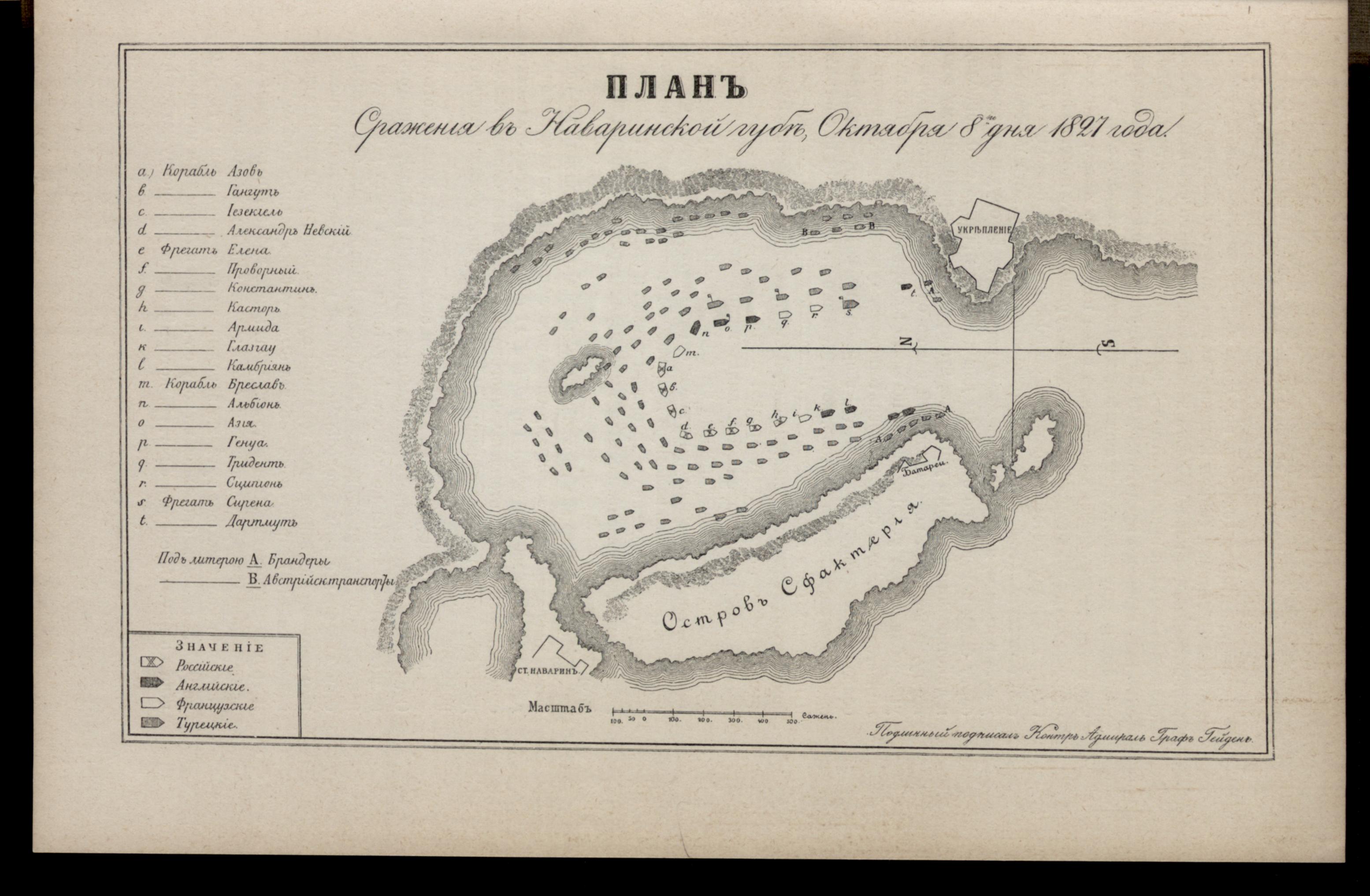
Plan sraženīja v Navarinskoj gubě, Oktjabrja 8go dnja 1827 goda |
|||||||||||||||||||||||
| Description |
Deutsch: Griechenland, Pylos, SeeschlachtvonNavarino |
|||||||||||||||||||||||
| Date | ||||||||||||||||||||||||
| Source | Leibniz-Institut für Ost- und Südosteuropaforschung (IOS) GeoPortOst | |||||||||||||||||||||||
| Permission (Reusing this file) |
|
|||||||||||||||||||||||
| Geotemporal data | ||||||||||||||||||||||||
| Date depicted | ||||||||||||||||||||||||
| Map location | Griechenland | |||||||||||||||||||||||
| Map type | Geschichtskarte | |||||||||||||||||||||||
| Bounding box |
|
|||||||||||||||||||||||
| Georeferencing | ||||||||||||||||||||||||
| Bibliographic data | ||||||||||||||||||||||||
| Map sheet | S. 189 | |||||||||||||||||||||||
| Language | Russian | |||||||||||||||||||||||
| Archival data | ||||||||||||||||||||||||
| Collection |
|
|||||||||||||||||||||||
| Accession number |
BV042516944 |
|||||||||||||||||||||||

Licensing
[edit]
|
This work is in the public domain in its country of origin and other countries and areas where the copyright term is the author's life plus 70 years or fewer. | |
| This file has been identified as being free of known restrictions under copyright law, including all related and neighboring rights. | |
File history
Click on a date/time to view the file as it appeared at that time.
| Date/Time | Thumbnail | Dimensions | User | Comment | |
|---|---|---|---|---|---|
| current | 12:44, 20 February 2019 | | 3,109 × 2,033 (546 KB) | H.bauer26 (talk | contribs) | pattypan 18.02 |
You cannot overwrite this file.
File usage on Commons
There are no pages that use this file.