File:Greystone-Heights-map.png
Jump to navigation
Jump to search
No higher resolution available.
Greystone-Heights-map.png (320 × 250 pixels, file size: 22 KB, MIME type: image/png)
Captions
Captions
Add a one-line explanation of what this file represents
Summary
[edit]
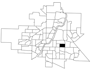
| Description | A map showing the location of the Greystone Heights neighbourhood in Saskatoon, Saskatchewan, Canada |
| Source | http://www.saskatoon.ca/org/city_planning/resources/neighbourhood_demographics/greystone_heights.pdf |
| Author | City of Saskatoon - City Planning Branch |
| Permission (Reusing this file) |
Licensing
[edit]

|
Permission is granted to copy, distribute and/or modify this document under the terms of the GNU Free Documentation License, Version 1.2 or any later version published by the Free Software Foundation; with no Invariant Sections, no Front-Cover Texts, and no Back-Cover Texts. A copy of the license is included in the section entitled GNU Free Documentation License. |
| This file is licensed under the Creative Commons Attribution-Share Alike 3.0 Unported license. | ||
| ||
| This licensing tag was added to this file as part of the GFDL licensing update. |
File history
Click on a date/time to view the file as it appeared at that time.
| Date/Time | Thumbnail | Dimensions | User | Comment | |
|---|---|---|---|---|---|
| current | 00:19, 21 April 2008 | | 320 × 250 (22 KB) | Drm310 (talk | contribs) | {{Information |Description=A map showing the location of the Greystone Heights neighbourhood in Saskatoon, Saskatchewan, Canada |Source=http://www.saskatoon.ca/org/city_planning/resources/neighbourhood_demographics/greystone_heights.pdf |Date= |Author=[ht |
You cannot overwrite this file.
File usage on Commons
The following page uses this file:
File usage on other wikis
The following other wikis use this file:
- Usage on en.wikipedia.org
- Usage on www.wikidata.org