File:Greater Sylhet Region.jpg
Original file (1,448 × 2,896 pixels, file size: 190 KB, MIME type: image/jpeg)
Captions
Captions

|
This map image could be re-created using vector graphics as an SVG file. This has several advantages; see Commons:Media for cleanup for more information. If an SVG form of this image is available, please upload it and afterwards replace this template with
{{vector version available|new image name}}.
It is recommended to name the SVG file “Greater Sylhet Region.svg”—then the template Vector version available (or Vva) does not need the new image name parameter. |


Summary
[edit]
| Description |
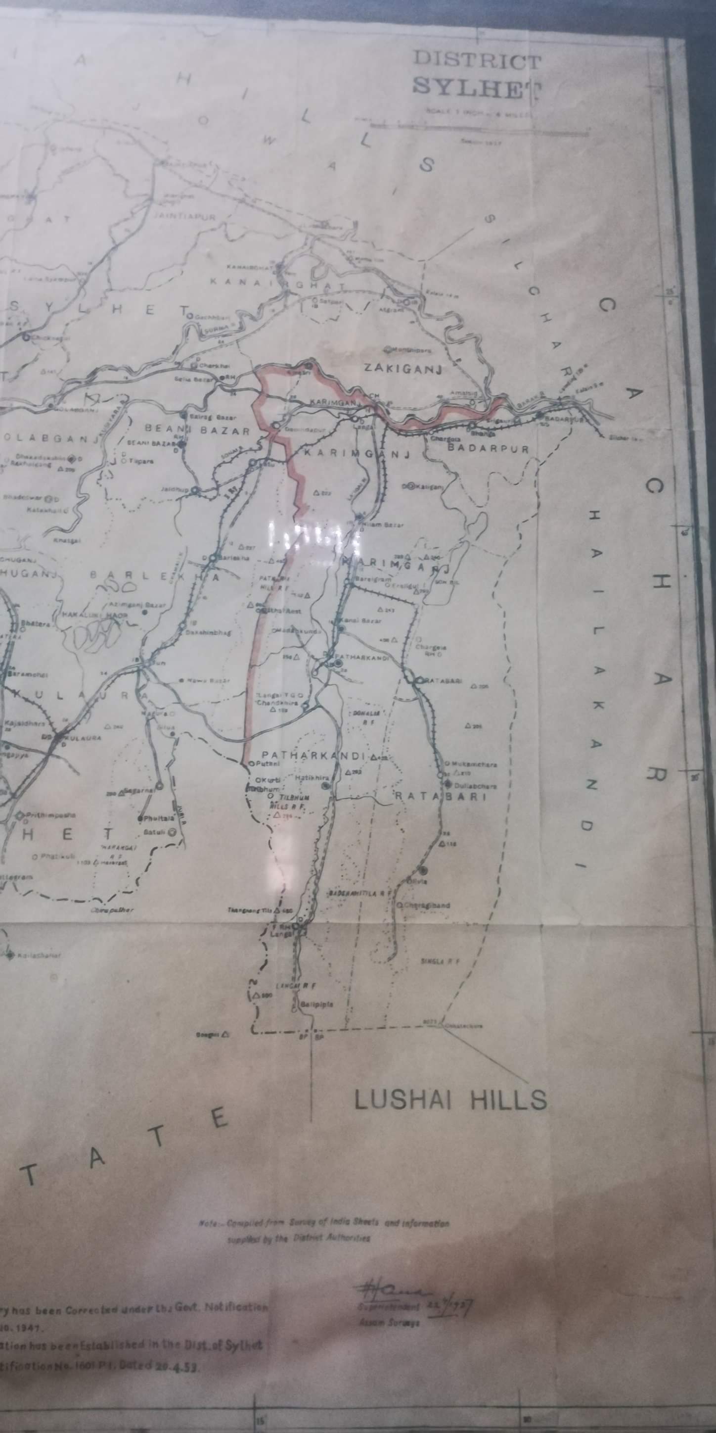
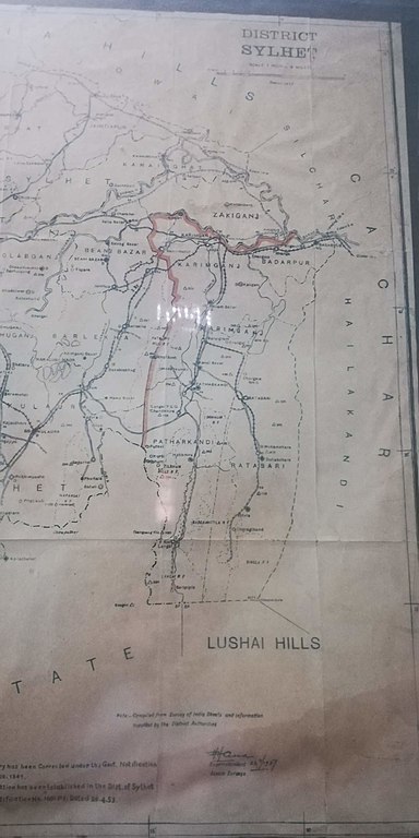
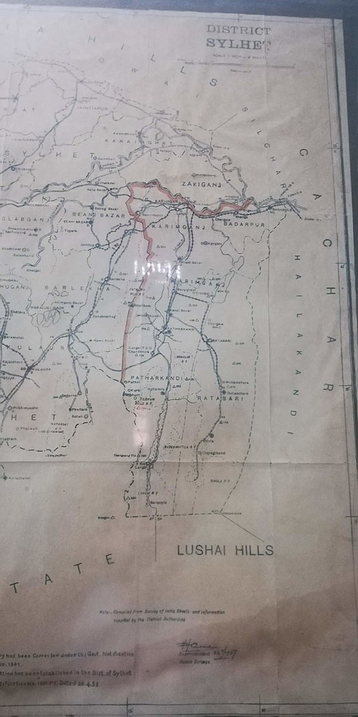
English: The Greater Sylhet region predominantly includes the Sylhet Division in Bangladesh, and Karimganj district in Assam, India.
Sylhet district was established on 3 January 1782, and until 1878 it was part of Bengal province. In that year, Sylhet was included in the newly created Assam Province, and it remained as part of Assam up to 1947 (except during the brief break-up of Bengal province in 1905–11). Sylhet district was divided into five subdivisions and the current Sylhet District was known as the North Sylhet subdivision. In 1947, Sylhet became a part of East Pakistan as a result of a referendum (except 3½ thanas of Karimganj subdivision) as part of Chittagong Division. It was subdivided into four districts in 1983-84 with the current Sylhet District being known as North Sylhet. It became a part of Sylhet Division after its formation in 1995. Notes: 1. Subdivision Boundary has been corrected under the Government Notification No. 527 G. A. Dated 03.10.1947 2. Zakiganj Police Station has been established in the District of Sylhet under the Government Notification No. 1601 P. I. Dated 20.04.1953 |
| Date | |
| Source | Compiled from Survey of India Sheets and information supplied by the District Authorities |
| Author | Superintendent of Assam Surveys |
Licensing
[edit]

|
Permission is granted to copy, distribute and/or modify this document under the terms of the GNU Free Documentation License, Version 1.2 or any later version published by the Free Software Foundation; with no Invariant Sections, no Front-Cover Texts, and no Back-Cover Texts. A copy of the license is included in the section entitled GNU Free Documentation License. |
If this file is eligible for relicensing, it may also be used under the Creative Commons Attribution-ShareAlike 3.0 license. The relicensing status of this image has not yet been reviewed. You can help.
|
File history
Click on a date/time to view the file as it appeared at that time.
| Date/Time | Thumbnail | Dimensions | User | Comment | |
|---|---|---|---|---|---|
| current | 05:51, 24 October 2020 | | 1,448 × 2,896 (190 KB) | Rnrctg (talk | contribs) | Uploaded a work by Superintendent of Assam Surveys from Compiled from Survey of India Sheets and information supplied by the District Authorities with UploadWizard |
You cannot overwrite this file.
File usage on Commons
There are no pages that use this file.
File usage on other wikis
The following other wikis use this file:
- Usage on incubator.wikimedia.org