File:Greater Boston.jpg
Jump to navigation
Jump to search
Size of this preview: 800 × 533 pixels. Other resolutions: 320 × 213 pixels | 640 × 427 pixels | 1,024 × 683 pixels | 1,280 × 853 pixels | 2,560 × 1,707 pixels | 3,600 × 2,400 pixels.
Original file (3,600 × 2,400 pixels, file size: 3.93 MB, MIME type: image/jpeg)
Captions
Captions
Add a one-line explanation of what this file represents
Summary
[edit]
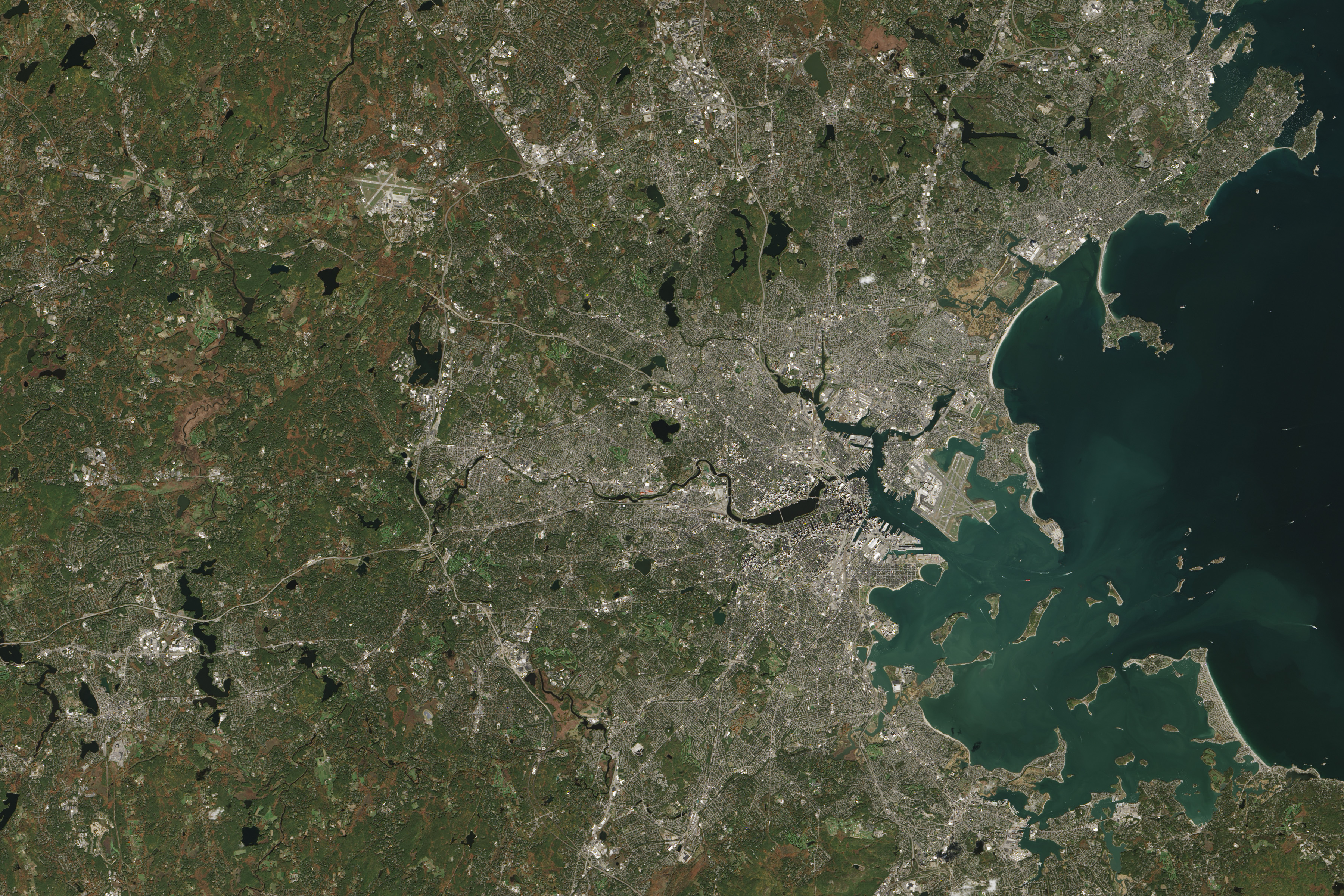
| Description | The Greater Boston area, encompassing the eastern third of Massachusetts, is a playground for the American history enthusiast. Sites important to the American Revolutionary War are interspersed throughout the modern-day metropolitan region; the view from space shows how preserved historic landscapes coexist with the new. |
| Date | |
| Source | https://earthobservatory.nasa.gov/images/88300/minute-man-national-historical-park |
| Author | NASA Earth Observatory image by Jesse Allen, using Landsat data from the U.S. Geological Survey. Caption by Kathryn Hansen. |
Licensing
[edit]
| This file is in the public domain in the United States because it was solely created by NASA. NASA copyright policy states that "NASA material is not protected by copyright unless noted". (See Template:PD-USGov, NASA copyright policy page or JPL Image Use Policy.) | ||
 |
Warnings:
|
File history
Click on a date/time to view the file as it appeared at that time.
| Date/Time | Thumbnail | Dimensions | User | Comment | |
|---|---|---|---|---|---|
| current | 04:51, 11 February 2021 | | 3,600 × 2,400 (3.93 MB) | StellarHalo (talk | contribs) | {{Information |Description=The Greater Boston area, encompassing the eastern third of Massachusetts, is a playground for the American history enthusiast. Sites important to the American Revolutionary War are interspersed throughout the modern-day metropolitan region; the view from space shows how preserved historic landscapes coexist with the new. |Source=https://earthobservatory.nasa.gov/images/88300/minute-man-national-historical-park |Date=15 October 2015 |Author=NASA Earth Observatory ima... |
You cannot overwrite this file.
File usage on Commons
There are no pages that use this file.