File:Great War Island.png
Jump to navigation
Jump to search
No higher resolution available.
Great_War_Island.png (400 × 450 pixels, file size: 349 KB, MIME type: image/png)
Captions
Captions
Add a one-line explanation of what this file represents
| Description |
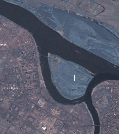
English: Satellite view of Great War Island in Belgrade
Deutsch: Satellitenaufnahme der Großen Kriegsinsel in Belgrad |
| Date | |
| Source | Created by Duja using NASA WorldWind |
| Author | Duja |
| This image is in the public domain because it is a screenshot from NASA’s globe software World Wind using a public domain layer, such as Blue Marble, MODIS, Landsat, SRTM, USGS or GLOBE.
|
 |
File history
Click on a date/time to view the file as it appeared at that time.
| Date/Time | Thumbnail | Dimensions | User | Comment | |
|---|---|---|---|---|---|
| current | 12:17, 5 June 2007 | | 400 × 450 (349 KB) | Duja (talk | contribs) | |
| 12:14, 5 June 2007 |  | 808 × 531 (651 KB) | Duja (talk | contribs) | {{english|Satellite map of en:Gerat War Island in Belgrade}} Created by en:User:Duja using NASA WorldWind {{PD-WorldWind}} Category:Belgrade |
You cannot overwrite this file.
File usage on Commons
The following page uses this file:
File usage on other wikis
The following other wikis use this file:
- Usage on be.wikipedia.org
- Usage on bg.wikipedia.org
- Usage on de.wikipedia.org
- Usage on el.wikipedia.org
- Usage on en.wikipedia.org
- Usage on eo.wikipedia.org
- Usage on es.wikipedia.org
- Usage on fr.wikipedia.org
- Usage on he.wikipedia.org
- Usage on hr.wikipedia.org
- Usage on id.wikipedia.org
- Usage on it.wikipedia.org
- Usage on mk.wikipedia.org
- Usage on nn.wikipedia.org
- Usage on ru.wikipedia.org
- Usage on sh.wikipedia.org
- Usage on sk.wikipedia.org
- Usage on sr.wikipedia.org
- Usage on sr.wiktionary.org
- Usage on tr.wikipedia.org
- Usage on uk.wikipedia.org