File:Grazing pasture, South Dakota, USA (9199).jpg
Jump to navigation
Jump to search
Size of this preview: 800 × 533 pixels. Other resolutions: 320 × 213 pixels | 640 × 427 pixels | 1,024 × 683 pixels | 1,280 × 853 pixels | 2,560 × 1,707 pixels | 6,720 × 4,480 pixels.
Original file (6,720 × 4,480 pixels, file size: 16.61 MB, MIME type: image/jpeg)
Captions
Captions
Add a one-line explanation of what this file represents
Summary
[edit].jpg&action=edit§ion=1)
| Grazing pasture, South Dakota, USA. | |
|---|---|
| Photographer |
USDA NRCS South Dakota |
| Title |
Grazing pasture, South Dakota, USA. |
| Description |
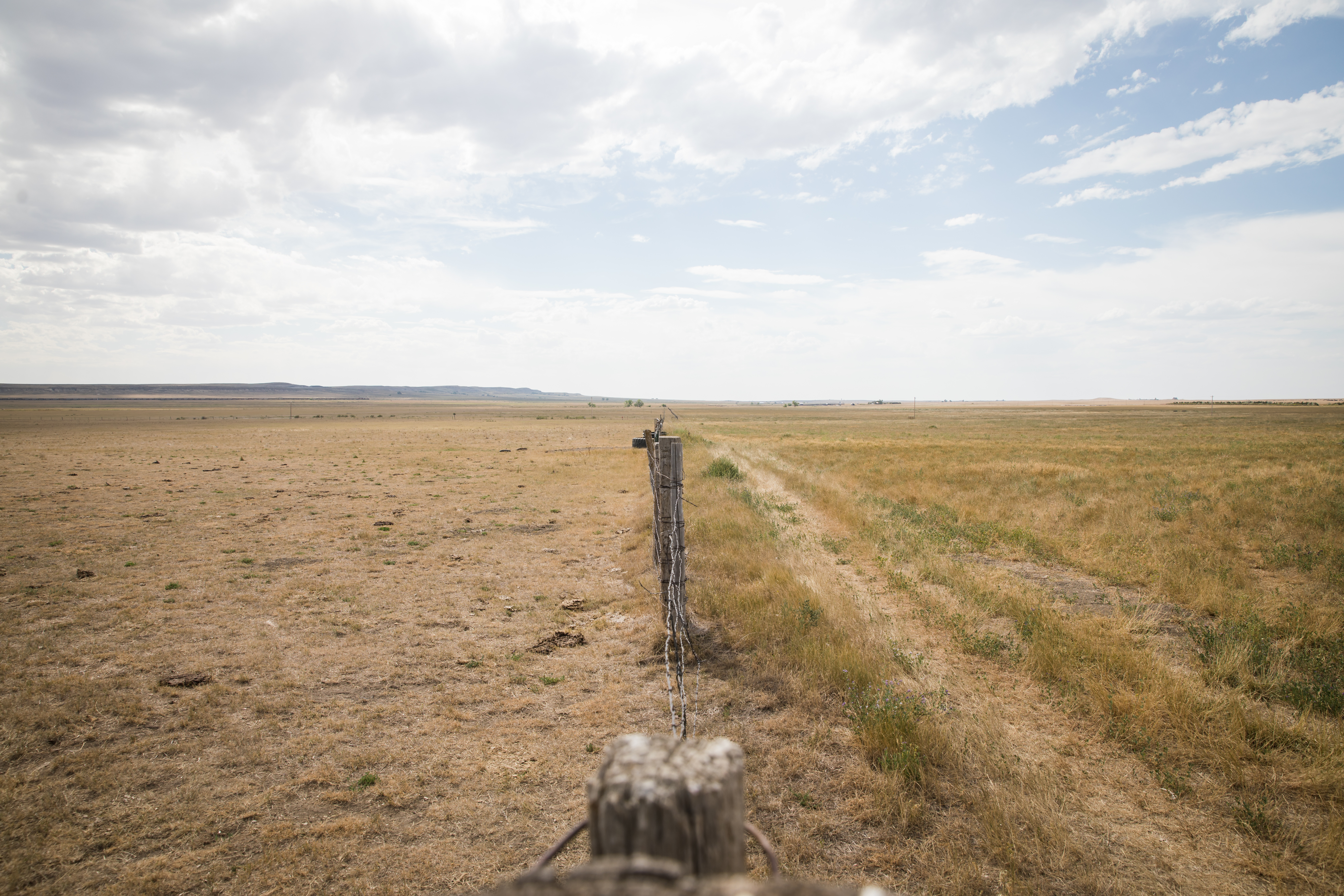
Overgrazed pasture versus ungrazed pasture in Fall River County, South Dakota. The left side of the fence is a pasture that has been overgrazed while the right side has not been grazed at all. Overgrazing reduces the usefulness, productivity, and biodiversity of the land and can cause erosion. Overgrazing weakens and eventually kills forage plants, which then allows weeds to grow in their place. |
| Depicted place | Depicted place: Fall River County |
| Date | 13 August 2020 |
| Source | Flickr.com |
Licensing
[edit].jpg&action=edit§ion=2)
| This image, originally posted to Flickr, was reviewed on 18 July 2023 by the administrator or reviewer Abzeronow, who confirmed that it was available on Flickr under the stated license on that date. |
This file is licensed under the Creative Commons Attribution-Share Alike 2.0 Generic license.
- You are free:
- to share – to copy, distribute and transmit the work
- to remix – to adapt the work
- Under the following conditions:
- attribution – You must give appropriate credit, provide a link to the license, and indicate if changes were made. You may do so in any reasonable manner, but not in any way that suggests the licensor endorses you or your use.
- share alike – If you remix, transform, or build upon the material, you must distribute your contributions under the same or compatible license as the original.
This image or file is a work of a United States Department of Agriculture employee, taken or made as part of that person's official duties. As a work of the U.S. federal government, the image is in the public domain.
|
 |
File history
Click on a date/time to view the file as it appeared at that time.
| Date/Time | Thumbnail | Dimensions | User | Comment | |
|---|---|---|---|---|---|
| current | 08:35, 27 June 2023 | | 6,720 × 4,480 (16.61 MB) | Jason.nlw (talk | contribs) | pattypan 22.03 |
You cannot overwrite this file.
File usage on Commons
The following page uses this file:
.jpg)
File usage on other wikis
The following other wikis use this file:
- Usage on en.wikipedia.org
- Usage on zh.wikipedia.org
.jpg&oldid=784499320)