File:Grave of Lorenzo D Immell.jpg
From Wikimedia Commons, the free media repository
Jump to navigation
Jump to search
Size of this preview: 362 × 599 pixels. Other resolutions: 145 × 240 pixels | 290 × 480 pixels | 464 × 768 pixels | 1,200 × 1,987 pixels.
Original file (1,200 × 1,987 pixels, file size: 466 KB, MIME type: image/jpeg)
File information
Structured data
Captions
Summary
[edit]DescriptionGrave of Lorenzo D Immell.jpg |
English: 
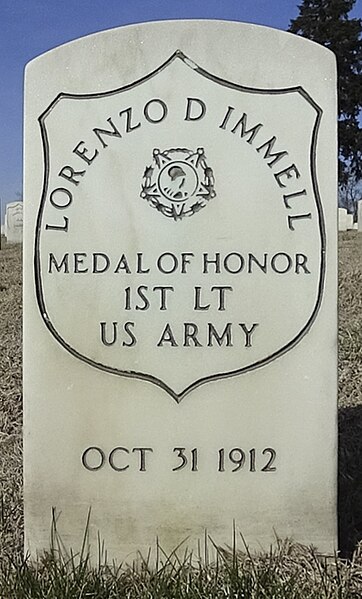
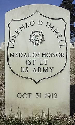
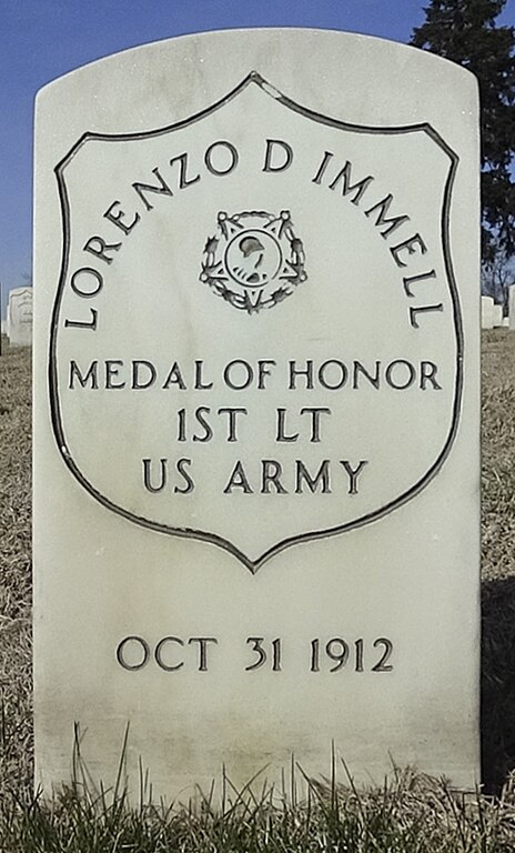
Grave of 1st Lt. Lorenzo D. Immell in Section 4 of Jefferson Barracks National Cemetery |
Date | |
Source | Lorenzo D Immell |
Author | U.S. Department of Veterans Affairs |
Camera location | 38° 29′ 54.15″ N, 90° 16′ 43.39″ W | View this and other nearby images on: OpenStreetMap | 38.498376; -90.278720 |
---|
Licensing
[edit]Public domainPublic domainfalsefalse |
This image is a work of a United States Department of Veterans Affairs employee, taken or made as part of that person's official duties. As a work of the U.S. federal government, the image is in the public domain. |
File history
Click on a date/time to view the file as it appeared at that time.
Date/Time | Thumbnail | Dimensions | User | Comment | |
---|---|---|---|---|---|
current | 23:41, 4 June 2024 | 1,200 × 1,987 (466 KB) | Maliepa (talk | contribs) | Uploaded a work by U.S. Department of Veterans Affairs from [https://www.vlm.cem.va.gov/LORENZODIMMELL/EADCEB4 Lorenzo D Immell] with UploadWizard |
You cannot overwrite this file.
File usage on Commons
The following page uses this file:
File usage on other wikis
The following other wikis use this file:
- Usage on www.wikidata.org
Metadata
This file contains additional information such as Exif metadata which may have been added by the digital camera, scanner, or software program used to create or digitize it. If the file has been modified from its original state, some details such as the timestamp may not fully reflect those of the original file. The timestamp is only as accurate as the clock in the camera, and it may be completely wrong.
Camera manufacturer | SONY |
---|---|
Camera model | HDR-AS200V |
Exposure time | 1/6,000 sec (0.00016666666666667) |
F-number | f/2.8 |
Date and time of data generation | 09:07, 4 March 2020 |
Lens focal length | 2.8 mm |
Latitude | 38° 29′ 54.15″ N |
Longitude | 90° 16′ 43.39″ W |
Altitude | 153 meters above sea level |
Horizontal resolution | 300 dpi |
Vertical resolution | 300 dpi |
Software used | Adobe Photoshop Camera Raw 11.4.1 (Windows) |
File change date and time | 13:16, 15 July 2020 |
Exposure Program | Normal program |
Exif version | 2.31 |
Date and time of digitizing | 09:07, 4 March 2020 |
APEX shutter speed | 12.550747 |
APEX aperture | 2.970854 |
APEX exposure bias | 0 |
Maximum land aperture | 2.96875 APEX (f/2.8) |
Metering mode | Pattern |
Light source | Unknown |
Flash | Flash did not fire, No flash function |
Color space | Uncalibrated |
File source | Digital still camera |
Scene type | A directly photographed image |
Custom image processing | Normal process |
Exposure mode | Auto exposure |
White balance | Auto white balance |
Digital zoom ratio | 1 |
Scene capture type | Standard |
Contrast | Normal |
Saturation | Normal |
Sharpness | Normal |
GPS time (atomic clock) | 15:07 |
Receiver status | Measurement in progress |
Measurement mode | 3-dimensional measurement |
Measurement precision | Poor (1.11) |
Speed unit | Kilometers per hour |
Speed of GPS receiver | 0.49 |
Reference for direction of movement | True direction |
Direction of movement | 86.54 |
Geodetic survey data used | WGS-84 |
GPS date | 4 March 2020 |
GPS differential correction | 0 |
GPS tag version | 0.0.3.2 |
Lens used | 2.8 mm f/2.8 |
Date metadata was last modified | 07:16, 15 July 2020 |
Unique ID of original document | 047AD99F63A3B7E5E1C6CD54B3D0FE65 |
IIM version | 4 |