File:Grauenbrunnen.jpg
Jump to navigation
Jump to search

Size of this preview: 732 × 599 pixels. Other resolutions: 293 × 240 pixels | 586 × 480 pixels | 938 × 768 pixels | 1,251 × 1,024 pixels | 2,502 × 2,048 pixels | 3,535 × 2,894 pixels.
Original file (3,535 × 2,894 pixels, file size: 5.42 MB, MIME type: image/jpeg)
Captions
Captions
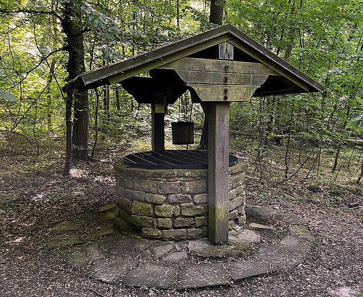
Historical fountain "Grauenbrunnen" on the Leimen/Nußloch district boundary
Summary
[edit]
| Description |
Deutsch: Historischer Grauenbrunnen auf der Gemarkungsgrenze Leimen/Nußloch, Rekonstruktion um 1960. Anstehendes feinkörniges Bodensubstrat (tonige Feinerde, Schluff) färben Böden und Wasser hier grau. Dies war wohl namensgebend für die mittelalterliche gleichnamige Ortslage auf dem Hirschberg. Durch die zunehmende klimabedingte Trockenheit ist die abgebildete Brunnenanlage seit mehreren Jahren trockengefallen (Stand: 2023). |
| Date | |
| Source | Own work |
| Author | Michael Linnenbach |
Licensing
[edit]
I, the copyright holder of this work, hereby publish it under the following license:
This file is licensed under the Creative Commons Attribution 4.0 International license.
- You are free:
- to share – to copy, distribute and transmit the work
- to remix – to adapt the work
- Under the following conditions:
- attribution – You must give appropriate credit, provide a link to the license, and indicate if changes were made. You may do so in any reasonable manner, but not in any way that suggests the licensor endorses you or your use.
| Object location | | View this and other nearby images on: OpenStreetMap |
|---|
File history
Click on a date/time to view the file as it appeared at that time.
| Date/Time | Thumbnail | Dimensions | User | Comment | |
|---|---|---|---|---|---|
| current | 11:28, 12 May 2022 | | 3,535 × 2,894 (5.42 MB) | Michael Linnenbach (talk | contribs) | Uploaded own work with UploadWizard |
You cannot overwrite this file.
File usage on Commons
The following 2 pages use this file:
File usage on other wikis
The following other wikis use this file:
- Usage on de.wikipedia.org