File:Grange farm map.png
Jump to navigation
Jump to search

Size of this preview: 800 × 536 pixels. Other resolutions: 320 × 214 pixels | 640 × 429 pixels | 818 × 548 pixels.
Original file (818 × 548 pixels, file size: 354 KB, MIME type: image/png)
Captions
Captions
Add a one-line explanation of what this file represents
Summary
[edit]
| Description |
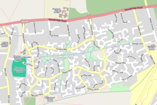
English: Map of Grange Farm and Kesgrave High School showing a network of footpaths as well as through-roads and Cul-de-sacs. |
| Date | (UTC) |
| Source | OpenStreetMap |
| Author | Contributors to OpenStreetMap |
| Other versions | Source mapping in OpenStreetMap |
Licensing
[edit]
This file is licensed under the Creative Commons Attribution-Share Alike 3.0 Unported license.
- You are free:
- to share – to copy, distribute and transmit the work
- to remix – to adapt the work
- Under the following conditions:
- attribution – You must give appropriate credit, provide a link to the license, and indicate if changes were made. You may do so in any reasonable manner, but not in any way that suggests the licensor endorses you or your use.
- share alike – If you remix, transform, or build upon the material, you must distribute your contributions under the same or compatible license as the original.
Original upload log
[edit]
Transferred from en.wikipedia to Commons by Kafuffle using CommonsHelper.
The original description page was here. All following user names refer to en.wikipedia.
- 2010-05-15 16:53 PeterEastern 818×548× (362858 bytes) {{Information |Description =A network of [[footpath]]s linking up residential areas of [[Grange farm]] near [[Ipswich]] ([[United Kingdom|UK]]) |Source = [[OpenStreetMap]] |Date = ~~~~~ |Author = OpenStreetMap and contribu
- 2010-01-10 19:19 PeterEastern 818×548× (362858 bytes) {{Information |Description = Map of Grange Farm and Kesgrave High School |Source = [[OpenStreetMap]] |Date = ~~~~~ |Author = Contributors to OpenStreetMap |Permission = |other_versions = [http://www.openstreetmap.or
File history
Click on a date/time to view the file as it appeared at that time.
| Date/Time | Thumbnail | Dimensions | User | Comment | |
|---|---|---|---|---|---|
| current | 12:21, 2 February 2011 | | 818 × 548 (354 KB) | File Upload Bot (Magnus Manske) (talk | contribs) | {{BotMoveToCommons|en.wikipedia|year={{subst:CURRENTYEAR}}|month={{subst:CURRENTMONTHNAME}}|day={{subst:CURRENTDAY}}}} {{Information |Description={{en|Map of Grange Farm and Kesgrave High School showing a network of en:footpaths as well as through- |
You cannot overwrite this file.
File usage on Commons
There are no pages that use this file.
File usage on other wikis
The following other wikis use this file:
- Usage on ar.wikipedia.org
- Usage on en.wikipedia.org