File:Grand Traverse County, Mich.svg
Jump to navigation
Jump to search

Size of this PNG preview of this SVG file: 497 × 599 pixels. Other resolutions: 199 × 240 pixels | 398 × 480 pixels | 637 × 768 pixels | 850 × 1,024 pixels | 1,699 × 2,048 pixels | 600 × 723 pixels.
Original file (SVG file, nominally 600 × 723 pixels, file size: 351 KB)
Captions
Captions
Add a one-line explanation of what this file represents
Summary
[edit]
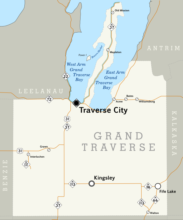
| Description | Map of Grand Traverse County, Michigan. |
| Date | |
| Source | Created by me. Based on data collected from [1] which was loaded into Quantum GIS 0.11.0 and used to export a PNG. This was then loaded into Inkscape, the county outline and roads were traced, and the other map symbols placed by hand. Most text is set in Pigiarniq, a font produced by the government of the Canadian province of Nunavut. |
| Author | Scott Nazelrod |
| SVG development |
Licensing
[edit]
This file is licensed under the Creative Commons Attribution-Share Alike 3.0 Unported license.
- You are free:
- to share – to copy, distribute and transmit the work
- to remix – to adapt the work
- Under the following conditions:
- attribution – You must give appropriate credit, provide a link to the license, and indicate if changes were made. You may do so in any reasonable manner, but not in any way that suggests the licensor endorses you or your use.
- share alike – If you remix, transform, or build upon the material, you must distribute your contributions under the same or compatible license as the original.
File history
Click on a date/time to view the file as it appeared at that time.
| Date/Time | Thumbnail | Dimensions | User | Comment | |
|---|---|---|---|---|---|
| current | 04:27, 25 September 2008 | | 600 × 723 (351 KB) | Scott5114 (talk | contribs) | Fix |
| 04:22, 25 September 2008 |  | 600 × 723 (352 KB) | Scott5114 (talk | contribs) | == Summary == {{Information |Description=Map of Grand Traverse County, Michigan. |Source=Created by me. Based on data collected from [http://www.mcgi.state.mi.us/mgdl/?action=thm] which was loaded into Quantum GIS 0.11.0 and used to export a PNG. This was |
You cannot overwrite this file.
File usage on Commons
There are no pages that use this file.