File:Grand Tetons Jenny Lake North View.jpg
Jump to navigation
Jump to search

Size of this preview: 800 × 532 pixels. Other resolutions: 320 × 213 pixels | 640 × 425 pixels | 1,024 × 680 pixels | 1,280 × 850 pixels | 2,500 × 1,661 pixels.
Original file (2,500 × 1,661 pixels, file size: 2.51 MB, MIME type: image/jpeg)
Captions
Captions
Add a one-line explanation of what this file represents
Summary
[edit]
| Description |
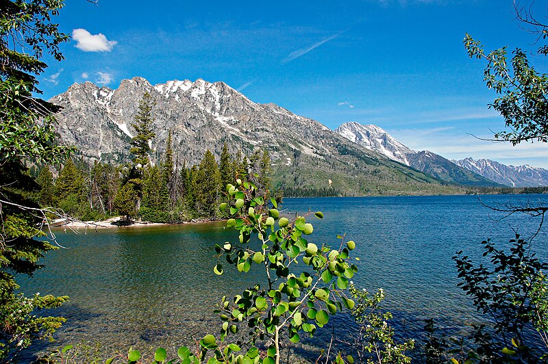
English: This is a view of Jenny Lake at Grand Teton National Park looking north. Grand Teton National Park lies in Northwestern Wyoming about ten miles south of Yellowstone National Park. This park, which includes most of the northern sections of the Jackson Hole valley, contains the major peaks of the Teton Range. The Grand Teton, for which the park is named, at 13,775 feet the is the highest of these peak and Mount Owen is the second highest. The park also contains the Snake River, Jackson, Jenny, Emma, Matilda, Two Oceans, Leigh, Bradley, Taggart and Phelps Lakes, large waterfalls, including Hidden Falls, and several small glaciers. Jackson Lake Dam is located at the outlet of Jackson Lake and was constructed before the creation of the park itself. Grand Teton and Yellowstone National Parks are connected by the John D. Rockefeller, Jr Memorial Parkway. |
| Date | |
| Source | Own work |
| Author | MichaelKirsh |
| Camera location | | View this and other nearby images on: OpenStreetMap |
|---|
Grand Teton National Park Yellowstone Wyoming "Jackson Hole" valley range peaks major Mount Owen Snake River Jackson Jenny Emma Matilda "Two Oceans" Leigh Bradley Taggart Phelps Lakes waterfalls Hidded Falls glaciers North John Rockefeller Memorial Parkway dam mountains snow blue water trees forests blue skies sky clouds cloudy high altitude sun sunshine leaves
Licensing
[edit]
I, the copyright holder of this work, hereby publish it under the following license:
This file is licensed under the Creative Commons Attribution-Share Alike 4.0 International license.
- You are free:
- to share – to copy, distribute and transmit the work
- to remix – to adapt the work
- Under the following conditions:
- attribution – You must give appropriate credit, provide a link to the license, and indicate if changes were made. You may do so in any reasonable manner, but not in any way that suggests the licensor endorses you or your use.
- share alike – If you remix, transform, or build upon the material, you must distribute your contributions under the same or compatible license as the original.
File history
Click on a date/time to view the file as it appeared at that time.
| Date/Time | Thumbnail | Dimensions | User | Comment | |
|---|---|---|---|---|---|
| current | 04:02, 20 July 2017 | | 2,500 × 1,661 (2.51 MB) | MichaelKirsh (talk | contribs) | User created page with UploadWizard |
You cannot overwrite this file.
File usage on Commons
The following page uses this file: