File:Grand Island - South Buffalo - Buffalo Plains - Illustrated Historical Atlas of Erie Co, New York.jpg
Jump to navigation
Jump to search

Size of this preview: 800 × 529 pixels. Other resolutions: 320 × 212 pixels | 640 × 423 pixels | 1,024 × 677 pixels | 1,280 × 846 pixels | 2,560 × 1,693 pixels | 7,230 × 4,780 pixels.
Original file (7,230 × 4,780 pixels, file size: 5.58 MB, MIME type: image/jpeg)
Captions
Captions
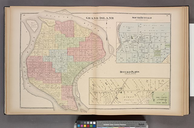
Plates 48 and 49 from an 1880 historical atlas of Erie County, New York
Summary
[edit]| Description |
English: Plates 48 and 49 from an 1880 historical atlas of Erie County, New York |
|||||||||||||||||||||||
| Location | Stephen A. Schwarzman Building / The Lionel Pincus and Princess Firyal Map Division | |||||||||||||||||||||||
| Catalogue ID | b10330138 | |||||||||||||||||||||||
| Date | ||||||||||||||||||||||||
| Source | https://digitalcollections.nypl.org/items/510d47e3-71ab-a3d9-e040-e00a18064a99 | |||||||||||||||||||||||
| Creator |
|
|||||||||||||||||||||||
| Geotemporal data | ||||||||||||||||||||||||
| Map type | city map | |||||||||||||||||||||||
| Bounding box |
|
|||||||||||||||||||||||
| Georeferencing | ||||||||||||||||||||||||
| Bibliographic data | ||||||||||||||||||||||||
| Page(s) | 48–49 | |||||||||||||||||||||||
| Archival data | ||||||||||||||||||||||||
| Collection |
|
|||||||||||||||||||||||
| Accession number |
Map Div. 76-255 |
|||||||||||||||||||||||
| Other versions | ||||||||||||||||||||||||


Licensing
[edit]
This work is in the public domain in the United States because it was published (or registered with the U.S. Copyright Office) before January 1, 1929.
Public domain works must be out of copyright in both the United States and in the source country of the work in order to be hosted on the Commons. If the work is not a U.S. work, the file must have an additional copyright tag indicating the copyright status in the source country.
Note: This tag should not be used for sound recordings. |
File history
Click on a date/time to view the file as it appeared at that time.
| Date/Time | Thumbnail | Dimensions | User | Comment | |
|---|---|---|---|---|---|
| current | 21:03, 23 January 2021 | | 7,230 × 4,780 (5.58 MB) | AleatoryPonderings (talk | contribs) | Uploaded a work by F.W. Beers & Co. (cartographer) from https://digitalcollections.nypl.org/items/510d47e3-71ab-a3d9-e040-e00a18064a99 with UploadWizard |
You cannot overwrite this file.
File usage on Commons
The following page uses this file: