File:Grängesberg-gruva.JPG
Jump to navigation
Jump to search

Size of this preview: 800 × 400 pixels. Other resolutions: 320 × 160 pixels | 640 × 320 pixels | 1,024 × 512 pixels | 1,551 × 775 pixels.
Original file (1,551 × 775 pixels, file size: 343 KB, MIME type: image/jpeg)
Captions
Captions
Add a one-line explanation of what this file represents
Summary
[edit]
| Description |
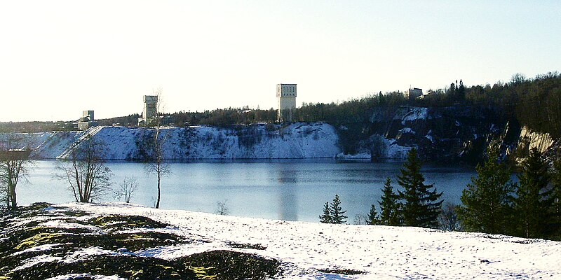
Svenska: Grängesbergs gruva sedd från Norra tippen. Byggnaderna (de som når över trädtopparna) är från vänster räknat: Pelletsverket i Lomberg, Centralschaktets lave, Jakobina lave och Gruvkontoret. |
| Date | |
| Source | Own work |
| Author | Taxelson |
| Camera location | | View this and other nearby images on: OpenStreetMap |
|---|
Licensing
[edit]
| I, the copyright holder of this work, release this work into the public domain. This applies worldwide. In some countries this may not be legally possible; if so: I grant anyone the right to use this work for any purpose, without any conditions, unless such conditions are required by law. |
File history
Click on a date/time to view the file as it appeared at that time.
| Date/Time | Thumbnail | Dimensions | User | Comment | |
|---|---|---|---|---|---|
| current | 15:08, 23 August 2014 | | 1,551 × 775 (343 KB) | Holger.Ellgaard (talk | contribs) | just färg |
| 17:39, 21 November 2008 |  | 1,551 × 775 (259 KB) | Taxelson (talk | contribs) | {{Information |Description={{sv|1=Grängesbergs gruva sedd från Norra tippen. Byggnaderna (de som når över trädtopparna) är från vänster räknat: Pelletsverket i Lomberg, Centralschaktets lave, Jakobina lave och Gruvkontoret. }} |Source=Uppladdare |
You cannot overwrite this file.
File usage on Commons
There are no pages that use this file.
File usage on other wikis
The following other wikis use this file:
- Usage on sv.wikipedia.org