File:Gomara-Analysis.png
Jump to navigation
Jump to search
Size of this preview: 432 × 600 pixels. Other resolutions: 173 × 240 pixels | 346 × 480 pixels | 553 × 768 pixels | 1,104 × 1,533 pixels.
Original file (1,104 × 1,533 pixels, file size: 467 KB, MIME type: image/png)
Captions
Captions
Add a one-line explanation of what this file represents
| Description |
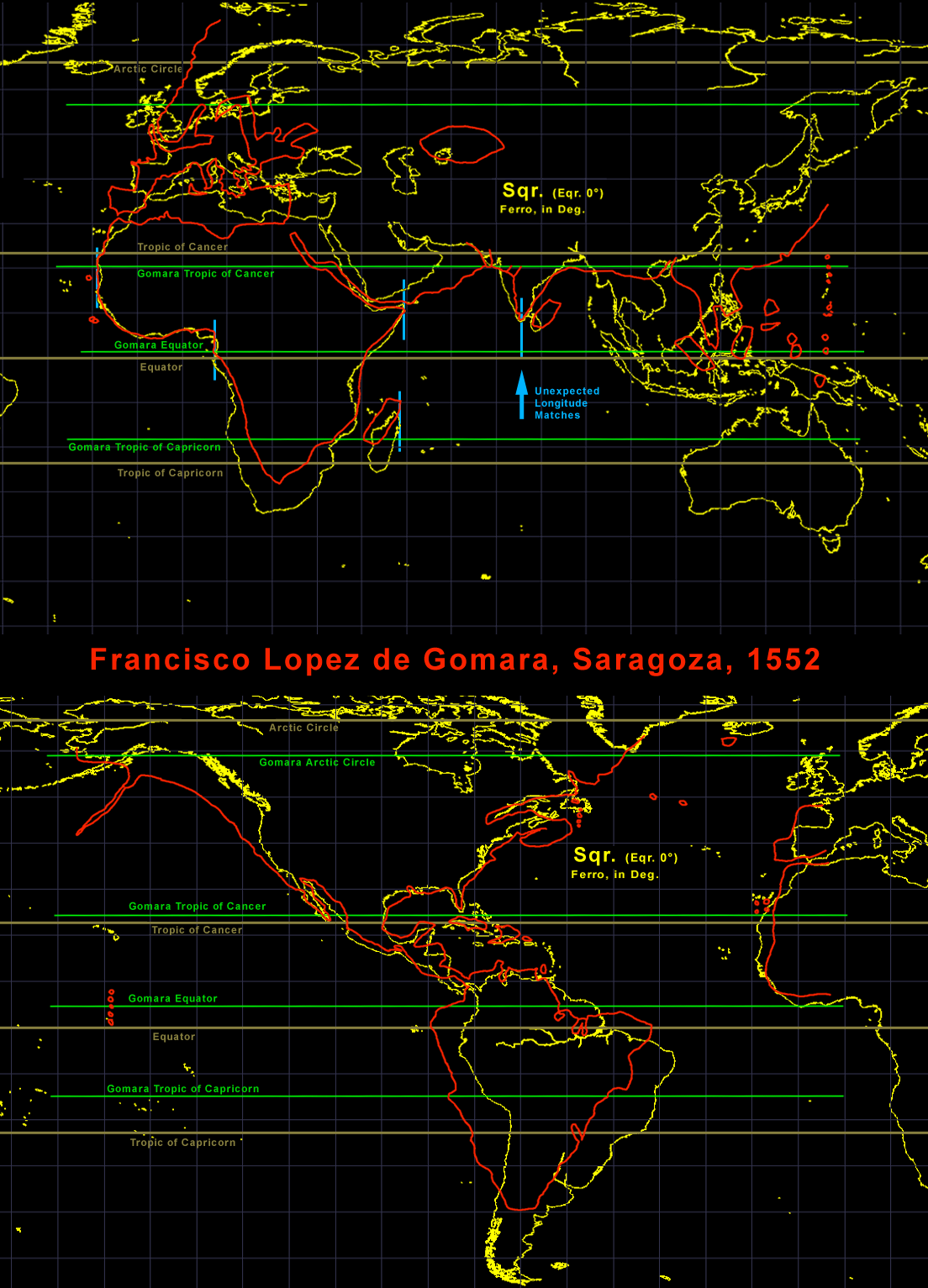
English: Analysis of the 1552 Gomara map with a modern square projection. The grid is in 10° and based on Ferro. The results were unexpected. The fit from West Africa to India is better in longitude then in latitude. The accuracy in Middle and North America is surprisingly good. The Gulf of Mexico is much better then Europe north of Spain. Such longitude data could not be acquired by the navigation we know from the 16th century. |
| Date | |
| Source | Own work |
| Author | Portolanero |
| Permission (Reusing this file) |
This file is licensed under the Creative Commons Attribution 3.0 Unported license.
|
| Attribution (required by the license) | http://en.wikipedia.org/wiki/User%3APortolanero / Wikimedia Commons / |
File history
Click on a date/time to view the file as it appeared at that time.
| Date/Time | Thumbnail | Dimensions | User | Comment | |
|---|---|---|---|---|---|
| current | 10:45, 14 December 2011 | | 1,104 × 1,533 (467 KB) | Portolanero (talk | contribs) | {{Information |Description={{en|1=Analysis of the 1552 Gomara map with a modern square projection. The grid is in 10° and based on Ferro. The results were unexpected. The fit from West Africa to India is better in longitude then in latitude. The accuracy |
You cannot overwrite this file.
File usage on Commons
There are no pages that use this file.
File usage on other wikis
The following other wikis use this file: