File:Glenbuck Loch - geograph.org.uk - 982168.jpg
Jump to navigation
Jump to search
No higher resolution available.
Glenbuck_Loch_-_geograph.org.uk_-_982168.jpg (639 × 415 pixels, file size: 145 KB, MIME type: image/jpeg)
Captions
Captions
Add a one-line explanation of what this file represents
Summary
[edit]
| Description |
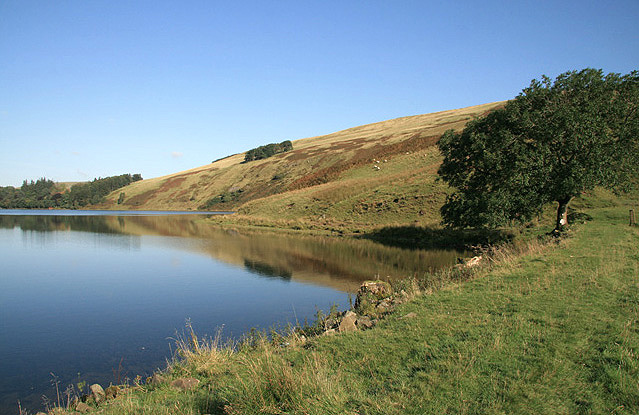
English: Glenbuck Loch The loch was formed in 1802 with the construction of two earthen dams at either end of the narrow glen, and it is the watershed for the River Ayr to the west and the Douglas Water to the east. This is the southeast part of the loch to the north of the former Caledonian Railway Line. Glenbuck Loch is a Site of Special Scientific Interest (SSSI) and Muirkirk Angling Association has the use of the loch for trout fishing. |
| Date | |
| Source | From geograph.org.uk |
| Author | Walter Baxter |
| Attribution (required by the license) | Walter Baxter / Glenbuck Loch / |
| Camera location | | View this and other nearby images on: OpenStreetMap |
|---|
_heading:337.00&language=en)
| Object location | | View this and other nearby images on: OpenStreetMap |
|---|
_heading:337.00&language=en)
Licensing
[edit]

|
This image was taken from the Geograph project collection. See this photograph's page on the Geograph website for the photographer's contact details. The copyright on this image is owned by Walter Baxter and is licensed for reuse under the Creative Commons Attribution-ShareAlike 2.0 license.
|
This file is licensed under the Creative Commons Attribution-Share Alike 2.0 Generic license.
Attribution: Walter Baxter
- You are free:
- to share – to copy, distribute and transmit the work
- to remix – to adapt the work
- Under the following conditions:
- attribution – You must give appropriate credit, provide a link to the license, and indicate if changes were made. You may do so in any reasonable manner, but not in any way that suggests the licensor endorses you or your use.
- share alike – If you remix, transform, or build upon the material, you must distribute your contributions under the same or compatible license as the original.
File history
Click on a date/time to view the file as it appeared at that time.
| Date/Time | Thumbnail | Dimensions | User | Comment | |
|---|---|---|---|---|---|
| current | 00:09, 23 February 2011 | | 639 × 415 (145 KB) | GeographBot (talk | contribs) | == {{int:filedesc}} == {{Information |description={{en|1=Glenbuck Loch The loch was formed in 1802 with the construction of two earthen dams at either end of the narrow glen, and it is the watershed for the River Ayr to the west and the Douglas Water to t |
You cannot overwrite this file.
File usage on Commons
There are no pages that use this file.