File:Gingee map.png
Jump to navigation
Jump to search

Size of this preview: 800 × 598 pixels. Other resolutions: 320 × 239 pixels | 640 × 478 pixels | 1,024 × 765 pixels | 1,280 × 956 pixels | 2,560 × 1,913 pixels | 10,139 × 7,575 pixels.
Original file (10,139 × 7,575 pixels, file size: 136.84 MB, MIME type: image/png)
Captions
Captions
Add a one-line explanation of what this file represents
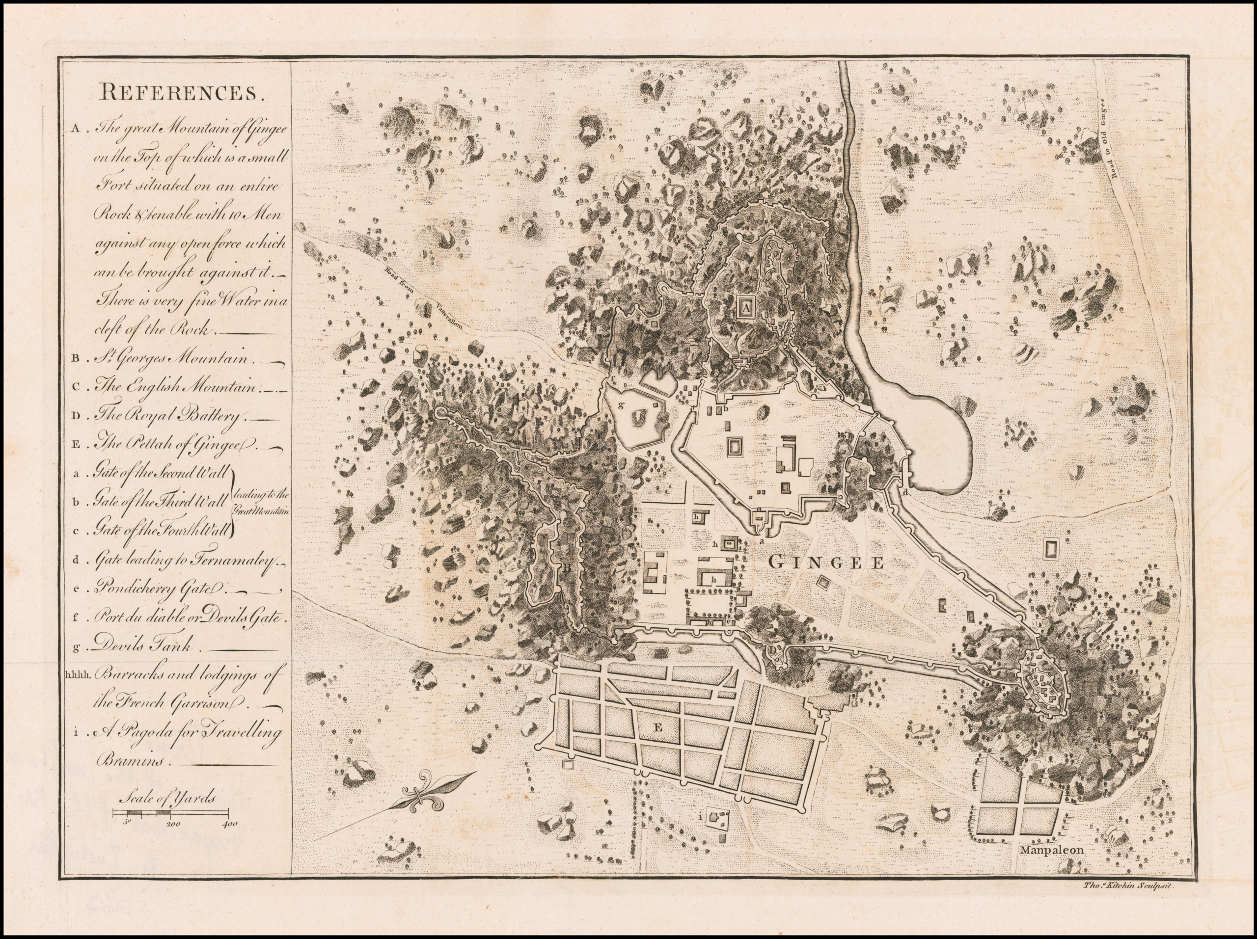
| Description |
The Great Mountain of Gingee |
|||||||||
| Date | ||||||||||
| Source | https://www.raremaps.com/gallery/detail/58792/fort-gingee-the-great-mountain-of-gingee-kitchin | |||||||||
| Creator |
Thomas Kitchin |
|||||||||
| Permission (Reusing this file) |
|
|||||||||
| Geotemporal data | ||||||||||
| Bounding box |
|
|||||||||
| Georeferencing | ||||||||||
File history
Click on a date/time to view the file as it appeared at that time.
| Date/Time | Thumbnail | Dimensions | User | Comment | |
|---|---|---|---|---|---|
| current | 04:50, 7 April 2022 | | 10,139 × 7,575 (136.84 MB) | Shyamal (talk | contribs) | c:User:Rillke/bigChunkedUpload.js: {{Information |description=The Great Mountain of Gingee |date=1750 |source= https://www.raremaps.com/gallery/detail/58792/fort-gingee-the-great-mountain-of-gingee-kitchin | author = Thomas Kitchin | permission = {{pd-old}} |
You cannot overwrite this file.
File usage on Commons
There are no pages that use this file.