File:Gewaessernetz + Verkarstung.jpg
Jump to navigation
Jump to search
Size of this preview: 518 × 600 pixels. Other resolutions: 207 × 240 pixels | 415 × 480 pixels | 663 × 768 pixels | 885 × 1,024 pixels | 1,555 × 1,800 pixels.
Original file (1,555 × 1,800 pixels, file size: 1.69 MB, MIME type: image/jpeg)
Captions
Captions
Add a one-line explanation of what this file represents
| Description |
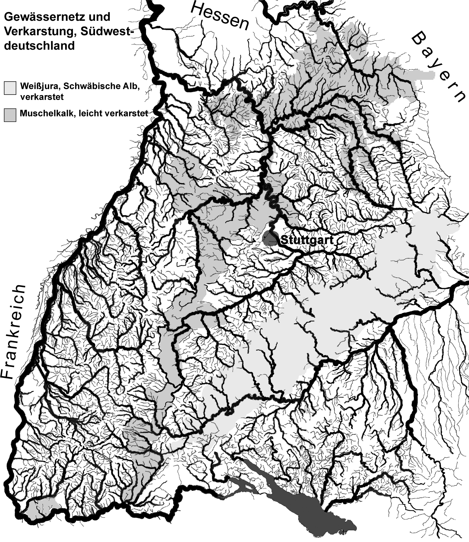
Deutsch: Gewässernetz Baden-Württemberg.
Die verkarsteten Gebiete sind gut erkennbar. Die Verkarstung der Schwäbischen Alb ist ausgeprägter als die Verkarstung des triassischen Muschelkalks. English: Network of watercourses of Baden-Württemberg. The karstification of the Swabian Alb is well distinguishable. The triassic Muschelkalk, a lithostratigraphic unit in Western and Central Europe is far less striking. |
| Date | |
| Source | see author |
| Author | Ustill |
This file is licensed under the Creative Commons Attribution-Share Alike 2.0 Germany license.
- You are free:
- to share – to copy, distribute and transmit the work
- to remix – to adapt the work
- Under the following conditions:
- attribution – You must give appropriate credit, provide a link to the license, and indicate if changes were made. You may do so in any reasonable manner, but not in any way that suggests the licensor endorses you or your use.
- share alike – If you remix, transform, or build upon the material, you must distribute your contributions under the same or compatible license as the original.

File history
Click on a date/time to view the file as it appeared at that time.
| Date/Time | Thumbnail | Dimensions | User | Comment | |
|---|---|---|---|---|---|
| current | 01:16, 8 February 2010 | | 1,555 × 1,800 (1.69 MB) | Ustill (talk | contribs) | {{Information |Description={{de|1=Gewässernetz Baden-Württemberg. Die verkarsteten Gebiete sind gut erkennbar. Die Verkarstung der Schwäbischen Alb ist ausgeprägter |
You cannot overwrite this file.
File usage on Commons
There are no pages that use this file.
File usage on other wikis
The following other wikis use this file:
- Usage on de.wikipedia.org