File:Geotop Gomaringen gtk 4658 P1190138.jpg
Jump to navigation
Jump to search
Size of this preview: 800 × 450 pixels. Other resolutions: 320 × 180 pixels | 640 × 360 pixels | 1,024 × 575 pixels | 1,280 × 719 pixels | 2,560 × 1,439 pixels | 4,000 × 2,248 pixels.
Original file (4,000 × 2,248 pixels, file size: 3.88 MB, MIME type: image/jpeg)
Captions
Captions
Add a one-line explanation of what this file represents
Summary
[edit]
| Description |
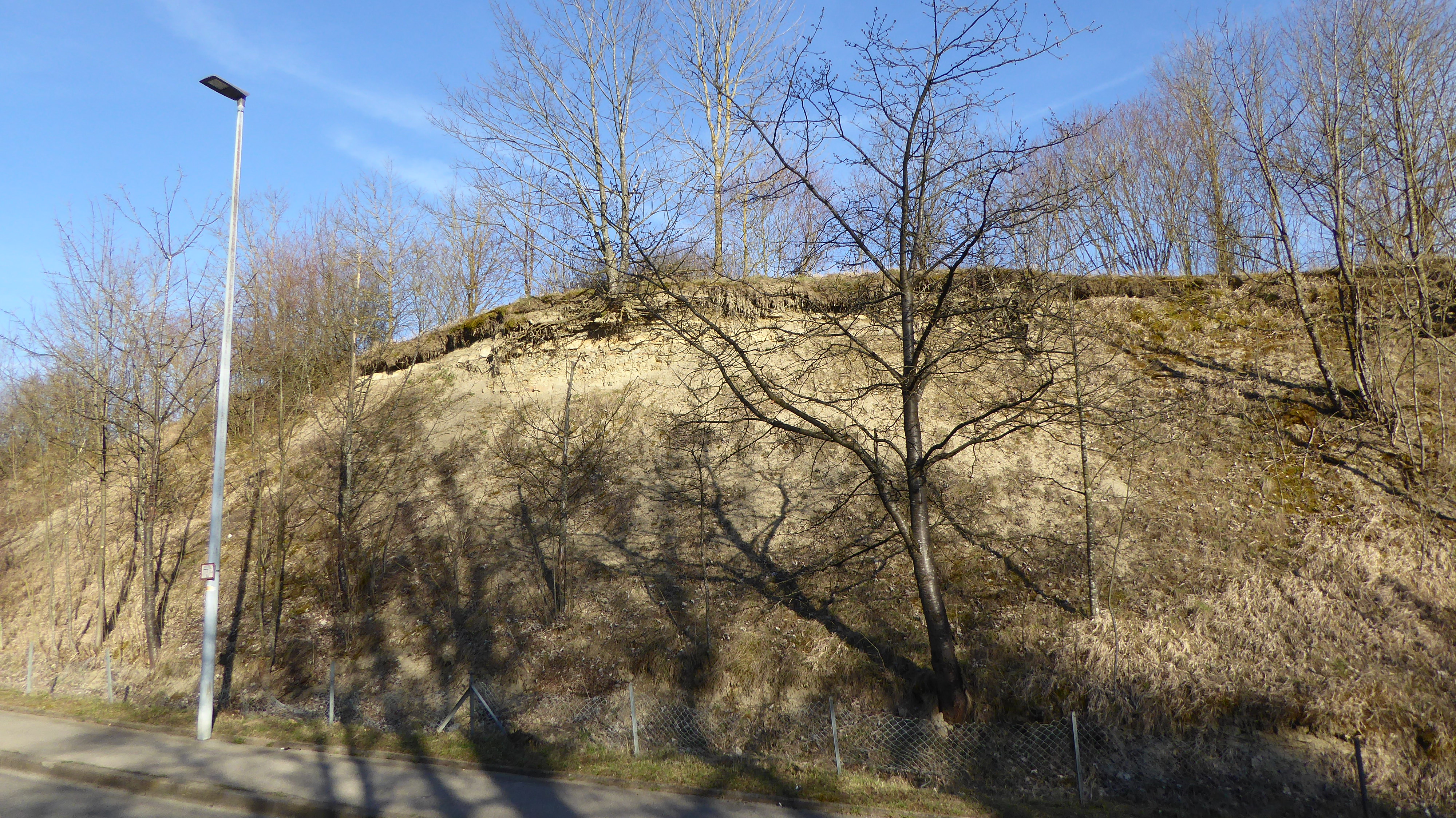
Deutsch: Der aufgelassene Steinbruch zwischen Gomaringen und Hinterweiler ist der Rest eines größeren Steinbruchgeländes in den unteren Schichten der Numismalismergel-Formation (pb1, früher Schwarzjura gamma). Das Profil zeigt einen insgesamt etwa 40 m langen und 7 m hohen Ausschnitt aus dieser Formation im mittleren Unterjura: Kalkmergel und Mergelsteine mit der abschließenden Devoei-Bank, die hier eine Verebnungsfläche verursacht. |
| Date | |
| Source | Own work |
| Author | Vux |
Licensing
[edit]
I, the copyright holder of this work, hereby publish it under the following license:
This file is licensed under the Creative Commons Attribution-Share Alike 4.0 International license.
- You are free:
- to share – to copy, distribute and transmit the work
- to remix – to adapt the work
- Under the following conditions:
- attribution – You must give appropriate credit, provide a link to the license, and indicate if changes were made. You may do so in any reasonable manner, but not in any way that suggests the licensor endorses you or your use.
- share alike – If you remix, transform, or build upon the material, you must distribute your contributions under the same or compatible license as the original.
This image was uploaded as part of Wiki Loves Earth 2020.
|
 |
File history
Click on a date/time to view the file as it appeared at that time.
| Date/Time | Thumbnail | Dimensions | User | Comment | |
|---|---|---|---|---|---|
| current | 21:07, 6 May 2020 | | 4,000 × 2,248 (3.88 MB) | Vux (talk | contribs) | Uploaded own work with UploadWizard |
You cannot overwrite this file.
File usage on Commons
There are no pages that use this file.