File:Geology of Wuling (closeup).jpg
Jump to navigation
Jump to search

Size of this preview: 800 × 533 pixels. Other resolutions: 320 × 213 pixels | 640 × 427 pixels | 1,024 × 683 pixels | 1,280 × 853 pixels | 2,560 × 1,707 pixels | 3,240 × 2,160 pixels.
Original file (3,240 × 2,160 pixels, file size: 7.77 MB, MIME type: image/jpeg)
Captions
Captions
Add a one-line explanation of what this file represents
Summary
[edit].jpg&action=edit§ion=1)
| Description |
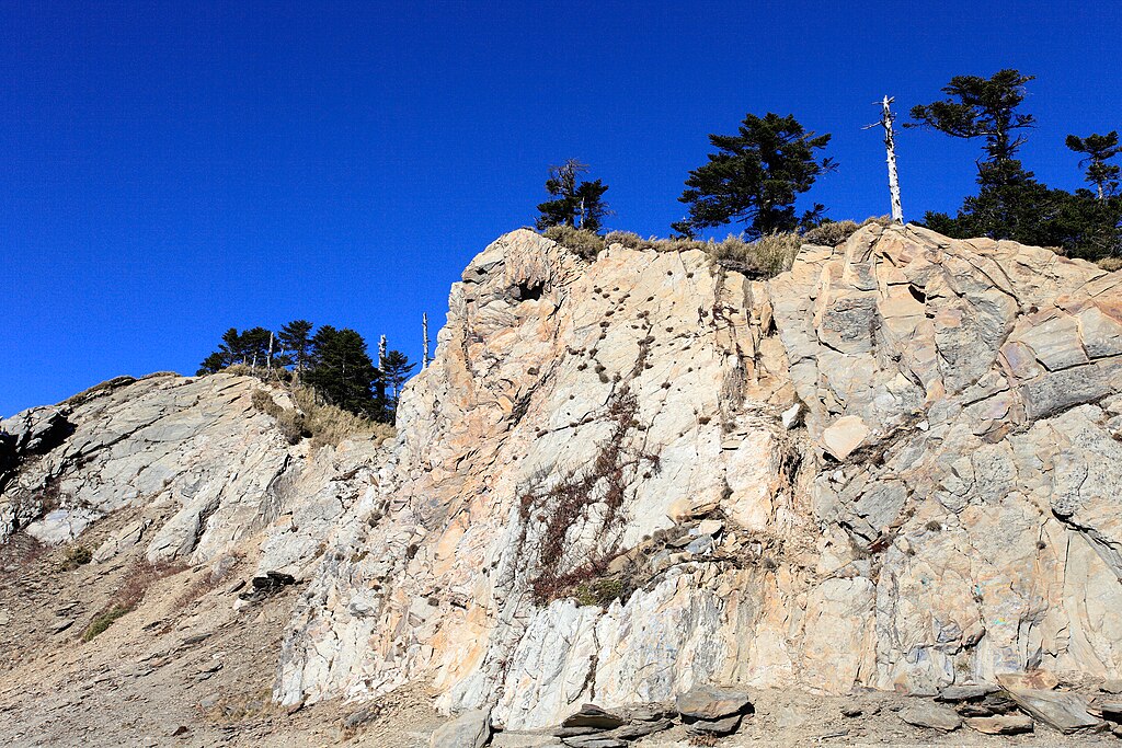
English: Showing the Slate Formation of Wuling in Nantou County.
中文(臺灣):南投縣武嶺的板岩層。 |
| Date | |
| Source | https://www.flickr.com/photos/sfmine79/5395619839 |
| Author | MiNe |
| Camera location | | View this and other nearby images on: OpenStreetMap |
|---|
.jpg¶ms=024.137512_N_0121.275719_E_globe:Earth_type:camera__&language=en)
Licensing
[edit].jpg&action=edit§ion=2)
| This image was originally posted to Flickr by MiNe (sfmine79) at https://flickr.com/photos/8996753@N06/5395619839. It was reviewed on 20 June 2016 by FlickreviewR and was confirmed to be licensed under the terms of the cc-by-2.0. |
This file is licensed under the Creative Commons Attribution 2.0 Generic license.
- You are free:
- to share – to copy, distribute and transmit the work
- to remix – to adapt the work
- Under the following conditions:
- attribution – You must give appropriate credit, provide a link to the license, and indicate if changes were made. You may do so in any reasonable manner, but not in any way that suggests the licensor endorses you or your use.
File history
Click on a date/time to view the file as it appeared at that time.
| Date/Time | Thumbnail | Dimensions | User | Comment | |
|---|---|---|---|---|---|
| current | 14:10, 20 June 2016 | | 3,240 × 2,160 (7.77 MB) | Liji6085 (talk | contribs) | User created page with UploadWizard |
You cannot overwrite this file.
File usage on Commons
The following 2 pages use this file:
File usage on other wikis
The following other wikis use this file:
- Usage on www.wikidata.org
.jpg&oldid=683771716)