File:Geologische Karte der Insel Sylt 1876 Ludwig Meyn.jpg
Jump to navigation
Jump to search

Size of this preview: 509 × 599 pixels. Other resolutions: 204 × 240 pixels | 408 × 480 pixels | 652 × 768 pixels | 870 × 1,024 pixels | 1,739 × 2,048 pixels | 7,645 × 9,002 pixels.
Original file (7,645 × 9,002 pixels, file size: 11.07 MB, MIME type: image/jpeg)
Captions
Captions
Add a one-line explanation of what this file represents
| Warning | The original file is very high-resolution. It might not load properly or could cause your browser to freeze when opened at full size. |
|---|
Summary
[edit]| Description |
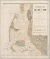
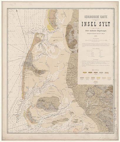
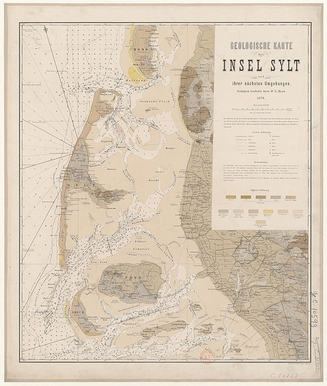
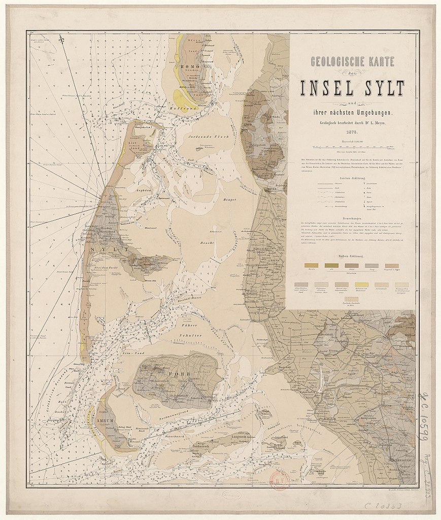
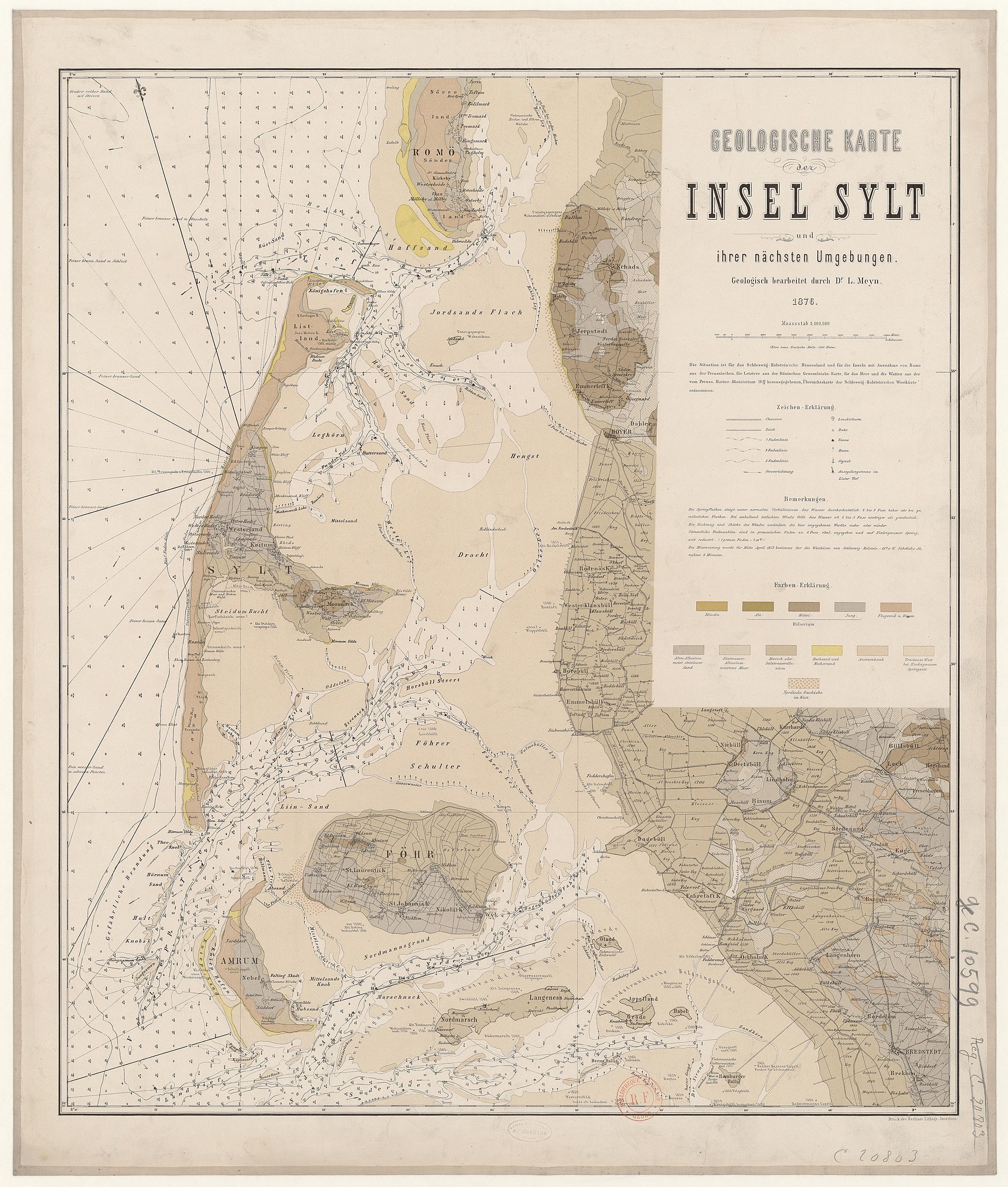
Deutsch: Geologische Karte der Insel Sylt und ihrer nächsten Umgebungen |
| Date | |
| Source | http://gallica.bnf.fr/ark:/12148/btv1b531027359 |
| Author | Ludwig Meyn |
| Other versions |
|


Licensing
[edit]
|
This work is in the public domain in its country of origin and other countries and areas where the copyright term is the author's life plus 70 years or fewer. This work is in the public domain in the United States because it was published (or registered with the U.S. Copyright Office) before January 1, 1929. | |
| This file has been identified as being free of known restrictions under copyright law, including all related and neighboring rights. | |
File history
Click on a date/time to view the file as it appeared at that time.
| Date/Time | Thumbnail | Dimensions | User | Comment | |
|---|---|---|---|---|---|
| current | 20:26, 28 August 2017 | | 7,645 × 9,002 (11.07 MB) | Ratzer (talk | contribs) | correct resolution, without artificial blow-up |
| 13:24, 28 August 2017 |  | 10,813 × 12,732 (17.44 MB) | Ratzer (talk | contribs) | User created page with UploadWizard |
You cannot overwrite this file.
File usage on Commons
The following 3 pages use this file:
File usage on other wikis
The following other wikis use this file: