File:Generalstabskartan södra 6 Christianstad 1874.jpg
Jump to navigation
Jump to search

Size of this preview: 773 × 599 pixels. Other resolutions: 310 × 240 pixels | 619 × 480 pixels | 991 × 768 pixels | 1,280 × 993 pixels | 2,560 × 1,985 pixels | 14,464 × 11,216 pixels.
Original file (14,464 × 11,216 pixels, file size: 11.48 MB, MIME type: image/jpeg)
Captions
Captions
Add a one-line explanation of what this file represents
| Warning | The original file is very high-resolution. It might not load properly or could cause your browser to freeze when opened at full size. |
|---|
Summary
[edit]
| Description |
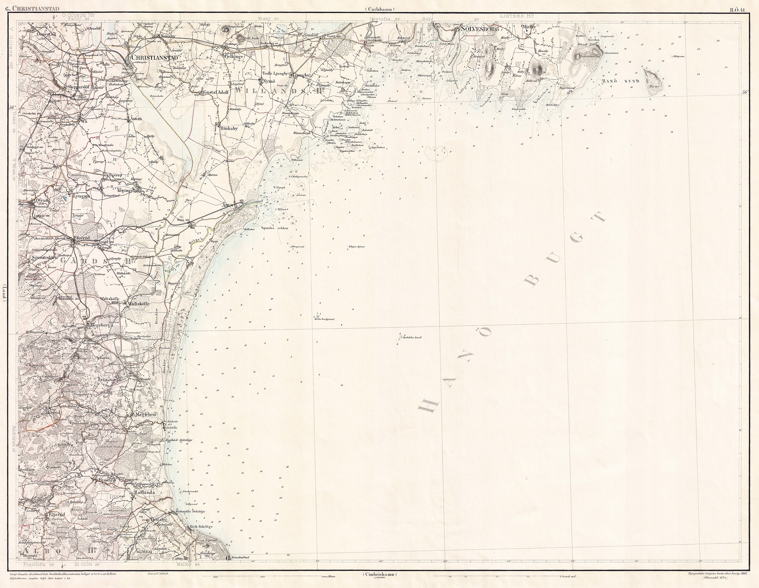
Svenska: Generalstabens karta öfver Sverige. Södra delen. 6 Christianstad (II.Ö. 41).
English: Swedish topographic map 'Generalstabskartan' for southern Sweden, leaf 6 Christianstad (II.Ö. 41). |
| Date | |
| Source | Engraved in 1862 by Carl Peter Schleich (born 1820), revised and printed in 1874, scanned in 600 dpi by Stockholm University[1]. |
| Author | Generalstabens litografiska anstalt |
Licensing
[edit]
|
This work is in the public domain in its country of origin and other countries and areas where the copyright term is the author's life plus 70 years or fewer. | |
| This file has been identified as being free of known restrictions under copyright law, including all related and neighboring rights. | |
File history
Click on a date/time to view the file as it appeared at that time.
| Date/Time | Thumbnail | Dimensions | User | Comment | |
|---|---|---|---|---|---|
| current | 19:53, 16 January 2013 | | 14,464 × 11,216 (11.48 MB) | LA2 (talk | contribs) | =={{int:filedesc}}== {{Information |description={{sv|1=Generalstabens karta öfver Sverige. Södra delen. 6 Christianstad (II.Ö. 41). Topografiska Corpsens karta öfver Sverige 1862. (Öfversedd 1874.)}} {{en|1=Swedish topog... |
You cannot overwrite this file.
File usage on Commons
There are no pages that use this file.