File:Generals Highway, Clover Creek Bridge, Spanning Clover Creek on Generals Highway, approxi, Three Rivers vicinity (Tulare County, California).jpg
Jump to navigation
Jump to search

Size of this preview: 800 × 561 pixels. Other resolutions: 320 × 225 pixels | 640 × 449 pixels | 1,024 × 719 pixels | 1,280 × 898 pixels | 2,560 × 1,796 pixels | 4,580 × 3,214 pixels.
Original file (4,580 × 3,214 pixels, file size: 1.62 MB, MIME type: image/jpeg)
Captions
Captions
Add a one-line explanation of what this file represents
Summary
[edit]| Description |
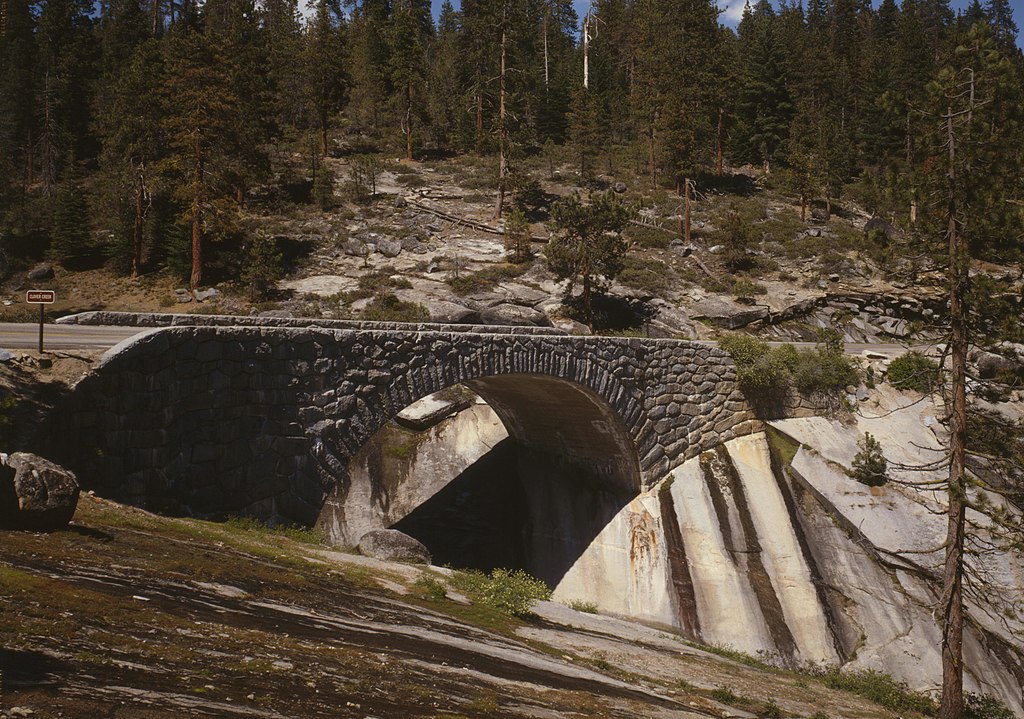
English: Clover Creek Bridge, Spanning Clover Creek on Generals Highway, Sequoia National Park — Three Rivers vicinity (Tulare County, California).
|
||
| Date | |||
| Source |
Historic American Engineering Record, Library of Congress, Call number CAL,54-THRIV.V,2B-6
|
||
| Author | Brian C. Grogan, Photographer |

.jpg&action=edit§ion=1)
| Object location | | View this and other nearby images on: OpenStreetMap |
|---|
.jpg¶ms=036.607500_N_-118.746111_E_globe:Earth_class:object_region:US_type:landmark_scale:1500_&language=en)
Licensing
[edit].jpg&action=edit§ion=2)
| This image or media file contains material based on a work of a National Park Service employee, created as part of that person's official duties. As a work of the U.S. federal government, such work is in the public domain in the United States. See the NPS website and NPS copyright policy for more information. |
|
File history
Click on a date/time to view the file as it appeared at that time.
| Date/Time | Thumbnail | Dimensions | User | Comment | |
|---|---|---|---|---|---|
| current | 19:54, 18 January 2010 | | 4,580 × 3,214 (1.62 MB) | Martin H. (talk | contribs) | from full size |
| 01:56, 13 January 2010 |  | 941 × 665 (203 KB) | KudzuVine (talk | contribs) | {{Information |Description={{en|1=Generals Highway, Clover Creek Bridge, Spanning Clover Creek on Generals Highway, approxi, Three Rivers vicinity (Tulare County, California) cropped {{PD-USGov-NPS-HAER|CAL,54-THRIV.V,2B-6}}}} |Source=http://memory.loc.go |
You cannot overwrite this file.
File usage on Commons
The following page uses this file:
File usage on other wikis
The following other wikis use this file:
- Usage on en.wikipedia.org
- Usage on fr.wikipedia.org
- Usage on zh.wikipedia.org
.jpg&oldid=808974590)