File:Generalkarta Uppsala och Stockholm.png
Jump to navigation
Jump to search
Size of this preview: 515 × 599 pixels. Other resolutions: 206 × 240 pixels | 413 × 480 pixels | 660 × 768 pixels | 880 × 1,024 pixels | 1,760 × 2,048 pixels | 5,600 × 6,515 pixels.
Original file (5,600 × 6,515 pixels, file size: 59.73 MB, MIME type: image/png)
Captions
Captions
Add a one-line explanation of what this file represents
Summary
[edit]
| Description |
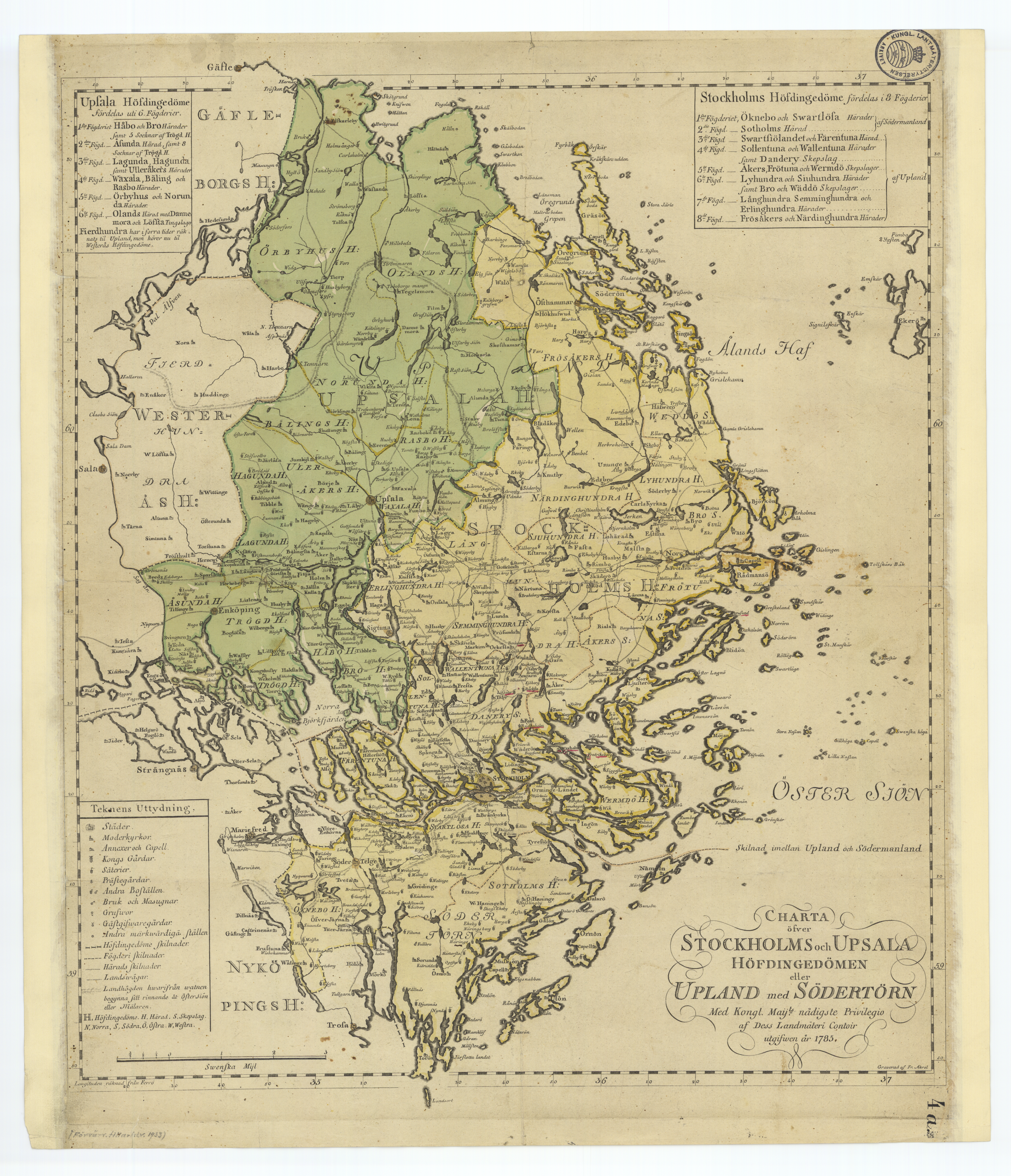
Svenska: Generalkarta över Uppsala och Stockholm, skapad 1785 av Kungliga Lantmäteriet. |
| Date | |
| Source | The Swedish National Land Survey's database with historical maps |
| Author | Kungl. Lantmäteriets Generalkartor |
Licensing
[edit]
|
This work is in the public domain in its country of origin and other countries and areas where the copyright term is the author's life plus 100 years or fewer. | |
| This file has been identified as being free of known restrictions under copyright law, including all related and neighboring rights. | |
File history
Click on a date/time to view the file as it appeared at that time.
| Date/Time | Thumbnail | Dimensions | User | Comment | |
|---|---|---|---|---|---|
| current | 12:44, 26 August 2023 | | 5,600 × 6,515 (59.73 MB) | VulpesVulpes42 (talk | contribs) | Högre upplösning. |
| 21:56, 14 September 2017 |  | 2,800 × 3,257 (11.98 MB) | Moralist (talk | contribs) | VicuñaUploader 1.23 |
You cannot overwrite this file.
File usage on Commons
There are no pages that use this file.