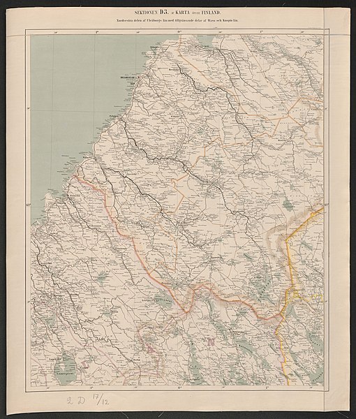
File:General map of the Grand Duchy of Finland 1863 Sheet D3.jpg

Original file (5,995 × 7,052 pixels, file size: 3.61 MB, MIME type: image/jpeg)
Captions
Captions
Summary
[edit]| Title |
Svenska: Sektionen D3 af karta öfver Finland. Nordvestra delen af Uleåborgs län med tillgränsande delar af Wasa och Kuopio län.
Suomi: Arkki D3 Suomen suuriruhtinaskunnan kartta vuodelta 1863. Kartassa näkyy Oulun lääniä, Vaasan lääniä ja Kuopion lääniä. |
|||||||||
| DescriptionGeneral map of the Grand Duchy of Finland 1863 Sheet D3.jpg |
Map of the Grand Duchy of Finland 1863 |
|||||||||
| Date | ||||||||||
| Source | http://digi.narc.fi/digi/slistaus.ka?ay=161325 | |||||||||
| Creator |
Öfverstyrelsen för Landtmäteriet |
|||||||||
| Permission (Reusing this file) |
|
|||||||||
| Geotemporal data | ||||||||||
| Date depicted | ||||||||||
| Bounding box |
|
|||||||||
| Georeferencing | View the georeferenced map in the Wikimaps Warper | |||||||||
| Archival data | ||||||||||
| Collection | National Archives of Finland | |||||||||
| Accession number |
Yleisk. Ia* 162/- - |
|||||||||
File history
Click on a date/time to view the file as it appeared at that time.
| Date/Time | Thumbnail | Dimensions | User | Comment | |
|---|---|---|---|---|---|
| current | 17:14, 13 February 2018 |  | 5,995 × 7,052 (3.61 MB) | Susannaanas (talk | contribs) | pattypan 17.12 |
You cannot overwrite this file.
File usage on Commons
The following page uses this file:
Metadata
This file contains additional information such as Exif metadata which may have been added by the digital camera, scanner, or software program used to create or digitize it. If the file has been modified from its original state, some details such as the timestamp may not fully reflect those of the original file. The timestamp is only as accurate as the clock in the camera, and it may be completely wrong.
| Author | National Archives of Finland |
|---|---|
| Image title |
|
| Related media | VAKKA ARCHIVAL DATABASE, NATIONAL ARCHIVES OF FINLAND |
| Short title |
|
| Width | 5,995 px |
| Height | 7,052 px |
| Bits per component |
|
| Pixel composition | RGB |
| Orientation | Normal |
| Number of components | 3 |
| Horizontal resolution | 300 dpi |
| Vertical resolution | 300 dpi |
| File change date and time | 07:57, 28 March 2012 |
| Exif version | 2.21 |
| Color space | sRGB |
| Identifier | 982103.KA |