File:Gendarmstien.svg
Jump to navigation
Jump to search

Size of this PNG preview of this SVG file: 747 × 600 pixels. Other resolutions: 299 × 240 pixels | 598 × 480 pixels | 957 × 768 pixels | 1,276 × 1,024 pixels | 2,551 × 2,048 pixels | 1,045 × 839 pixels.
Original file (SVG file, nominally 1,045 × 839 pixels, file size: 1.95 MB)
Captions
Captions
Add a one-line explanation of what this file represents
Summary
[edit]
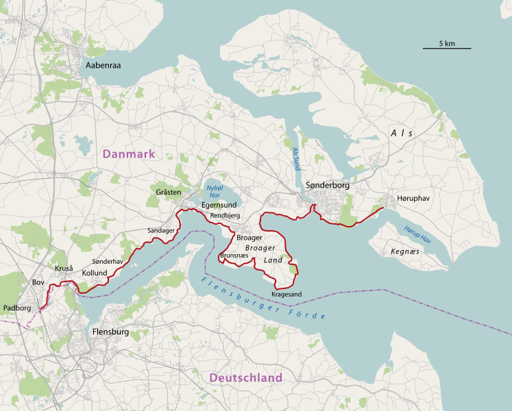
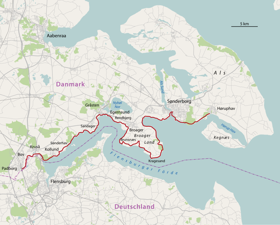
| Description |
Deutsch: Karte des Gendarmstien
English: Map of the Gendarmstien |
||||||||||||
| Date | |||||||||||||
| Source | Own work, using | ||||||||||||
| Author | NordNordWest | ||||||||||||
| Permission (Reusing this file) |
|

|
This map has been made or improved in the German Kartenwerkstatt (Map Lab). You can propose maps to improve as well.
|
File history
Click on a date/time to view the file as it appeared at that time.
| Date/Time | Thumbnail | Dimensions | User | Comment | |
|---|---|---|---|---|---|
| current | 18:30, 3 December 2010 | | 1,045 × 839 (1.95 MB) | NordNordWest (talk | contribs) | =={{int:filedesc}}== {{Information |Description= {{de|Karte des Gendarmstien}} {{en|Map of the Gendarmstien}} |Source={{Own}}, using |Date=2010-12-03 |Author={{U|NordNordWest}} |Permission={{OpenStreetMap}} |other_versions= }} {{Kart |
You cannot overwrite this file.
File usage on Commons
The following page uses this file:
File usage on other wikis
The following other wikis use this file:
- Usage on da.wikipedia.org
- Ullerup (Sønderborg Kommune)
- Egernsund
- Alssund
- Brunsnæs
- Egen
- Elsmark
- Osmark
- Dybbøl (Sønderborg Kommune)
- Lunden (Havnbjerg Sogn)
- Sandvig (Havnbjerg Sogn)
- Brandsbøl
- Broager Land
- Drejby
- Lusig
- Asserballe
- Kær (Als)
- Stensigmose
- Stensigmose Klint
- Skabelon:Sønderborg-geostub
- Rådhustorvet (Sønderborg)
- Sønder Havnegade
- Store Rådhusgade
- Omfartsvejen (Sønderborg)
- Usage on de.wikipedia.org
- Usage on de.wikivoyage.org
- Usage on pl.wiktionary.org