File:Gem-Voorne aan Zee-TopoPlus.jpg
Jump to navigation
Jump to search

Size of this preview: 713 × 600 pixels. Other resolutions: 285 × 240 pixels | 571 × 480 pixels | 913 × 768 pixels | 1,218 × 1,024 pixels | 2,435 × 2,048 pixels | 6,821 × 5,737 pixels.
Original file (6,821 × 5,737 pixels, file size: 3.94 MB, MIME type: image/jpeg)
Captions
Captions
Add a one-line explanation of what this file represents
Summary
[edit]
| Description |
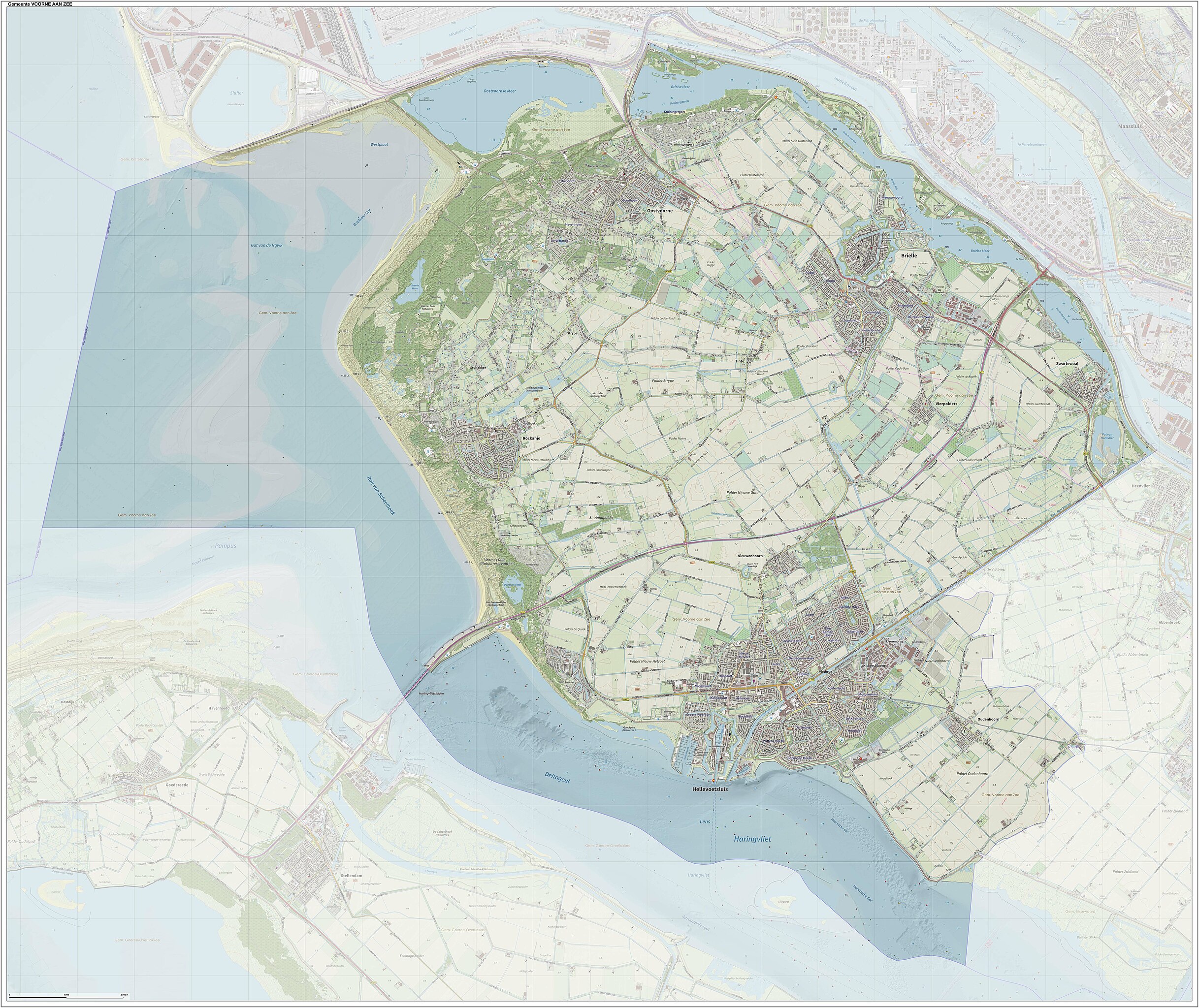
English: Topografisch kaartbeeld van de gemeente Voorne aan Zee, met indeling van de leefomgeving. Samengesteld uit meerdere overheids databronnen. Peildatum kaartgegevens: november 2022 |
| Date | |
| Source | Own work |
| Author | Janwillemvanaalst |
Licensing
[edit]
I, the copyright holder of this work, hereby publish it under the following license:
This file is licensed under the Creative Commons Attribution 4.0 International license.
- You are free:
- to share – to copy, distribute and transmit the work
- to remix – to adapt the work
- Under the following conditions:
- attribution – You must give appropriate credit, provide a link to the license, and indicate if changes were made. You may do so in any reasonable manner, but not in any way that suggests the licensor endorses you or your use.
File history
Click on a date/time to view the file as it appeared at that time.
| Date/Time | Thumbnail | Dimensions | User | Comment | |
|---|---|---|---|---|---|
| current | 21:17, 1 March 2024 | | 6,821 × 5,737 (3.94 MB) | Janwillemvanaalst (talk | contribs) | Map layers update, Feb. 2024 |
| 13:34, 9 July 2023 |  | 7,067 × 5,946 (4.29 MB) | Janwillemvanaalst (talk | contribs) | Map layers update, July 2023 | |
| 16:42, 24 November 2022 |  | 8,413 × 7,079 (8.01 MB) | Janwillemvanaalst (talk | contribs) | Uploaded own work with UploadWizard |
You cannot overwrite this file.
File usage on Commons
The following 3 pages use this file:
File usage on other wikis
The following other wikis use this file:
- Usage on af.wikipedia.org
- Usage on de.wikipedia.org
- Usage on en.wikipedia.org
- Usage on fy.wikipedia.org
- Usage on id.wikipedia.org
- Usage on lb.wikipedia.org
- Usage on nl.wikipedia.org
- Usage on ru.wikipedia.org
- Usage on uk.wikipedia.org
- Usage on vls.wikipedia.org
- Usage on www.wikidata.org
- Usage on zea.wikipedia.org