File:Geländekarte Scharmützel bei Bürgstadt.jpg
Original file (1,076 × 801 pixels, file size: 867 KB, MIME type: image/jpeg)
Captions
Captions
Summary
[edit]
| Description |
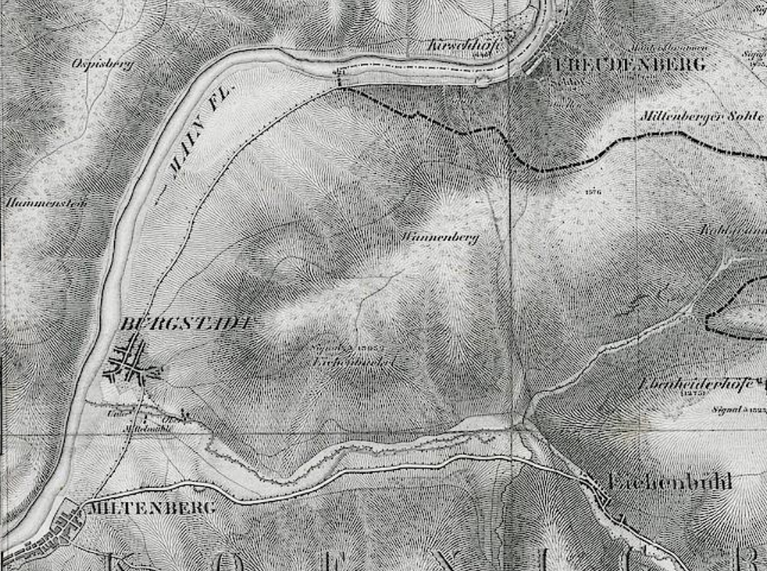
Deutsch: Auszug aus Topographische Karte über das Grossherzogthum Baden: nach der allgemeinen Landesvermessung des Großherzoglichen militairisch topographischen Bureaus (Blatt 4): Wertheim mit dem Gelände um Bürgstadt in dem 1866 preußischen Dragonern von badischen Jägern ein Hinterhalt gelegt wurde. |
| Date | |
| Source | https://digi.ub.uni-heidelberg.de/diglit/topographische_karte_grossherzogthum_baden_4 |
| Author | Simon, R. [Hrsg.]; Baden / Topographisches Bureau [Hrsg.] Universitätsbibliothek Heidelberg |
| Permission (Reusing this file) |
https://digi.ub.uni-heidelberg.de/diglit/topographische_karte_grossherzogthum_baden_4 |
Licensing
[edit]
|
This work is in the public domain in its country of origin and other countries and areas where the copyright term is the author's life plus 70 years or fewer.
| |
| This file has been identified as being free of known restrictions under copyright law, including all related and neighboring rights. | |
File history
Click on a date/time to view the file as it appeared at that time.
| Date/Time | Thumbnail | Dimensions | User | Comment | |
|---|---|---|---|---|---|
| current | 08:57, 26 August 2020 | | 1,076 × 801 (867 KB) | Granpar (talk | contribs) | {{Information |description ={{de|1=Auszug aus Topographische Karte über das Grossherzogthum Baden: nach der allgemeinen Landesvermessung des Großherzoglichen militairisch topographischen Bureaus (Blatt 4): Wertheim mit dem Gelände um Bürgstadt in dem 1866 preußischen Dragonern von badischen Jägern ein Hinterhalt gelegt wurde.}} |date =1840 |source =https://digi.ub.uni-heidelberg.de/diglit/topographische_karte_grossherzogthum_baden_4 |author =Simon, R. [Hrsg.]; Baden /... |
You cannot overwrite this file.
File usage on Commons
The following page uses this file:
File usage on other wikis
The following other wikis use this file:
- Usage on www.wikidata.org