File:Geigerhütte 1666m, Gemeinde Arriach, Nockberge Kärnten.jpg
Jump to navigation
Jump to search

Size of this preview: 800 × 447 pixels. Other resolutions: 320 × 179 pixels | 640 × 357 pixels | 1,024 × 572 pixels | 1,280 × 714 pixels | 2,560 × 1,429 pixels | 4,608 × 2,572 pixels.
Original file (4,608 × 2,572 pixels, file size: 6.9 MB, MIME type: image/jpeg)
Captions
Captions
Add a one-line explanation of what this file represents
Summary
[edit]
| Description |
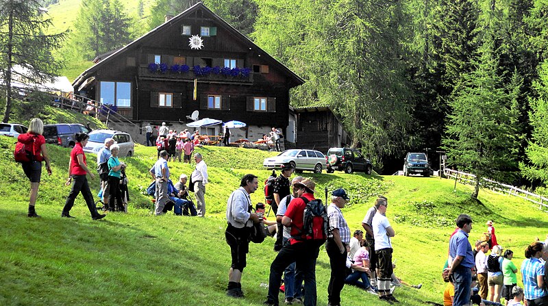
Deutsch: Über eine Mautstraße erreichbar, direkt am Wöllanernock, liegt in 1666 m Seehöhe der Alpengasthof „Geigerhütte“ in der Gemeinde Arriach. Diese spezielle Lage ist Ausgangspunkt für Wanderungen oder Touren mit dem Mountainbike sowie Veranstaltungen wie dem Ringen in den Nockbergen in Kärnten, Österreich, EU |
| Date | |
| Source | Own work |
| Author | Naturpuur |
Licensing
[edit]
I, the copyright holder of this work, hereby publish it under the following license:
This file is licensed under the Creative Commons Attribution-Share Alike 4.0 International license.
- You are free:
- to share – to copy, distribute and transmit the work
- to remix – to adapt the work
- Under the following conditions:
- attribution – You must give appropriate credit, provide a link to the license, and indicate if changes were made. You may do so in any reasonable manner, but not in any way that suggests the licensor endorses you or your use.
- share alike – If you remix, transform, or build upon the material, you must distribute your contributions under the same or compatible license as the original.
File history
Click on a date/time to view the file as it appeared at that time.
| Date/Time | Thumbnail | Dimensions | User | Comment | |
|---|---|---|---|---|---|
| current | 17:22, 14 April 2018 | | 4,608 × 2,572 (6.9 MB) | Naturpuur (talk | contribs) | User created page with UploadWizard |
You cannot overwrite this file.
File usage on Commons
There are no pages that use this file.