File:Gbg1682-2.jpg
Jump to navigation
Jump to search

Size of this preview: 800 × 385 pixels. Other resolutions: 320 × 154 pixels | 640 × 308 pixels | 1,024 × 493 pixels | 1,280 × 617 pixels | 2,560 × 1,233 pixels | 6,643 × 3,200 pixels.
Original file (6,643 × 3,200 pixels, file size: 2.98 MB, MIME type: image/jpeg)
Captions
Captions
Add a one-line explanation of what this file represents
Summary
[edit]
| Description |
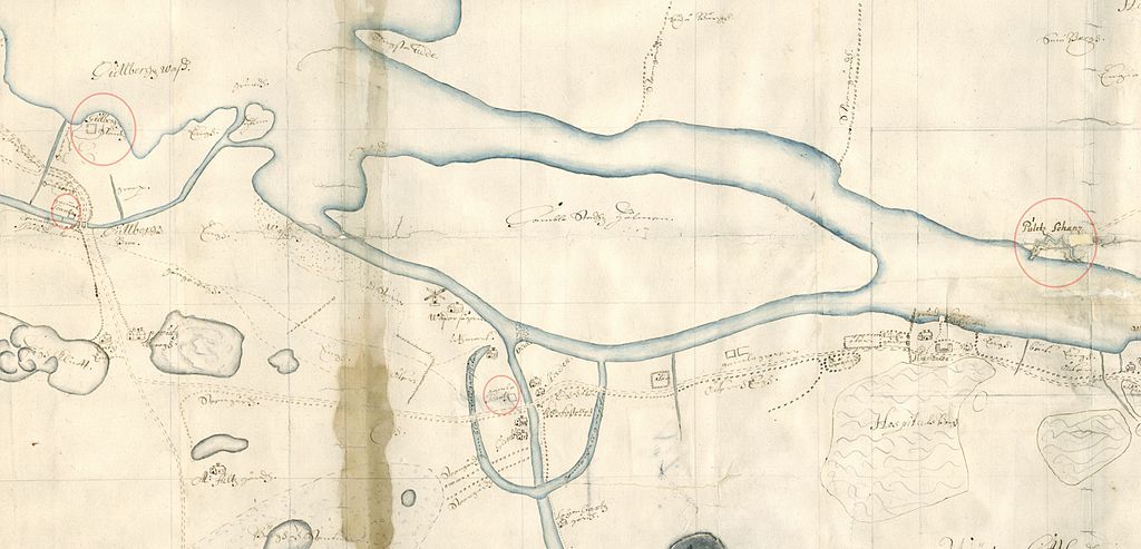
English: Map from 1682, showing the Göta älv river north of the Swedish city Göteborg, with some fortifications incircled.
Svenska: Karta från 1682 över Göta älv norr om Göteborg, med befästningar inringade, från Gullberg till Hospitalet. |
| Date | |
| Source | Krigsarkivet: 0424:037:370a Stads och fästningsplaner - Göteborg. |
| Author | D Lijdinghielm |
Licensing
[edit]
|
This work is in the public domain in its country of origin and other countries and areas where the copyright term is the author's life plus 100 years or fewer. | |
| This file has been identified as being free of known restrictions under copyright law, including all related and neighboring rights. | |
File history
Click on a date/time to view the file as it appeared at that time.
| Date/Time | Thumbnail | Dimensions | User | Comment | |
|---|---|---|---|---|---|
| current | 19:07, 17 September 2014 | | 6,643 × 3,200 (2.98 MB) | Dagjoh (talk | contribs) | {{Information |Description ={{en|1=Map from 1682, showing the Göta älv river north of the Swedish city Göteborg, with some fortifications incircled.}} {{sv|1=Karta från 1682 över Göta älv norr om Göteborg, med befästningar inringade, från... |
You cannot overwrite this file.
File usage on Commons
There are no pages that use this file.
File usage on other wikis
The following other wikis use this file:
- Usage on sv.wikipedia.org