File:Garliestown 2nd station (site), Dumfries & Galloway (geograph 6162892).jpg
Jump to navigation
Jump to search

Size of this preview: 800 × 600 pixels. Other resolutions: 320 × 240 pixels | 640 × 480 pixels | 1,024 × 768 pixels | 1,280 × 960 pixels | 1,600 × 1,200 pixels.
Original file (1,600 × 1,200 pixels, file size: 576 KB, MIME type: image/jpeg)
Captions
Captions
Add a one-line explanation of what this file represents
Summary
[edit],_Dumfries_%26_Galloway_(geograph_6162892).jpg&action=edit§ion=1)
| Description |
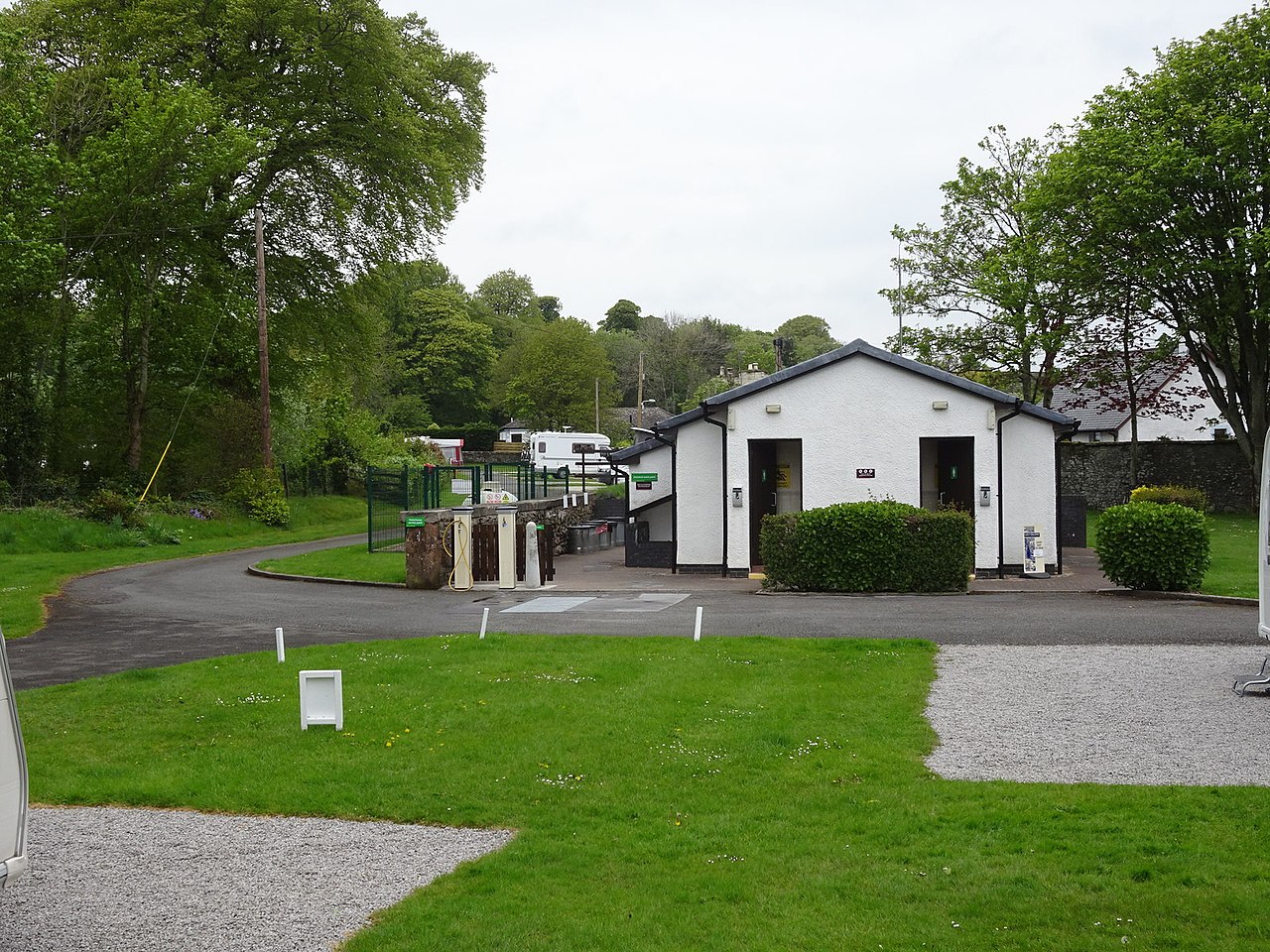
English: Garliestown 2nd station (site), Dumfries & Galloway Opened in 1876 by Directors of the Wigtown Railway on what later became the Portpatrick & Wigtownshire Joint Railway, this station was on a short branch line off the P&WJR branch line from Newton Stewart to Whithorn. It replaced NX4646 : Millisle railway station (site), Dumfries & Galloway but closed to regular passenger traffic as early as 1903 and to occasional excursions in 1935. View north west along the former platform. The only remainder is the short section of grey wall to the left of the white facilities block, which carried the platform edge. The platform was on a curve, which can still be identified looking towards the camper vans in the distance. |
| Date | |
| Source | From geograph.org.uk |
| Author | Nigel Thompson |
| Permission (Reusing this file) |
Creative Commons Attribution Share-alike license 2.0 |
| Attribution (required by the license) | Nigel Thompson / Garliestown 2nd station (site), Dumfries & Galloway / |
,_Dumfries_%26_Galloway_(geograph_6162881).jpg)
| Camera location | | View this and other nearby images on: OpenStreetMap |
|---|
,_Dumfries_%26_Galloway_(geograph_6162892).jpg¶ms=054.787361_N_-004.368474_E_globe:Earth_type:camera_source:geograph-osgb36(NX47804618)_heading:292.00&language=en)
| Object location | | View this and other nearby images on: OpenStreetMap |
|---|
,_Dumfries_%26_Galloway_(geograph_6162892).jpg¶ms=054.787520_N_-004.369570_E_globe:Earth_class:object_type:object_source:geograph-osgb36(NX47734620)_heading:292.00&language=en)
Licensing
[edit],_Dumfries_%26_Galloway_(geograph_6162892).jpg&action=edit§ion=2)

|
This image was taken from the Geograph project collection. See this photograph's page on the Geograph website for the photographer's contact details. The copyright on this image is owned by Nigel Thompson and is licensed for reuse under the Creative Commons Attribution-ShareAlike 2.0 license.
|
This file is licensed under the Creative Commons Attribution-Share Alike 2.0 Generic license.
Attribution: Nigel Thompson
- You are free:
- to share – to copy, distribute and transmit the work
- to remix – to adapt the work
- Under the following conditions:
- attribution – You must give appropriate credit, provide a link to the license, and indicate if changes were made. You may do so in any reasonable manner, but not in any way that suggests the licensor endorses you or your use.
- share alike – If you remix, transform, or build upon the material, you must distribute your contributions under the same or compatible license as the original.
File history
Click on a date/time to view the file as it appeared at that time.
| Date/Time | Thumbnail | Dimensions | User | Comment | |
|---|---|---|---|---|---|
| current | 18:49, 4 January 2020 | | 1,600 × 1,200 (576 KB) | Lamberhurst (talk | contribs) | Transferred from geograph.co.uk using [https://tools.wmflabs.org/geograph2commons/ geograph2commons] |
You cannot overwrite this file.
File usage on Commons
The following page uses this file:
File usage on other wikis
The following other wikis use this file:
- Usage on en.wikipedia.org
,_Dumfries_%26_Galloway_(geograph_6162892).jpg&oldid=706247094)