File:Gare de Lapalisse-Ville.jpg
Jump to navigation
Jump to search

Size of this preview: 800 × 420 pixels. Other resolutions: 320 × 168 pixels | 640 × 336 pixels | 1,024 × 538 pixels | 1,280 × 672 pixels | 2,226 × 1,169 pixels.
Original file (2,226 × 1,169 pixels, file size: 996 KB, MIME type: image/jpeg)
Captions
Captions
Add a one-line explanation of what this file represents
Summary
[edit]
| Description |
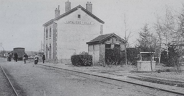
Français : Ancienne gare de Lapalisse-Ville, sur la ligne à voie métrique de la SE entre Lapalisse-Saint-Prix et Trezelles |
| Date | before 1910 |
| Source | Own work |
| Author | Unknown (upload TCY) |
| Camera location | | View this and other nearby images on: OpenStreetMap |
|---|
Licensing
[edit]
|
This work is in the public domain in its country of origin and other countries and areas where the copyright term is the author's life plus 70 years or fewer. This work is in the public domain in the United States because it was published (or registered with the U.S. Copyright Office) before January 1, 1929. | |
| This file has been identified as being free of known restrictions under copyright law, including all related and neighboring rights. | |
| This file was uploaded via Mobile Android App (Commons mobile app) 2.13.2~757c7b008. |
File history
Click on a date/time to view the file as it appeared at that time.
| Date/Time | Thumbnail | Dimensions | User | Comment | |
|---|---|---|---|---|---|
| current | 13:42, 23 March 2021 | | 2,226 × 1,169 (996 KB) | TCY (talk | contribs) | Uploaded using Commons Mobile App |
You cannot overwrite this file.
File usage on Commons
The following page uses this file:
File usage on other wikis
The following other wikis use this file:
- Usage on fr.wikipedia.org
- Usage on zh.wikipedia.org