File:Gallica Biloxy map zoom caption.jpg
Jump to navigation
Jump to search
Size of this preview: 753 × 599 pixels. Other resolutions: 302 × 240 pixels | 603 × 480 pixels | 965 × 768 pixels | 1,280 × 1,019 pixels | 1,609 × 1,281 pixels.
Original file (1,609 × 1,281 pixels, file size: 288 KB, MIME type: image/jpeg)
Captions
Captions
Add a one-line explanation of what this file represents
Summary
[edit]
| Description |
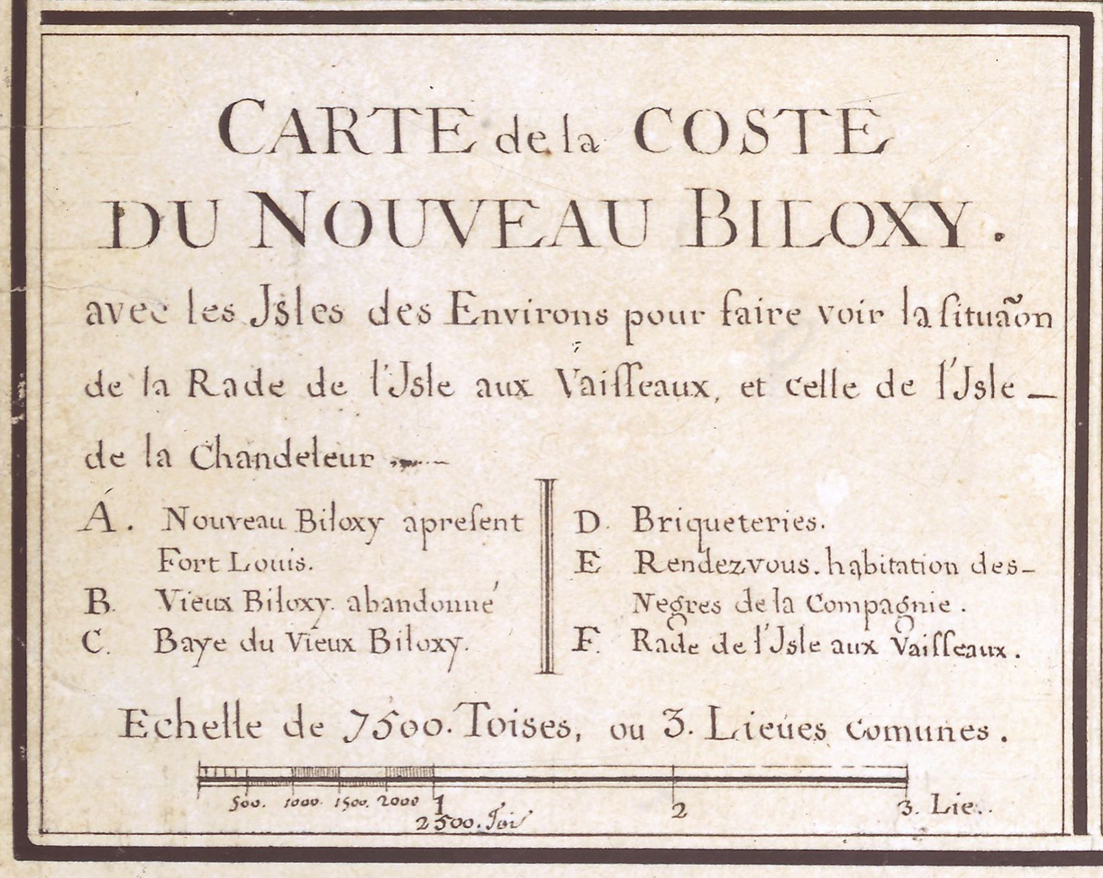
English: Map of the new Biloxy Coast, French 18th-century map caption
Français : Carte de la coste du nouveau Biloxy avec les isles des environs pour faire voir la situation de la rade de l'isle aux vaisseaux, et celle de l'isle de la Chandeleur. Légende: A. Nouveau Biloxy à présent Fort Louis. B. Vieux Biloxy abandonné. C. Baye du Vieux Biloxy. D. Briqueteries. E. Rendezvous habitation des Négres de la Compagnie. F. Rade de l'Isle aux Vaisseaux. Echelle de 7400 Toises, ou 3. Lieues comunes. |
||
| Source | Gallica, BnF. | ||
| Author | GAllegre | ||
| Other versions |
 |
Licensing
[edit]
|
This work is in the public domain in its country of origin and other countries and areas where the copyright term is the author's life plus 70 years or fewer. | |
| This file has been identified as being free of known restrictions under copyright law, including all related and neighboring rights. | |
File history
Click on a date/time to view the file as it appeared at that time.
| Date/Time | Thumbnail | Dimensions | User | Comment | |
|---|---|---|---|---|---|
| current | 16:29, 2 February 2016 | | 1,609 × 1,281 (288 KB) | GAllegre (talk | contribs) |
You cannot overwrite this file.
File usage on Commons
The following 2 pages use this file: