File:Gallia cisalpina-es.svg
Jump to navigation
Jump to search

Size of this PNG preview of this SVG file: 583 × 397 pixels. Other resolutions: 320 × 218 pixels | 640 × 436 pixels | 1,024 × 697 pixels | 1,280 × 872 pixels | 2,560 × 1,743 pixels.
Original file (SVG file, nominally 583 × 397 pixels, file size: 25.18 MB)
Captions
Captions
Add a one-line explanation of what this file represents
Summary
[edit]| Description |
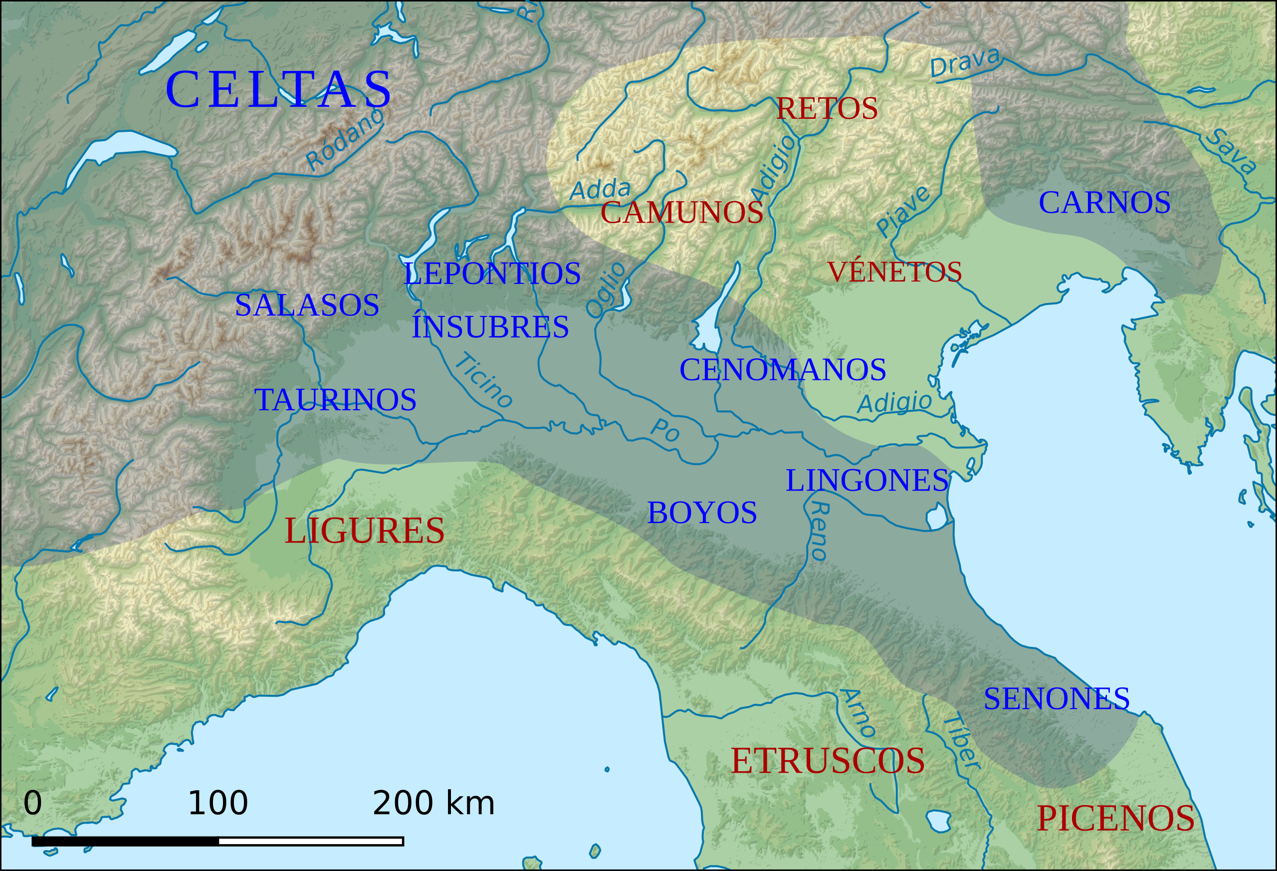
Français : Carte de la Gaule cisalpine et de l'emplacement approximatif des peuples qui l'habitaient et des peuples voisins. |
| Date | |
| Source |
This file was derived from:
|
| Author | Sémhur, Eric Gaba, Agamemnus, Flappiefh |
| Other versions |
[]
|


Licensing
[edit]
This file is licensed under the Creative Commons Attribution-Share Alike 4.0 International license.
- You are free:
- to share – to copy, distribute and transmit the work
- to remix – to adapt the work
- Under the following conditions:
- attribution – You must give appropriate credit, provide a link to the license, and indicate if changes were made. You may do so in any reasonable manner, but not in any way that suggests the licensor endorses you or your use.
- share alike – If you remix, transform, or build upon the material, you must distribute your contributions under the same or compatible license as the original.
File history
Click on a date/time to view the file as it appeared at that time.
| Date/Time | Thumbnail | Dimensions | User | Comment | |
|---|---|---|---|---|---|
| current | 09:44, 9 November 2019 | | 583 × 397 (25.18 MB) | Rowanwindwhistler (talk | contribs) | Uploading a file from a free published source using File Upload Wizard |
You cannot overwrite this file.
File usage on Commons
The following 4 pages use this file:
File usage on other wikis
The following other wikis use this file:
- Usage on es.wikipedia.org
- Usage on gl.wikipedia.org