File:Galactic Empire Map V3.png
Jump to navigation
Jump to search
Size of this preview: 558 × 599 pixels. Other resolutions: 223 × 240 pixels | 447 × 480 pixels | 715 × 768 pixels | 1,257 × 1,350 pixels.
Original file (1,257 × 1,350 pixels, file size: 1.85 MB, MIME type: image/png)
Captions
Captions
Add a one-line explanation of what this file represents
Summary
[edit]
| Description |
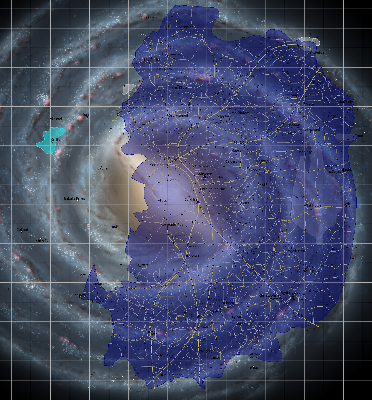
English: As before, this is a map of the Galactic Empire from Star Wars. It was constructed with Legends sources, being supplemented with Canon wherever available. It shows all the sectors I could find as well as hyperlanes. Planets that I felt were iconic or important are labeled, but most charted systems are at least present on the map. Super detailed areas like Hapes were glossed over because too many systems right next to each other clogs the map.
As for a key, the light grey lines are sectors, the darker grey are regions. Gold lines are hyperspace lanes with the thicker ones being the majors routes. Dark blue is officially owned by the Empire while lighter blue is semi-independent sectors. White planets and sectors are completely independent. The Chiss are the lightest shade of blue and are also independent. |
| Date | |
| Source | https://www.deviantart.com/zanzibar42/art/Galactic-Empire-Map-V3-815984861 |
| Author | Zanzibar42 |
This file is in the public domain because For people to see a map from a famous movie series.
|
File history
Click on a date/time to view the file as it appeared at that time.
| Date/Time | Thumbnail | Dimensions | User | Comment | |
|---|---|---|---|---|---|
| current | 04:19, 6 June 2020 | | 1,257 × 1,350 (1.85 MB) | Citadel2811 (talk | contribs) | {{subst:Upload marker added by en.wp UW}} {{Information |Description = {{en|As before, this is a map of the Galactic Empire from Star Wars. It was constructed with Legends sources, being supplemented with Canon wherever available. It shows all the sectors I could find as well as hyperlanes. Planets that I felt were iconic or important are labeled, but most charted systems are at least present on the map. Super detailed areas like Hapes were glossed over because too many systems right next to... |
You cannot overwrite this file.
File usage on Commons
There are no pages that use this file.
File usage on other wikis
The following other wikis use this file:
- Usage on simple.wikipedia.org
- Usage on uk.wikipedia.org