File:Gael Feb 4 2009 0635Z.jpg
Jump to navigation
Jump to search
Size of this preview: 466 × 599 pixels. Other resolutions: 187 × 240 pixels | 373 × 480 pixels | 597 × 768 pixels | 796 × 1,024 pixels | 1,593 × 2,048 pixels | 5,600 × 7,200 pixels.
Original file (5,600 × 7,200 pixels, file size: 5.62 MB, MIME type: image/jpeg)
Captions
Captions
Add a one-line explanation of what this file represents
Summary
[edit]
| Description |
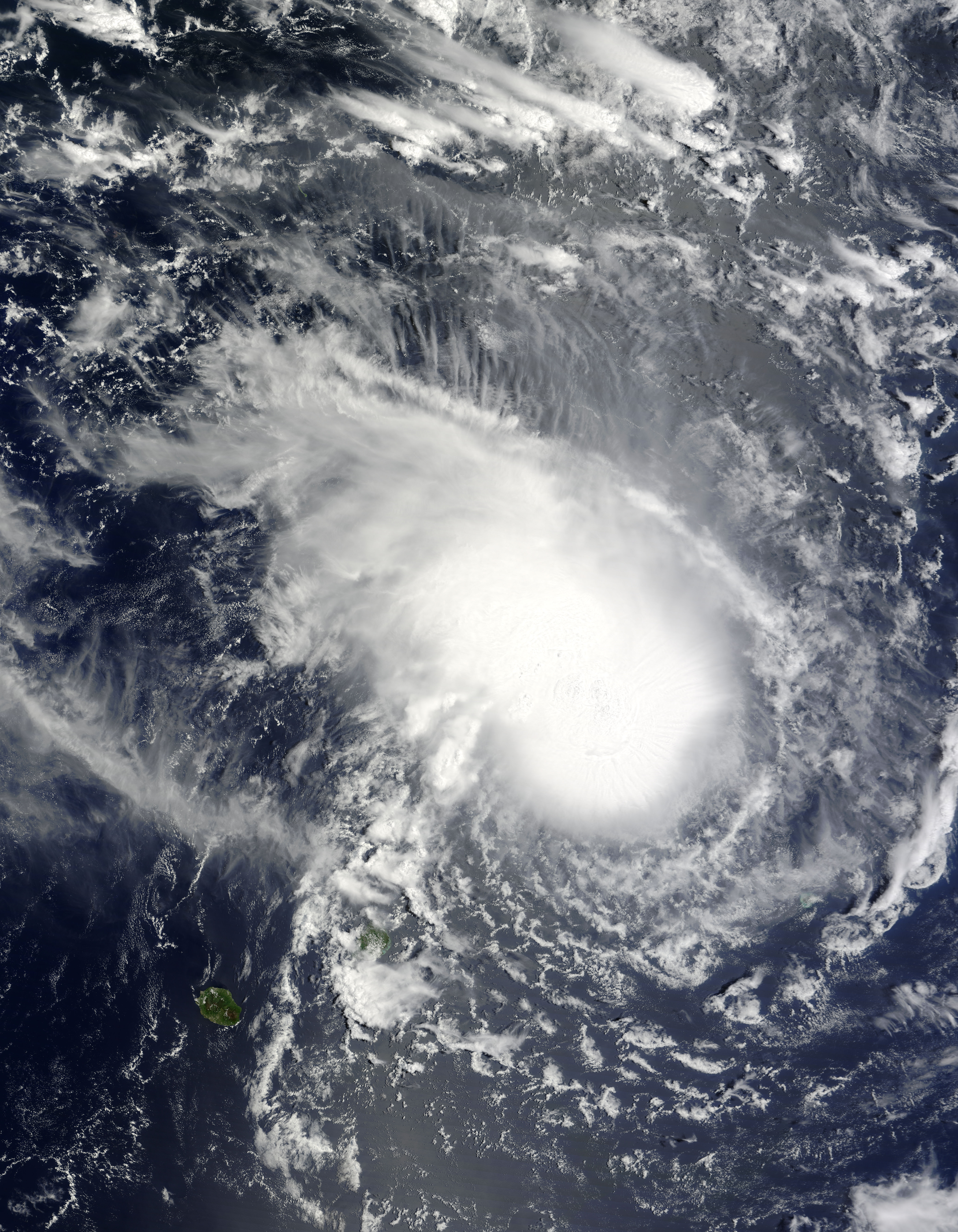
English: Tropical Cyclone Gael in the southern Indian Ocean was captured in this natural-color image from the Moderate Resolution Imaging Spectroradiometer (MODIS) on NASA’s Terra satellite on February 4, 2009. The storm has the appearance of a nautilus: a tight ball of clouds (lower right) with “ridges” of clouds streaking out in rays from the core of the storm. The clockwise spiral of winds flowing into the storm (the typical pattern for Southern Hemisphere cyclones) is not dramatic, suggesting the system is not particularly well organized. The small island of Mauritius is located at bottom of the image, left of center. The storm was headed west-southwest toward Madagascar when this image was captured at 6:35 a.m. local time in Mauritius. |
| Date | |
| Source | http://earthobservatory.nasa.gov/NaturalHazards/view.php?id=36939 |
| Author | NASA image by Jeff Schmaltz, MODIS Rapid Response Team, Goddard Space Flight Center. Caption by Rebecca Lindsey. |
Licensing
[edit]
| This file is in the public domain in the United States because it was solely created by NASA. NASA copyright policy states that "NASA material is not protected by copyright unless noted". (See Template:PD-USGov, NASA copyright policy page or JPL Image Use Policy.) | ||
 |
Warnings:
|
File history
Click on a date/time to view the file as it appeared at that time.
| Date/Time | Thumbnail | Dimensions | User | Comment | |
|---|---|---|---|---|---|
| current | 01:01, 7 August 2023 | | 5,600 × 7,200 (5.62 MB) | Nino Marakot (talk | contribs) | Original color |
| 14:08, 16 August 2010 |  | 5,600 × 7,200 (5.82 MB) | Supportstorm (talk | contribs) | {{Information |Description={{en|1=Tropical Cyclone Gael in the southern Indian Ocean was captured in this natural-color image from the Moderate Resolution Imaging Spectroradiometer (MODIS) on NASA’s Terra satellite on February 4, 2009. The storm has the |
You cannot overwrite this file.
File usage on Commons
There are no pages that use this file.