File:GS Växjö.svg
Jump to navigation
Jump to search

Size of this PNG preview of this SVG file: 800 × 593 pixels. Other resolutions: 320 × 237 pixels | 640 × 475 pixels | 1,024 × 759 pixels | 1,280 × 949 pixels | 2,560 × 1,899 pixels | 5,946 × 4,410 pixels.
Original file (SVG file, nominally 5,946 × 4,410 pixels, file size: 556 KB)
Captions
Captions
Add a one-line explanation of what this file represents
| Description |
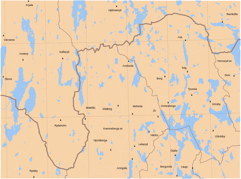
English: Map showing borders of parishes and hundreds in the vicinity of Växjö, based on information from map by Topografiska Corpsen.
Växjö Graverad af Wirsing, Wennersten och Herlin. Topografiska Corpsens karta öfver Sverige 1875 Uppmätt åren 1865, 1866 och 1867. |
| Date | (1875) |
| Source | Lantmäteriet |
| Author | Own work and Topografiska Corpsen |
| Permission (Reusing this file) |
This file is licensed under the Creative Commons Attribution 3.0 Unported license. Attribution: Edaen
|
File history
Click on a date/time to view the file as it appeared at that time.
| Date/Time | Thumbnail | Dimensions | User | Comment | |
|---|---|---|---|---|---|
| current | 08:12, 2 November 2010 | | 5,946 × 4,410 (556 KB) | Edaen (talk | contribs) | {{Information |Description={{en|1=Map showing borders of parishes and hundreds in the vicinity of Växjö, based on information from map by Topografiska Corpsen. <small>'''Växjö''' Graverad af Wirsing, Wennersten och Herlin. Topografiska Corpsens ka |
You cannot overwrite this file.
File usage on Commons
There are no pages that use this file.
File usage on other wikis
The following other wikis use this file:
- Usage on gd.wikipedia.org