File:GLAS instrument on ICESat (side).jpg
Jump to navigation
Jump to search

Size of this preview: 671 × 600 pixels. Other resolutions: 269 × 240 pixels | 537 × 480 pixels | 695 × 621 pixels.
Original file (695 × 621 pixels, file size: 181 KB, MIME type: image/jpeg)
Captions
Captions
Add a one-line explanation of what this file represents
Summary
[edit].jpg&action=edit§ion=1)
| Description |
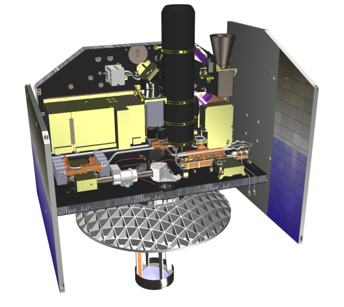
English: Illustration of the Geoscience Laser Altimeter System on ICESat. |
| Source | https://attic.gsfc.nasa.gov/glas/gallery.html (image link) |
| Author | NASA/GSFC |
Licensing
[edit].jpg&action=edit§ion=2)
| This file is in the public domain in the United States because it was solely created by NASA. NASA copyright policy states that "NASA material is not protected by copyright unless noted". (See Template:PD-USGov, NASA copyright policy page or JPL Image Use Policy.) | ||
 |
Warnings:
|
File history
Click on a date/time to view the file as it appeared at that time.
| Date/Time | Thumbnail | Dimensions | User | Comment | |
|---|---|---|---|---|---|
| current | 18:44, 21 September 2018 | | 695 × 621 (181 KB) | Huntster (talk | contribs) | {{Information |Description={{en|1=Illustration of the Geoscience Laser Altimeter System on ICESat.}} |Source=https://attic.gsfc.nasa.gov/glas/gallery.html ([https://attic.gsfc.nasa.gov/glas/images/sitepics/glas_srs_side.jpg image link]) |Date= |Author=NASA/GSFC |Permission= |other_versions= }} == {{int:license-header}} == {{PD-USGov-NASA}} Category:Geoscience Laser Altimeter System (GLAS) |
You cannot overwrite this file.
File usage on Commons
The following page uses this file:
.jpg&oldid=792287838)