File:GADM LBN Administrative Divisions.svg
Jump to navigation
Jump to search

Size of this PNG preview of this SVG file: 467 × 599 pixels. Other resolutions: 187 × 240 pixels | 374 × 480 pixels | 598 × 768 pixels | 798 × 1,024 pixels | 1,596 × 2,048 pixels | 491 × 630 pixels.
Original file (SVG file, nominally 491 × 630 pixels, file size: 214 KB)
Captions
Captions
Add a one-line explanation of what this file represents
Summary
[edit]
| Description |
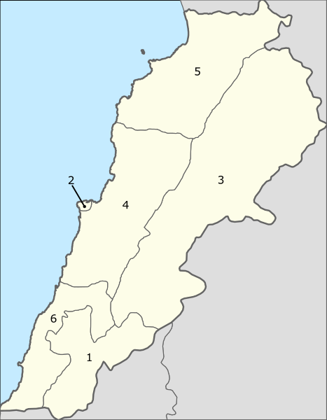
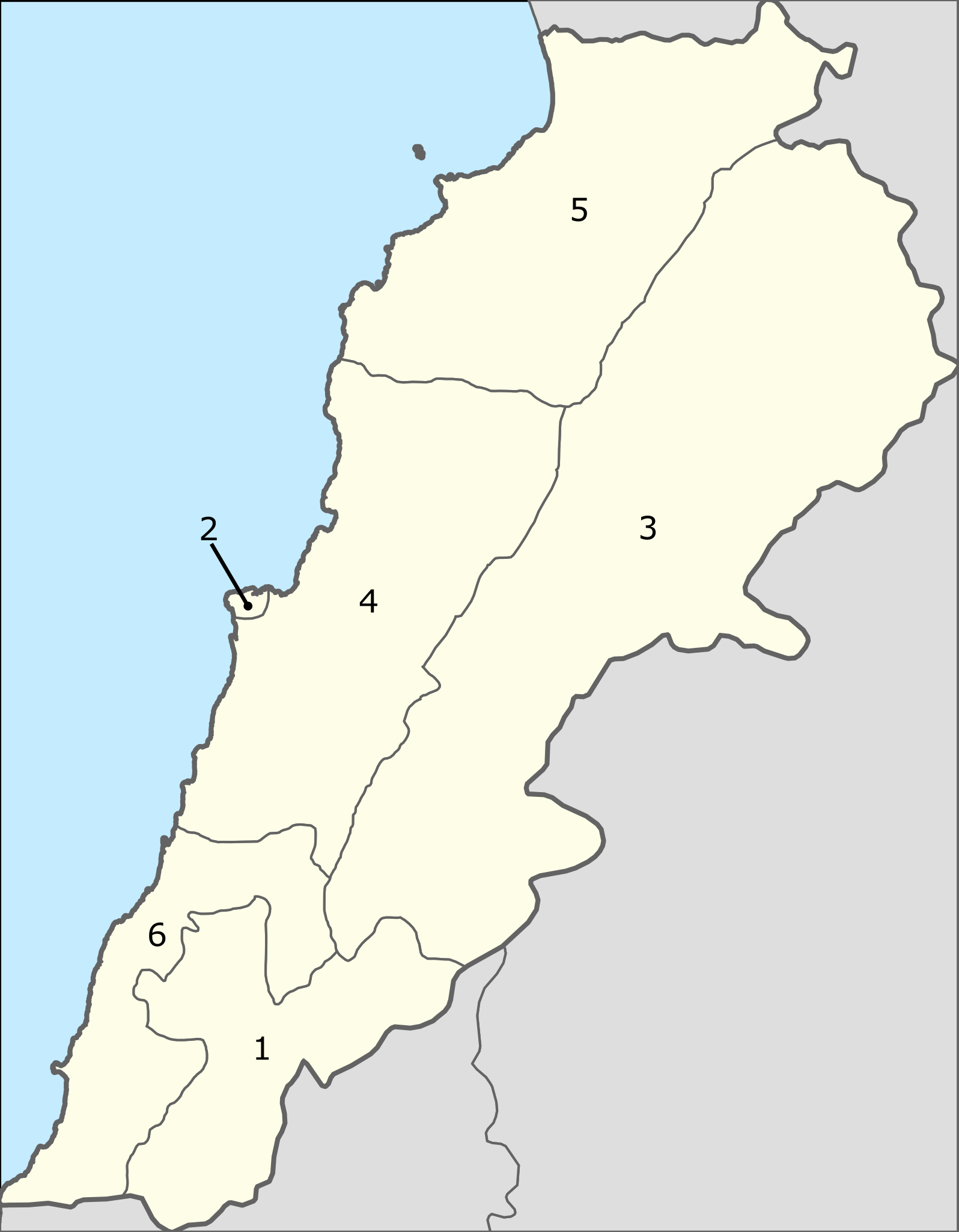
English: Administrative divisions of Czech Republic (numbered), showing surrounding countries. Created using GADM data and gringer's R script.
Region Names
|
| Date | |
| Source | Own work |
| Author | Gringer |
Licensing
[edit]
I, the copyright holder of this work, hereby publish it under the following licenses:
This file is licensed under the Creative Commons Attribution-Share Alike 3.0 Unported license.
- You are free:
- to share – to copy, distribute and transmit the work
- to remix – to adapt the work
- Under the following conditions:
- attribution – You must give appropriate credit, provide a link to the license, and indicate if changes were made. You may do so in any reasonable manner, but not in any way that suggests the licensor endorses you or your use.
- share alike – If you remix, transform, or build upon the material, you must distribute your contributions under the same or compatible license as the original.

|
Permission is granted to copy, distribute and/or modify this document under the terms of the GNU Free Documentation License, Version 1.2 or any later version published by the Free Software Foundation; with no Invariant Sections, no Front-Cover Texts, and no Back-Cover Texts. A copy of the license is included in the section entitled GNU Free Documentation License. |
You may select the license of your choice.
File history
Click on a date/time to view the file as it appeared at that time.
| Date/Time | Thumbnail | Dimensions | User | Comment | |
|---|---|---|---|---|---|
| current | 00:14, 12 August 2010 | | 491 × 630 (214 KB) | Gringer (talk | contribs) | Cleaned up with Inkscape, shifted region numbers and removed clip path |
| 00:01, 12 August 2010 |  | 491 × 630 (402 KB) | Gringer (talk | contribs) | {{Information |Description={{en|1=Administrative divisions of Czech Republic (numbered), showing surrounding countries. Created using [http://gadm.org GADM] data and gringer's R script. === Region Names === : '''1''' (An Nabat |
You cannot overwrite this file.
File usage on Commons
The following page uses this file: