File:Gąsawa (gmina) location map.png
Jump to navigation
Jump to search
Size of this preview: 700 × 599 pixels. Other resolutions: 280 × 240 pixels | 561 × 480 pixels | 744 × 637 pixels.
Original file (744 × 637 pixels, file size: 92 KB, MIME type: image/png)
Captions
Captions
Add a one-line explanation of what this file represents
| Description |
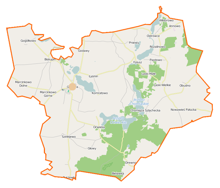
Polski: Mapa gminy Gąsawa, Polska
English: Map of Gmina Gąsawa, Poland |
|||||||||
| Date | ||||||||||
| Source | You may find a page on the OpenStreetMap wiki page for Gąsawa (gmina) | |||||||||
| Creator |
OpenStreetMap contributors OpenStreetMap contributors |
|||||||||
| Permission (Reusing this file) |
OpenStreetMap data is available under the Open Database License (details). Map tiles are licensed under the Creative Commons Attribution-ShareAlike 2.0 license (CC-BY-SA 2.0).
This file is licensed under the Creative Commons Attribution-Share Alike 2.0 Generic license.
|
|||||||||
| Geotemporal data | ||||||||||
| Bounding box |
|
|||||||||
| Georeferencing | If inappropriate please set warp_status = skip to hide. | |||||||||
File history
Click on a date/time to view the file as it appeared at that time.
| Date/Time | Thumbnail | Dimensions | User | Comment | |
|---|---|---|---|---|---|
| current | 11:38, 23 November 2014 | | 744 × 637 (92 KB) | VanWiel (talk | contribs) | {{OpenStreetMap | name = Gąsawa (gmina) | location = Gąsawa (gmina) | description = {{pl|Mapa gminy Gąsawa, Polska}} {{en|Map of Gmina Gąsawa, Poland}} | top = 52.8297 | bottom = 52.6970 | left... |
You cannot overwrite this file.
File usage on Commons
There are no pages that use this file.
File usage on other wikis
The following other wikis use this file:
- Usage on de.wikipedia.org
- Usage on fr.wikipedia.org
- Gąsawa
- Biskupin (Żnin)
- Annowo (gmina de Gąsawa)
- Chomiąża Szlachecka
- Wiktorowo (Couïavie-Poméranie)
- Szelejewo
- Ryszewko (Couïavie-Poméranie)
- Rozalinowo
- Pniewy (Couïavie-Poméranie)
- Piastowo (Couïavie-Poméranie)
- Oćwieka (Couïavie-Poméranie)
- Obudno
- Nowawieś Pałucka
- Marcinkowo Górne
- Marcinkowo Dolne
- Łysinin (Couïavie-Poméranie)
- Laski Wielkie (Couïavie-Poméranie)
- Laski Małe (Couïavie-Poméranie)
- Komratowo
- Gogółkowo
- Godawy
- Głowy (Couïavie-Poméranie)
- Drewno (Couïavie-Poméranie)
- Modèle:Géolocalisation/Gąsawa (gmina)
- Modèle:Géolocalisation/Gąsawa (gmina)/Documentation
- Usage on pl.wikipedia.org
- Biskupin (powiat żniński)
- Chomiąża Szlachecka
- Gąsawa
- Gąsawa (gmina)
- Drewno (wieś)
- Godawy
- Gogółkowo
- Komratowo
- Marcinkowo Dolne
- Marcinkowo Górne
- Nowawieś Pałucka
- Obudno
- Oćwieka (wieś)
- Rozalinowo
- Szelejewo (województwo kujawsko-pomorskie)
- Głowy (województwo kujawsko-pomorskie)
- Laski Małe (województwo kujawsko-pomorskie)
- Laski Wielkie (województwo kujawsko-pomorskie)
- Łysinin (wieś w województwie kujawsko-pomorskim)
- Piastowo (województwo kujawsko-pomorskie)
- Pniewy (wieś w województwie kujawsko-pomorskim)
- Ryszewko (województwo kujawsko-pomorskie)
- Annowo (gmina Gąsawa)
- Wiktorowo (gmina Gąsawa)
View more global usage of this file.
_location_map.png)
_location_map.png&oldid=519966302)