File:Güstrow Karte aus der Topographia Saxoniae Inferioris.jpg
Jump to navigation
Jump to search
Size of this preview: 678 × 599 pixels. Other resolutions: 272 × 240 pixels | 543 × 480 pixels | 750 × 663 pixels.
Original file (750 × 663 pixels, file size: 366 KB, MIME type: image/jpeg)
Captions
Captions
Add a one-line explanation of what this file represents
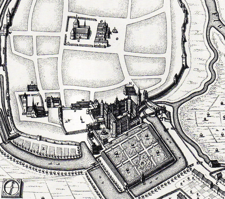
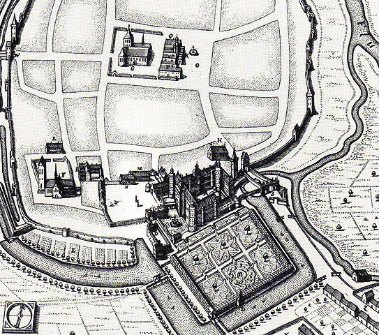
| Description | Schloß Güstrow und seine Gärten. Kupferstich aus der Topographia Saxoniae Inferioris | ||||
| Date | |||||
| Source | Andreas Pečar: Genealogie als Instrument fürstlicher Selbstdarstellung[1] | ||||
| Author | Carl H. A. Osten | ||||
| Permission (Reusing this file) |
|
||||
File history
Click on a date/time to view the file as it appeared at that time.
| Date/Time | Thumbnail | Dimensions | User | Comment | |
|---|---|---|---|---|---|
| current | 14:26, 23 March 2010 | | 750 × 663 (366 KB) | Patrice77 (talk | contribs) | {{Information |Description= Schloß Güstrow und seine Gärten. Kupferstich aus der Topographia Saxoniae Inferioris |Source= Andreas Pečar: Genealogie als Instrument fürstlicher Selbstdarstellung[http://www.zeitenblicke.de/2005/2/Pecar] |Date=1653 |Auth |
You cannot overwrite this file.
File usage on Commons
There are no pages that use this file.
File usage on other wikis
The following other wikis use this file:
- Usage on de.wikipedia.org