File:Fundación de Guayaquil - Principales ciudades fundadas hasta 1547.svg
Jump to navigation
Jump to search

Size of this PNG preview of this SVG file: 364 × 599 pixels. Other resolutions: 146 × 240 pixels | 292 × 480 pixels | 467 × 768 pixels | 622 × 1,024 pixels | 1,245 × 2,048 pixels | 792 × 1,303 pixels.
Original file (SVG file, nominally 792 × 1,303 pixels, file size: 752 KB)
Captions
Captions
Add a one-line explanation of what this file represents
Summary
[edit]| Description |
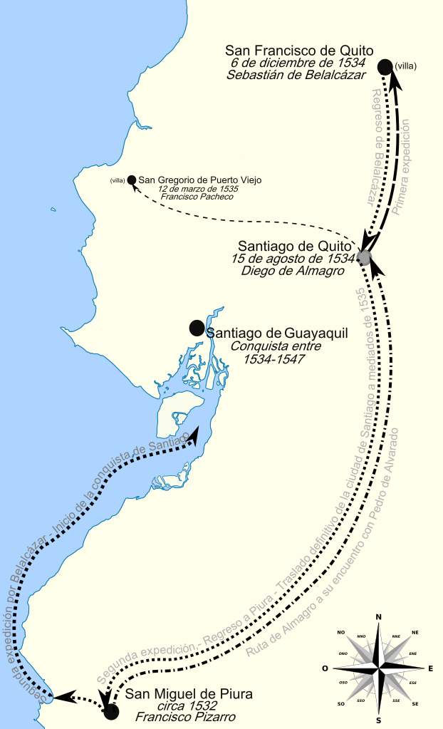
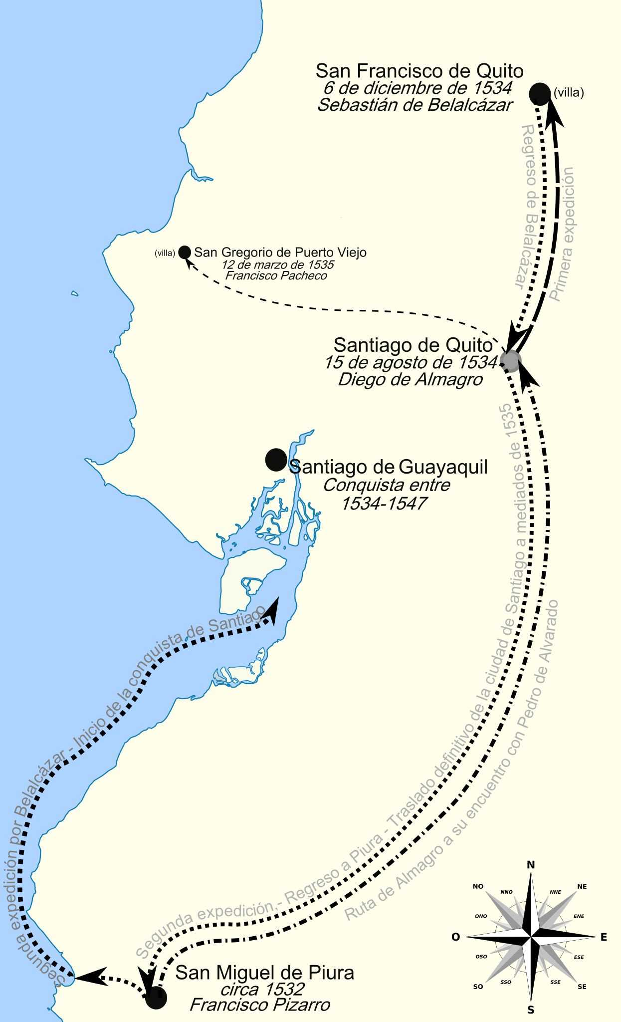
Español: Mapa de las pricipales ciudadas y villas fundadas hasta 1547. |
| Date | |
| Source | Own work |
| Author | Sageo |
Licensing
[edit]I, the copyright holder of this work, hereby publish it under the following licenses:

|
Permission is granted to copy, distribute and/or modify this document under the terms of the GNU Free Documentation License, Version 1.2 or any later version published by the Free Software Foundation; with no Invariant Sections, no Front-Cover Texts, and no Back-Cover Texts. A copy of the license is included in the section entitled GNU Free Documentation License. |
This file is licensed under the Creative Commons Attribution-Share Alike 4.0 International, 3.0 Unported, 2.5 Generic, 2.0 Generic and 1.0 Generic license.
- You are free:
- to share – to copy, distribute and transmit the work
- to remix – to adapt the work
- Under the following conditions:
- attribution – You must give appropriate credit, provide a link to the license, and indicate if changes were made. You may do so in any reasonable manner, but not in any way that suggests the licensor endorses you or your use.
- share alike – If you remix, transform, or build upon the material, you must distribute your contributions under the same or compatible license as the original.
You may select the license of your choice.

File history
Click on a date/time to view the file as it appeared at that time.
| Date/Time | Thumbnail | Dimensions | User | Comment | |
|---|---|---|---|---|---|
| current | 22:50, 7 July 2011 | | 792 × 1,303 (752 KB) | Sageo (talk | contribs) | Cambios menores. |
| 22:47, 7 July 2011 |  | 792 × 1,303 (752 KB) | Sageo (talk | contribs) | Reverted to version as of 22:45, 7 July 2011 | |
| 22:46, 7 July 2011 |  | 792 × 1,303 (752 KB) | Sageo (talk | contribs) | Flecha. | |
| 22:45, 7 July 2011 |  | 792 × 1,303 (752 KB) | Sageo (talk | contribs) | Solución final a la punta del último trayecto. | |
| 22:42, 7 July 2011 |  | 792 × 1,303 (772 KB) | Sageo (talk | contribs) | Cambios menores. | |
| 22:38, 7 July 2011 |  | 792 × 1,303 (752 KB) | Sageo (talk | contribs) | Cambios minúsculos. | |
| 19:46, 27 November 2010 |  | 792 × 1,303 (752 KB) | Sageo (talk | contribs) | Anexo de la Rosa de los vientos... | |
| 19:31, 27 November 2010 |  | 792 × 1,303 (699 KB) | Sageo (talk | contribs) | Cambios triviales | |
| 04:06, 27 November 2010 |  | 792 × 1,303 (449 KB) | Sageo (talk | contribs) | Cambios menores en el texto. | |
| 04:02, 27 November 2010 |  | 792 × 1,303 (199 KB) | Sageo (talk | contribs) | {{Information |Description={{es|1=Mapa de las pricipales ciudadas y villas fundadas hasta 1547.}} |Source={{own}} |Author=Sageo |Date=26 de septiembre de 2010 |Permission= |other_versions= }} Category:History of Guayaquil |
You cannot overwrite this file.
File usage on Commons
There are no pages that use this file.
File usage on other wikis
The following other wikis use this file: