File:Front Royal - Nineveh Virginia.png
Jump to navigation
Jump to search
No higher resolution available.
Front_Royal_-_Nineveh_Virginia.png (692 × 559 pixels, file size: 891 KB, MIME type: image/png)
Captions
Captions
Add a one-line explanation of what this file represents
Summary
[edit]
| Description |
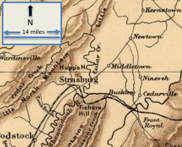
English: This is a map of Front Royal, Virginia, and the area around it during the American Civil War. |
| Date | |
| Source | This is a portion of a Civil War map created in 1912 by Sifton, Praed & Co. The entire map can be found in the Library of Congress map, and shows mostly Virginia and Maryland. |
| Author | Sifton, Praed & Company, Ltd. |
Licensing
[edit]
This work is in the public domain in the United States because it was published (or registered with the U.S. Copyright Office) before January 1, 1929.
Public domain works must be out of copyright in both the United States and in the source country of the work in order to be hosted on the Commons. If the work is not a U.S. work, the file must have an additional copyright tag indicating the copyright status in the source country.
Note: This tag should not be used for sound recordings. |
File history
Click on a date/time to view the file as it appeared at that time.
| Date/Time | Thumbnail | Dimensions | User | Comment | |
|---|---|---|---|---|---|
| current | 16:21, 19 June 2017 | | 692 × 559 (891 KB) | TwoScarsUp (talk | contribs) | User created page with UploadWizard |
You cannot overwrite this file.
File usage on Commons
The following page uses this file: