File:Friedrichsdorf TS-Panorama 3.jpg
Jump to navigation
Jump to search
Size of this preview: 800 × 110 pixels. Other resolutions: 320 × 44 pixels | 640 × 88 pixels | 1,024 × 140 pixels | 7,300 × 1,000 pixels.
Original file (7,300 × 1,000 pixels, file size: 4.13 MB, MIME type: image/jpeg)
Captions
Captions
Add a one-line explanation of what this file represents
Summary
[edit]| Description |
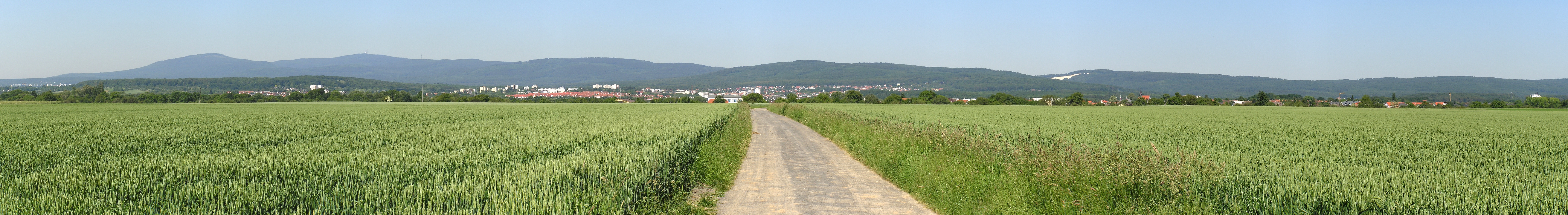
Deutsch: Panorama von Friedrichsdorf. Von links nach rechts: Seulberg mit Siedlungen am Dammwald/Ostpreußenstraße und Römerhof (rote Dächer), Kernstadt mit Dillingen (am Hang), Burgholzhausen. Köppern liegt etwa hinter Burgholzhausen und ist auf dem Foto nicht zu sehen.
English: Panorama of Friedrichsdorf. From left to right: Seulberg with districts am Dammwald/Ostpreußenstraße and Römerhof (red roofs), city center with Dillingen (at the hillside), Burgholzhausen. Köppern is approximately located behing Burgholzhausen an can not be seen on this photo. |
| Date | Taken on 12 June 2006 |
| Source | own photo (Panorama) |
| Author |
MdE |
| Camera location | | View this and other nearby images on: OpenStreetMap |
|---|
Licensing
[edit]
This file is licensed under the Creative Commons Attribution-Share Alike 3.0 Germany license.
 |

File history
Click on a date/time to view the file as it appeared at that time.
| Date/Time | Thumbnail | Dimensions | User | Comment | |
|---|---|---|---|---|---|
| current | 13:38, 27 July 2016 | 7,300 × 1,000 (4.13 MB) | MdE (talk | contribs) | neu in besserer Qualität | |
| 17:23, 28 March 2010 | 4,819 × 424 (1.08 MB) | MdE (talk | contribs) | cropped | ||
| 20:37, 8 May 2008 | 5,000 × 682 (1.42 MB) | MdE (talk | contribs) | {{User:MdE/FotoCC2DE |InfoDE=Panorama von Friedrichsdorf. Von links nach rechts: Seulberg mit Siedlungen am Dammwald/Ostpreußenstraße und Römerhof (rote Dächer), Kernstadt mit Dillingen (am Hang), Burgholzhausen. Köppern liegt |
You cannot overwrite this file.
File usage on Commons
There are no pages that use this file.
File usage on other wikis
The following other wikis use this file:
- Usage on de.wikipedia.org