File:Fremantle Fortress Map.png
Jump to navigation
Jump to search
Size of this preview: 533 × 599 pixels. Other resolutions: 213 × 240 pixels | 427 × 480 pixels | 683 × 768 pixels | 1,033 × 1,161 pixels.
Original file (1,033 × 1,161 pixels, file size: 182 KB, MIME type: image/png)
Captions
Captions
Add a one-line explanation of what this file represents
Summary
[edit]
| Description |
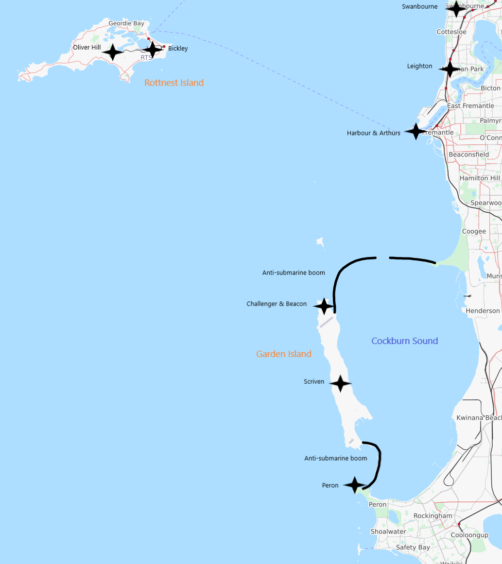
English: Map of the Fremantle Fortress, with the various batteries shown as black four-pointed stars and the anti-submarine booms as black lines. The map was created using Open Street Map. |
| Date | |
| Source | Own work |
| Author | Calistemon |
Licensing
[edit]
| Description |
This map was created from OpenStreetMap project data, collected by the community. This map may be incomplete, and may contain errors. Don't rely solely on it for navigation. |
|||
| Date | (see file history) | |||
| Source | openstreetmap.org | |||
| Creator |
OpenStreetMap contributors |
|||
| Permission (Reusing this file) |
OpenStreetMap data is available under the Open Database License (details). Map tiles are licensed under the Creative Commons Attribution-ShareAlike 2.0 license (CC-BY-SA 2.0).
This file is licensed under the Creative Commons Attribution-Share Alike 2.0 Generic license.
|
File history
Click on a date/time to view the file as it appeared at that time.
| Date/Time | Thumbnail | Dimensions | User | Comment | |
|---|---|---|---|---|---|
| current | 09:39, 4 May 2020 | | 1,033 × 1,161 (182 KB) | Calistemon (talk | contribs) | Uploaded own work with UploadWizard |
You cannot overwrite this file.
File usage on Commons
There are no pages that use this file.
File usage on other wikis
The following other wikis use this file:
- Usage on en.wikipedia.org