File:Francisco Oct 17 2013 0405Z.jpg
Jump to navigation
Jump to search

Size of this preview: 774 × 600 pixels. Other resolutions: 310 × 240 pixels | 619 × 480 pixels | 991 × 768 pixels | 1,280 × 992 pixels | 2,560 × 1,984 pixels | 8,000 × 6,200 pixels.
Original file (8,000 × 6,200 pixels, file size: 6.3 MB, MIME type: image/jpeg)
Captions
Captions
Add a one-line explanation of what this file represents
Summary
[edit]
| Description |
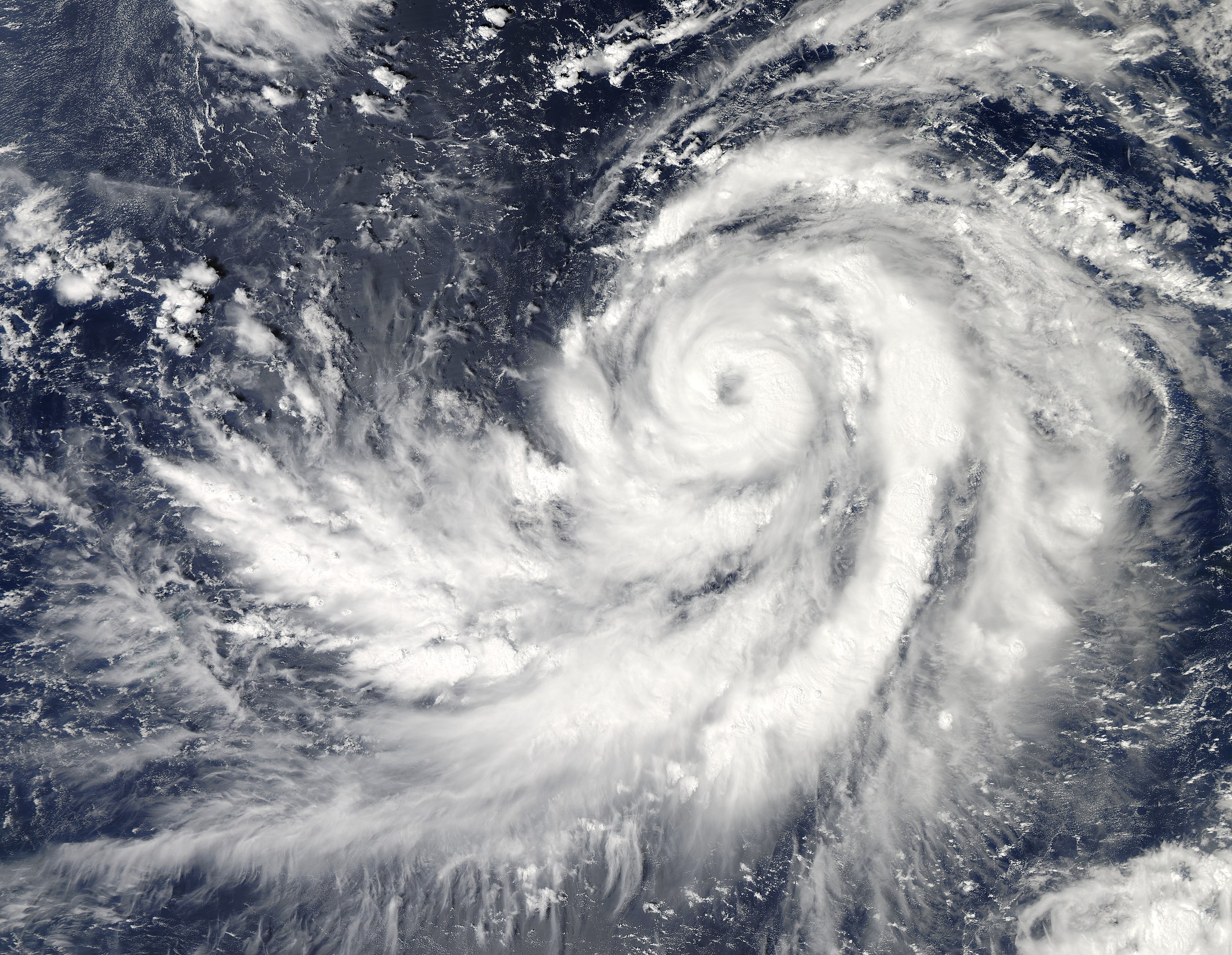
English: On October 17, 2013, Typhoon Francisco skirted around Guam, but the storm was headed on a track that could bring it toward Japan next week. The Moderate Resolution Imaging Spectroradiometer (MODIS) on NASA’s Aqua satellite acquired this image of the storm at 11:05 a.m. local time (4:05 UTC).
At the time, the storm had maximum sustained winds near 85 knots (157 kilometers/hour or 98 miles/hour) and was expected to strengthen in coming days. Francisco’s center was located about 147 nautical miles southwest of Guam, near 12.5° North and 143.1° East. Weather Underground’s Jeff Masters noted that two of the best models predict that Francisco will hit Japan on Wednesday or Thursday of next week, though model results are still quite uncertain that far into the future. This is the 27th named storm in the Pacific in 2013. |
| Date | |
| Source | http://earthobservatory.nasa.gov/NaturalHazards/view.php?id=82195 |
| Author | NASA images courtesy Jeff Schmaltz LANCE/EOSDIS MODIS Rapid Response Team, GSFC. Caption by Adam Voiland. |
Licensing
[edit]
| This file is in the public domain in the United States because it was solely created by NASA. NASA copyright policy states that "NASA material is not protected by copyright unless noted". (See Template:PD-USGov, NASA copyright policy page or JPL Image Use Policy.) | ||
 |
Warnings:
|
File history
Click on a date/time to view the file as it appeared at that time.
| Date/Time | Thumbnail | Dimensions | User | Comment | |
|---|---|---|---|---|---|
| current | 01:12, 18 October 2013 | | 8,000 × 6,200 (6.3 MB) | Supportstorm (talk | contribs) | {{Information |Description ={{en|1=On October 17, 2013, Typhoon Francisco skirted around Guam, but the storm was headed on a track that could bring it toward Japan next week. The Moderate Resolution Imaging Spectroradiometer (MODIS) on NASA’s Aqua... |
You cannot overwrite this file.
File usage on Commons
The following page uses this file: