File:France all regions.svg
Jump to navigation
Jump to search

Size of this PNG preview of this SVG file: 386 × 296 pixels. Other resolutions: 313 × 240 pixels | 626 × 480 pixels | 1,002 × 768 pixels | 1,280 × 982 pixels | 2,560 × 1,963 pixels.
Original file (SVG file, nominally 386 × 296 pixels, file size: 152 KB)
Captions
Captions
Add a one-line explanation of what this file represents
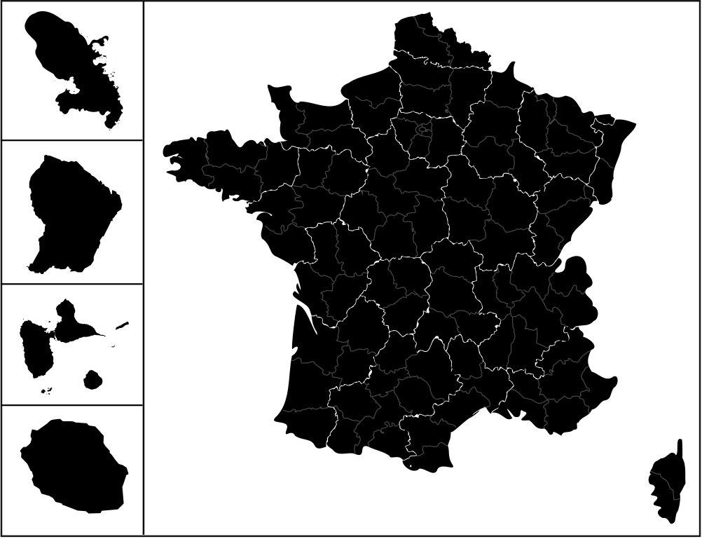
| Description | carte des regions de france avec l'outre-mers |
| Date | (UTC) |
| Source | |
| Author |
|
| This is a retouched picture, which means that it has been digitally altered from its original version. The original can be viewed here: Communes-guyane-blank.svg:
|
This file is licensed under the Creative Commons Attribution-Share Alike 3.0 Unported license.
- You are free:
- to share – to copy, distribute and transmit the work
- to remix – to adapt the work
- Under the following conditions:
- attribution – You must give appropriate credit, provide a link to the license, and indicate if changes were made. You may do so in any reasonable manner, but not in any way that suggests the licensor endorses you or your use.
- share alike – If you remix, transform, or build upon the material, you must distribute your contributions under the same or compatible license as the original.
Original upload log
[edit]
This image is a derivative work of the following images:
- File:France_location_map-Regions_and_departements.svg licensed with Cc-by-sa-3.0,2.5,2.0,1.0, GFDL
- 2009-02-02T16:12:50Z Yug 2000x1922 (772026 Bytes) Restore light style version ; a specific file name will be use for polygon departement maps.
- 2009-02-01T19:34:09Z Yug 2000x1922 (1849428 Bytes) restore East and southern border deleted by mistake + code improving.
- 2009-02-01T14:41:40Z Yug 2000x1922 (1852045 Bytes) Statistic friendly added, as an upper layer.
- 2008-11-07T13:23:10Z Sting 2000x1922 (772026 Bytes) + boundary for Channel Islands
- 2008-08-23T16:29:48Z Sting 2000x1922 (769918 Bytes) Larger strokes for boundaries
- 2008-07-25T17:35:54Z Sting 2000x1922 (770878 Bytes) Display bug
- 2008-07-25T17:28:38Z Sting 2000x1922 (772649 Bytes) Variable scale
- 2008-07-25T14:29:27Z Sting 2000x1922 (773101 Bytes) - border
- 2008-07-25T14:23:11Z Sting 2000x1922 (773214 Bytes) Other countries' color
- 2008-07-04T20:32:47Z Sting 2000x1922 (772973 Bytes) == Summary == {{Location|46|15|00|N|02|06|00|E|scale:10000000}} {{Information |Description={{en|Blank administrative map of [[:en:France|France]] for geo-location purpose, with regions and departements distinguished.Approxim
- File:Réunion_communes.svg licensed with Cc-by-sa-2.5,2.0,1.0, GFDL
- 2007-03-10T18:48:13Z Kimdime69 699x610 (491125 Bytes) {{Information |Description=Communes de l'île de la Réunion (France) |Source=Own creation based on[[:Image:Réunion-communes.png]] |Date=2007 |Author=[[User:Kimdime69]] |Permission= |other_versions= }} [[Category:Maps of Ré
- 2007-03-10T18:47:14Z Kimdime69 699x610 (491125 Bytes) {{Information |Description=Communes de l'île de la Réunion (France) |Source=Own creation based on[[:Image:Réunion-communes.png]] |Date=2007 |Author=[[User:Kimdime69]] |Permission= |other_versions= }} [[Category:Maps of Ré
- File:Guadeloupe_department_location_map.svg licensed with Cc-by-sa-3.0, GFDL
- 2008-09-22T20:00:26Z Sting 1015x890 (221742 Bytes) == Summary == {{Location|16|10|30|N|61|24|00|W|scale:500000}} {{Information |Description={{en|Blank administrative map of the region and department of [[:en:Guadeloupe|Guadeloupe]], France, for geo-location purpose, with arr
- File:Martinique_department_location_map.svg licensed with Cc-by-sa-3.0, GFDL
- 2008-08-16T20:46:56Z Sting 961x1112 (134399 Bytes) == Summary == {{Location|14|39|00|N|61|00|45|W|scale:500000}} {{Information |Description={{en|Blank administrative map of the region and department of [[:en:Martinique|Martinique]], France, for geo-location purpose, with arr
- File:Communes-guyane-blank.svg licensed with Cc-by-sa-2.5,2.0,1.0, GFDL
- 2007-04-04T21:56:28Z Kimdime69 587x729 (119711 Bytes) {{Information |Description=Communes of the french region and departement of Guyane |Source=own creation based on [http://www.cries-guyane.fr/upload/actus_42e7c4ec8679d.pdf] |Date=2007 |Author={{u|Kimdime69}} |Permission= |oth
Uploaded with derivativeFX
File history
Click on a date/time to view the file as it appeared at that time.
| Date/Time | Thumbnail | Dimensions | User | Comment | |
|---|---|---|---|---|---|
| current | 12:56, 25 April 2009 | | 386 × 296 (152 KB) | 3dsman (talk | contribs) | {{Information |Description=carte des regions de france avec l'outre-mers |Source=*File:France_location_map-Regions_and_departements.svg *File:Réunion_communes.svg *File:Guadeloupe_department_location_map.svg *[[:File:Martinique_departme |
You cannot overwrite this file.
File usage on Commons
There are no pages that use this file.