File:Fr Ouidah 1920s B002b.png
Jump to navigation
Jump to search

Size of this preview: 595 × 600 pixels. Other resolutions: 238 × 240 pixels | 476 × 480 pixels | 762 × 768 pixels | 1,016 × 1,024 pixels | 2,032 × 2,048 pixels | 3,263 × 3,289 pixels.
Original file (3,263 × 3,289 pixels, file size: 3.39 MB, MIME type: image/png)
Captions
Captions
Add a one-line explanation of what this file represents
| Description |
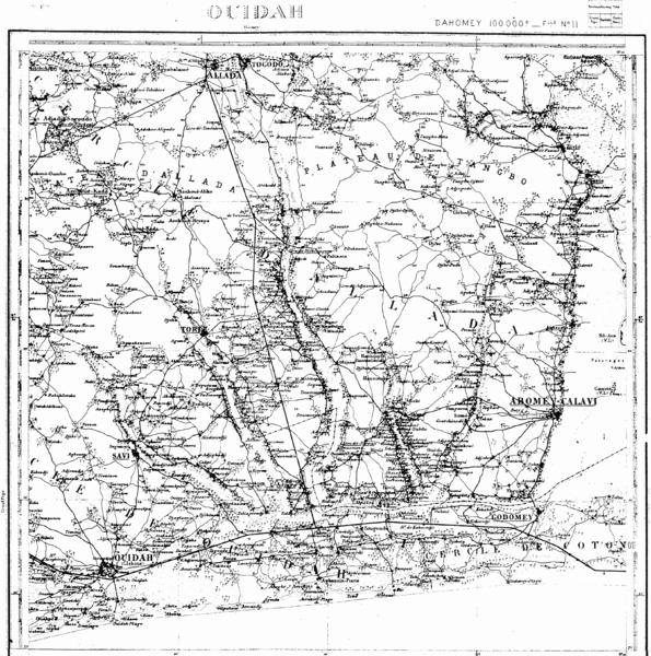
English: French map of Whydah ("Ouidah") and the territory of the Kingdom of Allada (Arda, Dahomey, contemporary Benin) |
||||
| Date | 1920s | ||||
| Source | Henri Labouret, Paul Rivet, "Le Royaume d'Arda et son Évangélisation au XVIIe siècle", Paris 1929 | ||||
| Author | Unknown author | ||||
| Permission (Reusing this file) |
|
||||
| Other versions |
|
||||

File history
Click on a date/time to view the file as it appeared at that time.
| Date/Time | Thumbnail | Dimensions | User | Comment | |
|---|---|---|---|---|---|
| current | 16:15, 18 November 2016 | | 3,263 × 3,289 (3.39 MB) | Katharinaiv (talk | contribs) | {{Information |Description ={{en|1=French map of Whydah ("Ouidah") and the territory of the Kingdom of Allada (Arda, Dahomey, contemporary Benin)}} |Source =Henri Labouret, Paul Rivet, ''"Le Royaume d'Arda et son Évangélisation au XVIIe si... |
You cannot overwrite this file.
File usage on Commons
The following page uses this file: