File:Fröndenberg-NaturschutzgebietObergrabenwestlichWickede-3-Asio.jpg
Original file (4,032 × 3,024 pixels, file size: 6.91 MB, MIME type: image/jpeg)
Captions
Summary
[edit]DescriptionFröndenberg-NaturschutzgebietObergrabenwestlichWickede-3-Asio.jpg |
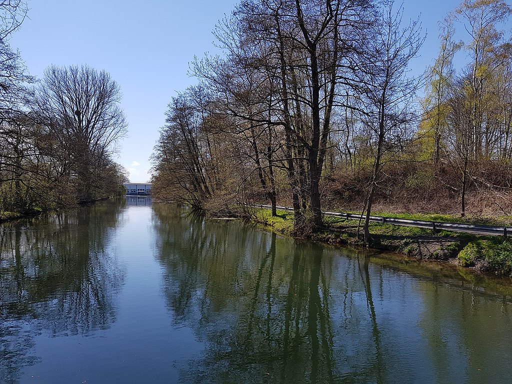
Deutsch: Naturschutzgebiet "Obergraben westlich Wickede" (UN-042) in Fröndenberg/Ruhr. Im Bildhintergrund ein Teil des denkmalgeschützten Elektrizitätswerkes Fröndenberg-Warmen, Am Kraftwerk 1. English: Nature reserve "Upperditch west of Wickede" (UN-042) in the city of Fröndenberg/Ruhr. In the background part of the listed Fröndenberg-Warmen power station, Am Kraftwerk 1. Français : Réserve naturelle "Oberergraben à l'ouest de Wickede" (UN-042) dans la ville de Fröndenberg/Ruhr. Dans le fond de la centrale électrique cotée de Fröndenberg-Warmen, Am Kraftwerk 1. |
Date | Taken on 27 April 2021 |
Source | Self-photographed |
Author | Asio otus |
Permission (Reusing this file) |
I, the copyright holder of this work, hereby publish it under the following license: This file is licensed under the Creative Commons Attribution-Share Alike 3.0 Unported license.
|
Attribution (required by the license) InfoField | © Asio otus / Wikimedia Commons / |
InfoField | © Asio otus / Wikimedia Commons |
Camera location | 51° 28′ 51″ N, 7° 50′ 39″ E | View this and other nearby images on: OpenStreetMap | 51.480833; 7.844167 |
---|
Object location | 51° 28′ 50.98″ N, 7° 50′ 40.39″ E | View this and other nearby images on: OpenStreetMap | 51.480827; 7.844553 |
---|
This image was uploaded as part of Wiki Loves Earth 2021.
aragonés ∙ asturianu ∙ azərbaycanca ∙ Bahasa Indonesia ∙ Bahasa Melayu ∙ brezhoneg ∙ català ∙ čeština ∙ Cymraeg ∙ Deutsch ∙ eesti ∙ English ∙ español ∙ euskara ∙ français ∙ galego ∙ hrvatski ∙ italiano ∙ latviešu ∙ Nederlands ∙ norsk ∙ norsk bokmål ∙ português ∙ polski ∙ português do Brasil ∙ română ∙ shqip ∙ sicilianu ∙ slovenščina ∙ svenska ∙ Türkçe ∙ Ελληνικά ∙ беларуская (тарашкевіца) ∙ български ∙ македонски ∙ русский ∙ српски / srpski ∙ українська ∙ ქართული ∙ հայերեն ∙ नेपाली ∙ मराठी ∙ বাংলা ∙ മലയാളം ∙ ไทย ∙ 한국어 ∙ 日本語 ∙ 中文 ∙ 中文(台灣) ∙ 中文(简体) ∙ 中文(繁體) ∙ עברית ∙ اردو ∙ العربية ∙ فارسی ∙ +/− |
File history
Click on a date/time to view the file as it appeared at that time.
Date/Time | Thumbnail | Dimensions | User | Comment | |
---|---|---|---|---|---|
current | 19:44, 4 May 2021 | 4,032 × 3,024 (6.91 MB) | Asio otus (talk | contribs) | {{Information |Description={{de|1=Naturschutzgebiet Obergraben westlich Wickede (UN-042) in Fröndenberg/Ruhr. Im Bildhintergrund ein Teil des denkmalgeschützten Elektrizitätswerkes Fröndenberg-Warmen, Am Kraftwerk 1.}} |Source={{self-photographed}} |Date={{Taken on|1=2021-04-27|location=North Rhine-Westphalia}} |Author=Asio otus |Permission={{self|cc-by-sa-3.0}} |other_versions= |Other fields = {{Cr... |
You cannot overwrite this file.
File usage on Commons
The following page uses this file:
File usage on other wikis
The following other wikis use this file:
- Usage on de.wikipedia.org
Metadata
This file contains additional information such as Exif metadata which may have been added by the digital camera, scanner, or software program used to create or digitize it. If the file has been modified from its original state, some details such as the timestamp may not fully reflect those of the original file. The timestamp is only as accurate as the clock in the camera, and it may be completely wrong.
Camera manufacturer | samsung |
---|---|
Camera model | SM-G950F |
Exposure time | 1/2,080 sec (0.00048076923076923) |
F-number | f/1.7 |
ISO speed rating | 40 |
Date and time of data generation | 14:54, 27 April 2021 |
Lens focal length | 4.2 mm |
Latitude | 51° 28′ 51″ N |
Longitude | 7° 50′ 39″ E |
Altitude | 174 meters above sea level |
Orientation | Rotated 180° |
Horizontal resolution | 72 dpi |
Vertical resolution | 72 dpi |
Software used | G950FXXUCDUD1 |
File change date and time | 14:54, 27 April 2021 |
Y and C positioning | Centered |
Exposure Program | Normal program |
Exif version | 2.2 |
Date and time of digitizing | 14:54, 27 April 2021 |
Meaning of each component |
|
APEX shutter speed | 11.03 |
APEX aperture | 1.53 |
APEX brightness | 8.75 |
APEX exposure bias | 0 |
Maximum land aperture | 1.53 APEX (f/1.7) |
Metering mode | Center weighted average |
Flash | Flash did not fire |
DateTime subseconds | 0229 |
DateTimeOriginal subseconds | 0229 |
DateTimeDigitized subseconds | 0229 |
Supported Flashpix version | 1 |
Color space | sRGB |
Scene type | A directly photographed image |
Exposure mode | Auto exposure |
White balance | Auto white balance |
Focal length in 35 mm film | 26 mm |
Scene capture type | Standard |
Contrast | Normal |
Saturation | Normal |
Sharpness | Normal |
Unique image ID | F12LLJA00SM F12LLKL01GM |
GPS time (atomic clock) | 12:54 |
GPS date | 27 April 2021 |
GPS tag version | 0.0.2.2 |
Rating (out of 5) | 0 |
Structured data
Items portrayed in this file
depicts
51°28'50.977"N, 7°50'40.391"E
27 April 2021
51°28'50.999"N, 7°50'39.001"E
0.00048076923076923076 second
1.7
4.2 millimetre
- North Rhine-Westphalia photographs taken on 2021-04-27
- CC-BY-SA-3.0
- Self-published work
- Information field template with formatting
- Files with coordinates missing SDC location of creation (51° N, 7° E)
- Images from Wiki Loves Earth 2021
- Images from Wiki Loves Earth 2021 in Germany
- Images from Wiki Loves Earth missing SDC depicts
- Images from Wiki Loves Earth missing SDC location of creation
- Images from Wiki Loves Earth 2021, DE landscape
- Images from Wiki Loves Earth 2021, DE-NW