File:Fossummålinger Nr. 6, 1900.jpg
Jump to navigation
Jump to search
Size of this preview: 595 × 599 pixels. Other resolutions: 238 × 240 pixels | 477 × 480 pixels | 763 × 768 pixels | 1,017 × 1,024 pixels | 2,034 × 2,048 pixels | 6,822 × 6,870 pixels.
Original file (6,822 × 6,870 pixels, file size: 4.61 MB, MIME type: image/jpeg)
Captions
Captions
Add a one-line explanation of what this file represents
Summary
[edit]
| Title |
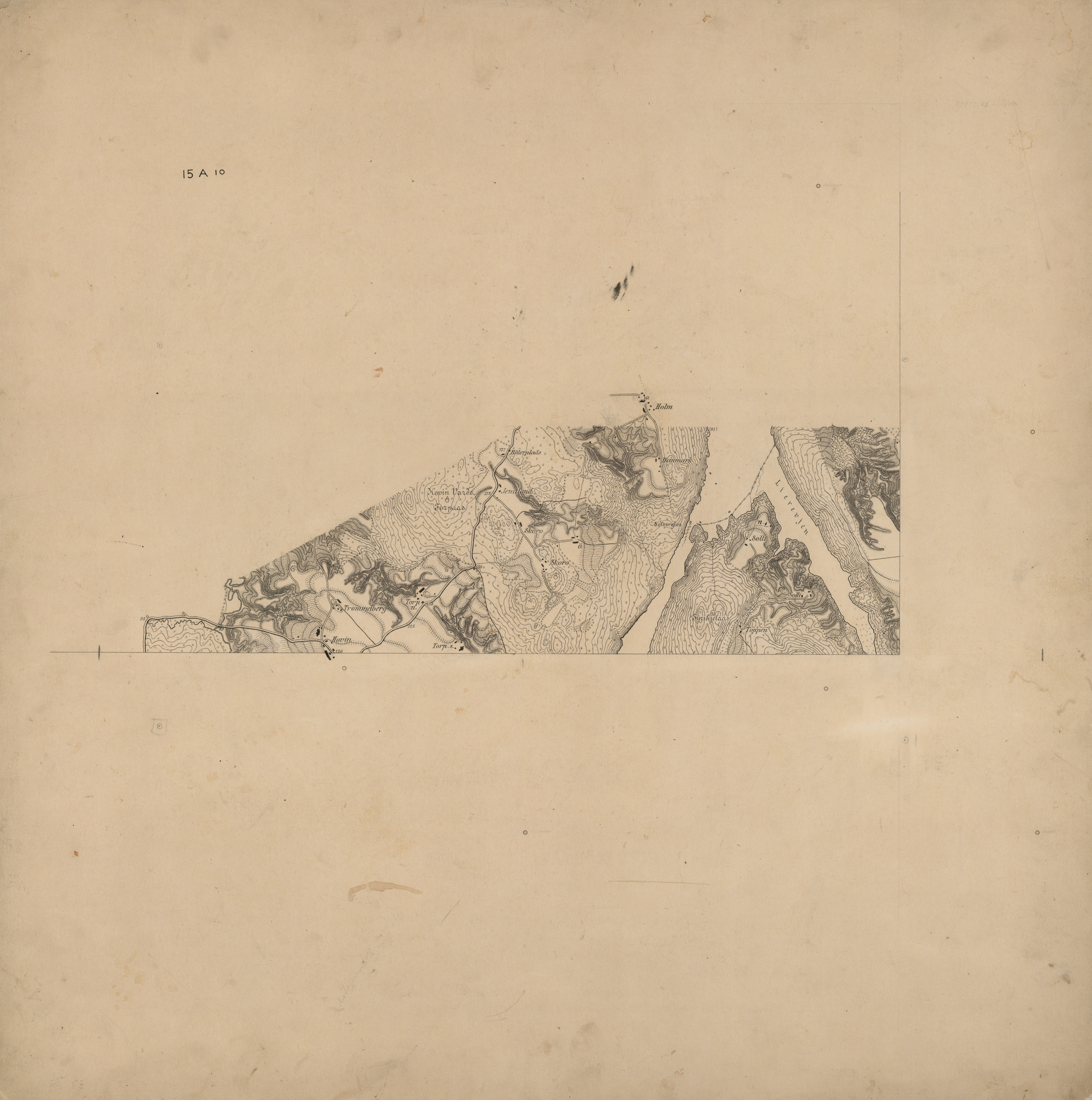
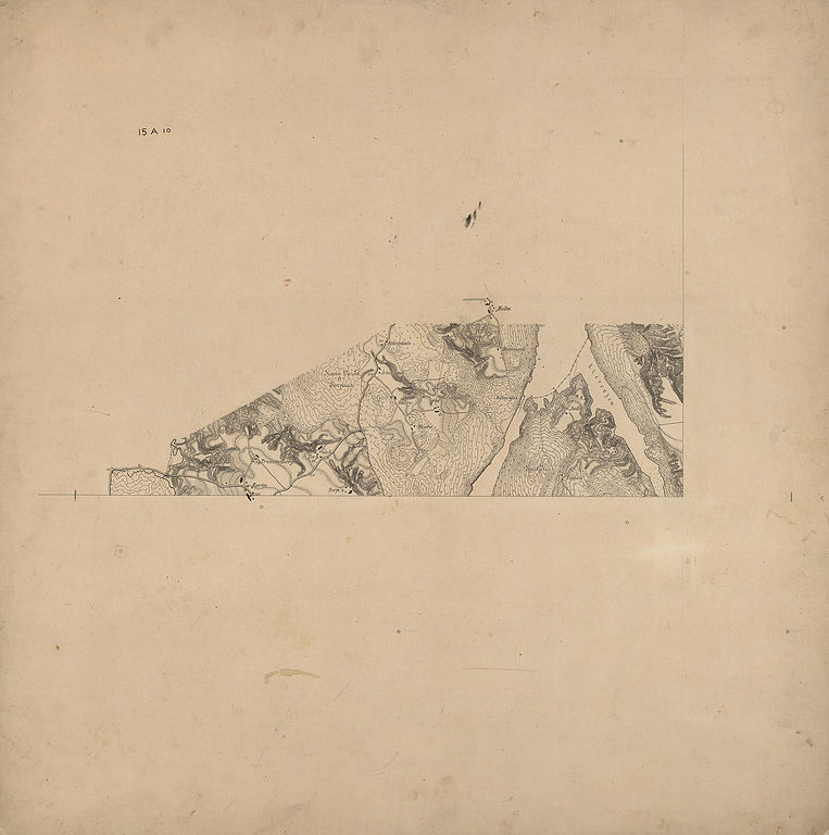
Norsk bokmål: Fossummålinger Nr. 6, 1900 |
||||||||||||||||||||||||||
| Description |
Norsk bokmål: Henviser til rektangel 15A10 |
||||||||||||||||||||||||||
| Date | |||||||||||||||||||||||||||
| Source |
|
||||||||||||||||||||||||||
| Creator |
Staff fanejunker Egeberg |
||||||||||||||||||||||||||
| Permission (Reusing this file) |
This file is licensed under the Creative Commons Attribution 4.0 International license.
|
||||||||||||||||||||||||||
| Geotemporal data | |||||||||||||||||||||||||||
| Date depicted | |||||||||||||||||||||||||||
| Map location | Østfold (Østfold) | ||||||||||||||||||||||||||
| Scale | 1:10,000 | ||||||||||||||||||||||||||
| Georeferencing | If inappropriate please set warp_status = skip to hide. | ||||||||||||||||||||||||||
| Bibliographic data | |||||||||||||||||||||||||||
| Part of the series | Category:Fossum measurement maps | ||||||||||||||||||||||||||
| Map sheet | 6 | ||||||||||||||||||||||||||
| Language | Norwegian | ||||||||||||||||||||||||||
| Publisher |
Generalstabens topografiske avdeling |
||||||||||||||||||||||||||
| Archival data | |||||||||||||||||||||||||||
| Collection |
|
||||||||||||||||||||||||||
| Accession number | |||||||||||||||||||||||||||
| Medium | drawing | ||||||||||||||||||||||||||
File history
Click on a date/time to view the file as it appeared at that time.
| Date/Time | Thumbnail | Dimensions | User | Comment | |
|---|---|---|---|---|---|
| current | 13:45, 2 November 2015 | | 6,822 × 6,870 (4.61 MB) | Artturimatias (talk | contribs) | GWToolset: Creating mediafile for Artturimatias. |
You cannot overwrite this file.
File usage on Commons
There are no pages that use this file.