File:Fort du Mont Bart (4852688378).jpg
Jump to navigation
Jump to search
Size of this preview: 800 × 595 pixels. Other resolutions: 320 × 238 pixels | 640 × 476 pixels | 1,000 × 744 pixels.
Original file (1,000 × 744 pixels, file size: 1,004 KB, MIME type: image/jpeg)
Captions
Captions
Add a one-line explanation of what this file represents
Summary
[edit].jpg&action=edit§ion=1)
| Description |
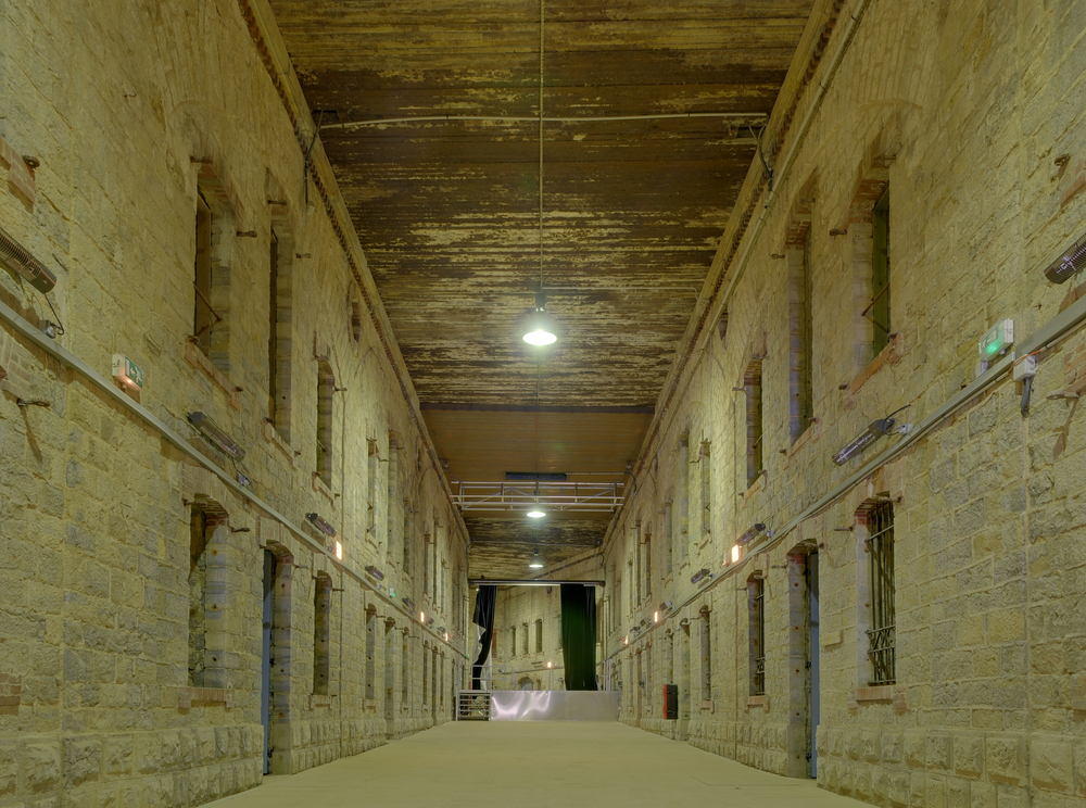
Dans l'ancienne cour intérieure du casernement, recouverte pendant la première guerre mondiale de rails de chemin de fer, de béton et de terre. Bart hill fortifications (HDR). |
| Date | |
| Source | Fort du Mont Bart |
| Author | Thomas Bresson from Belfort, France |
| Camera location | | View this and other nearby images on: OpenStreetMap |
|---|
.jpg¶ms=047.486194_N_0006.761669_E_globe:Earth_type:camera_source:Flickr_&language=en)
Licensing
[edit].jpg&action=edit§ion=2)
This file is licensed under the Creative Commons Attribution 2.0 Generic license.
- You are free:
- to share – to copy, distribute and transmit the work
- to remix – to adapt the work
- Under the following conditions:
- attribution – You must give appropriate credit, provide a link to the license, and indicate if changes were made. You may do so in any reasonable manner, but not in any way that suggests the licensor endorses you or your use.
| This image was originally posted to Flickr by ComputerHotline at https://flickr.com/photos/36519414@N00/4852688378. It was reviewed on 18 February 2021 by FlickreviewR 2 and was confirmed to be licensed under the terms of the cc-by-2.0. |
File history
Click on a date/time to view the file as it appeared at that time.
| Date/Time | Thumbnail | Dimensions | User | Comment | |
|---|---|---|---|---|---|
| current | 19:37, 18 February 2021 | | 1,000 × 744 (1,004 KB) | Matlin (talk | contribs) | Transferred from Flickr via #flickr2commons |
You cannot overwrite this file.
File usage on Commons
There are no pages that use this file.
.jpg&oldid=909916812)